 CUBA DESCONOCIDA: PUERTO DE MANATI, EN EL ORIENTE DE LA ISLA.
Puerto Manatí, Municipio Manatí, Provincia Las Tunas en el Oriente Cubano esta situado en el canal de entrada de la bahía de Manatí, a 18 Km de la cabecera municipal, en los 21 º 22′ N y 76 º 52′ W en la llanura del Norte de Camagüey – Las Tunas.
La bahía o Puerto de Manati es de tipo bolsa, de gran belleza física y tamaño, de aguas muy limpias y está considerada entre las de mayor calado del país, su playa (Chapaleta) en la margen oriental de su canal de entrada es de una preciosidad singular y sus arenas de gran pureza.
Los 18 kilómetros que lo separan de la cabecera municipal son transitados a diario por sus pobladores en un trencito o en el carata -coche locomotor pequeño que sirve como principal medio de transporte para muchas comunidades rurales en Cuba-, aunque también se accede a través de un terraplén.
En esta región, las unidades paisajísticas se basan fundamentalmente en la salinidad del suelo, pues es una llanura cársica baja, con suelos esqueléticos y jóvenes, en parte inundada por el mar. Por tanto, los paisajes son de dos grupos: los salinos y los no salinizados.
Los salinos son los más diversos a causa del mayor o menor contenido de sal y basado en la cubierta vegetal que presenta, que es el componente más distintivo, debido a que el relieve es siempre llano y sobre un mismo tipo de roca carbonatada, podemos diferenciarlos por los ecosistemas vegetales que aparecen, y que se encuentran bastante conservados debido al poco valor agrícola de los suelos.
En la bahía de Manatí, en el lado de barlovento en la playa de arena conocida por los tuneros, existen palmas de guano hediondo y existían hasta las misma orillas hasta hace unos cinco años, cuando se cortaron para “jatas” del balneario del muelle “La Gloria”. El calado de la bahía de Manatí concuerda con la descripción de Colón. Colón decía en su bitácora “Tenía la boca de río doce brazas y es bien ancha para barloventear “. La loma que describe Colón es el cerro de Dumañuecos, que se ve por arriba de la loma Tabaco a una distancia de 15 a 20 millas de la costa. Dumañuecos- Una loma prominente en forma de pan de azúcar, está en el lado Oeste (de la bahía) y con un poquito más al Oeste está Pardo de Manatí(loma Tabaco). Estas lomas se pueden ver a una distancia de 15-20 millas y son buenas guías desde la mar. Sin embargo, se debe tener en cuenta que cuando estas dos lomas están en línea, desde el mar, se parecen a la “Silla de Gibara”. Esta misma advertencia se hace en todos los derroteros de pilotos publicados por la Armada Española antes de ser Cuba una República independiente.
Su rada, de bolsa, se distingue por tener 32 pies de calado natural, lo cual posibilita el arribo de buques de gran porte.
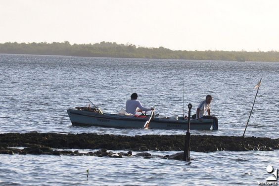
Ubicada en la margen oriental de su canal de entrada, con sus aguas azul turquesa, arenas blancas y finas, y la presencia de mangles que dan cobija a numerosos esteros, la playa Chapaleta constituye un sitio que permanece virgen, cuidado por los pobladores como un tesoro natural al que solo se accede mediante chalanas o chalupas.
De estas y otras cosas son eternamente guardianes los habitantes del puerto, conocidos por su nobleza y arraigo al terruño, aunque el auge económico que le dio origen es la tradición popular de sobrevivir gracias al mar.
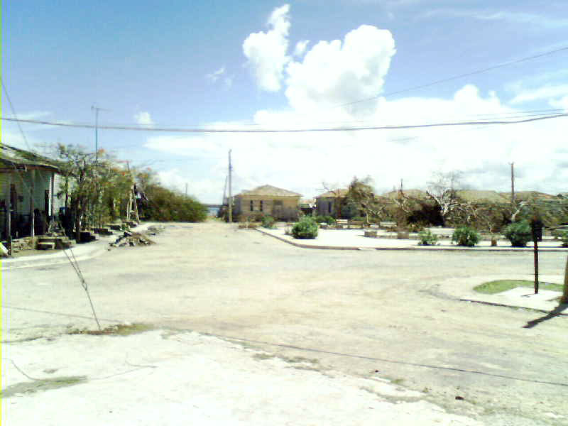
Pero más que su vía férrea de más de un siglo, su viejo espigón curtido por el tiempo, su belleza natural y el aire con olor a salitre, hay una curiosidad del puerto de Manatí que llama la atención de quienes pasan por esos lares, y es que allí casi todos los habitantes tienen apodos desde los primeros años de vida. Ello constituye ya un patrimonio popular.
Con el afán de otorgar apelativos a puntos de referencia, a pesar de ser una localidad tan diminuta, han hecho que surjan la gente de La Pesca, los de La Playita, El Barracón, La Reparación y El Campo de Pelota, algunos de los cuales se encuentran dentro de barrios como Corea y El Pueblo.
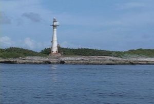
Lo cierto es que el puerto de Manatí tiene un encanto peculiar que es difícil de explicar; su “Playita” repleta de niños en los meses de verano, el Faro enclavado en la costa, su estirpe de gente trabajadora y desenfadada, porque son sus pobladores los que hacen que cada historia, cada nombrete, cada arribo del tren o el carata, se conviertan en un viaje de curiosas sorpresas.
 UNKNOWN CUBA: PUERTO DE MANATI, IN THE ISLAND EASTERN SIDE.
Puerto Manatí, Manatí Municipality, Las Tunas Province in the Cuban East is located at the entrance channel of the Manatí Bay, 18 km from the municipal capital, at 21 º 22 ‘N and 76 º 52’ W on the plain from the North of Camagüey – Las Tunas.
The bay or Port of Manati is of the bag type, of great physical beauty and size, of very clean waters and is considered among the largest in the country, its beach (Chapaleta) on the eastern margin of its entrance channel is one singular preciousness and its sands of great purity.
The 18 kilometers that separate it from the municipal seat are traveled daily by its inhabitants in a little train or in the carata – a small locomotive car that serves as the main means of transport for many rural communities in Cuba -, although it is also accessed through an embankment
In this region, landscape units are based primarily on soil salinity, as it is a low karst plain, with skeletal and young soils, partly flooded by the sea. Therefore, the landscapes are of two groups: the saline and the non-salinized.
The salines are the most diverse because of the greater or lesser salt content and based on the vegetation cover that it presents, which is the most distinctive component, because the relief is always flat and on the same type of carbonated rock, we can differentiate them by the vegetal ecosystems that appear, and that is quite conserved due to the little agricultural value of the soils.
In the bay of Manatí, on the windward side of the sandy beach known to the tuneros, there are palms of stinking guano and existed until the same shores until about five years ago, when they were cut for “jatas” of the pier’s spa ” The glory”. The draft of the Bay of Manati matches the description of Columbus. Columbus said in his log “He had twelve fathoms and is wide enough to wind.” The hill described by Colón is the hill of Dumañuecos, which is seen above the Tobacco hill at a distance of 15 to 20 miles from the coast. Dumañuecos- A prominent hill in the shape of a sugar loaf, is on the west side (of the bay) and with a little further west is Pardo de Manatí (Tobacco hill). These hills can be seen at a distance of 15-20 miles and are good guides from the sea. However, it should be borne in mind that when these two hills are in line, from the sea, they resemble the “Silla de Gibara”. This same warning is made in all the paths of pilots published by the Spanish Navy before being the independent Republic of Cuba.
Its rada, bag, is distinguished by having 32 feet of natural draft, which allows the arrival of large ships.
Located on the eastern margin of its entrance channel, with its turquoise blue waters, fine white sands, and the presence of mangroves that shelter many estuaries, the Chapaleta beach is a site that remains virgin, taken care of by the inhabitants as a natural treasure that is only accessed through chalanas or chalupas.
The inhabitants of the port, known for their nobility and roots to the land, are eternally guardians of these and other things, although the economic boom that gave rise to it is the popular tradition of surviving thanks to the sea.
But more than its railroad of more than a century, its old breakwater tanned by time, its natural beauty and the air with the smell of saltpeter, there is a curiosity of the port of Manatí that attracts the attention of those who pass through those parts, and is that there almost all the inhabitants have nicknames from the first years of life. This already constitutes a popular heritage.
With the aim of granting appeals to landmarks, despite being such a tiny town, they have brought up the people of La Pesca, those of La Playita, El Barracón, La Repair and El Campo de Pelota, some of which they are located in neighborhoods like Korea and El Pueblo.
The truth is that the port of Manati has a peculiar charm that is difficult to explain; its “Playita” full of children in the summer months, the Lighthouse nestled on the coast, its lineage of hardworking and carefree people, because it is its inhabitants that make each story, each name, each arrival of the train or the carata, Become a journey of curious surprises.
Agencies/ RHC/ Danielle L. Gómez/ Extractos/ Excerpts/ Internet Photos/ Arnoldo Varona/ www.TheCubanHistory.com
THE CUBAN HISTORY, HOLLYWOOD.


 < UNKNOWN CUBA: Puerto de Manatí, in the Island Eastern side.


