 COSAS QUE TU NO SABIAS DEL MALECÓN HABANERO. FOTOS.
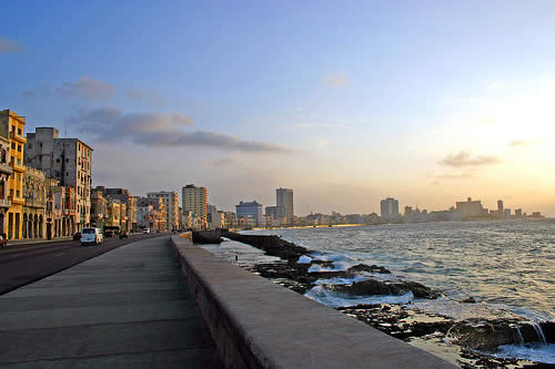
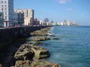
El Malecón (oficialmente Avenida de Maceo) es una amplia explanada, calzada y malecón que se extiende por 8 km (5 millas) a lo largo de la costa en La Habana, Cuba, desde la boca del puerto de La Habana en La Habana Vieja, a lo largo del norte lado del barrio Centro Habana y el barrio del Vedado, que termina en la desembocadura del río Almendares.
Esa avenida se construyó por tramos y aunque cada uno de ellos tiene su nombre, los cubanos la han conocido siempre por el nombre genérico de Malecón.
El primer tramo se extendió desde el extremo del Paseo del Prado hasta el parque Maceo. Se le dio a esta vía, primeramente, el nombre de Avenida del Golfo. Con posterioridad, y de manera sucesiva, este tramo recibió los nombres de Avenida de la República, en 1902, Avenida del General Antonio Maceo, en 1908 y en 1909 Avenida Antonio Maceo, que es su nombre oficial actual.
A partir de 1921 el Malecón se extendería hasta el lugar que ocupa el monumento al Maine, a un costado del Hotel Nacional. Se denominó ese tramo Avenida Washington.
A partir de 1930, Carlos Miguel de Céspedes, ministro de Obras Públicas del presidente Machado a quien apodaron El Dinámico por el ritmo que supo imprimir a las construcciones, lleva el Malecón hasta la calle G o Avenida de los Presidentes. Se dio a este tramo el nombre de Pi Margall, en homenaje al político republicano español que tanto simpatizó con la independencia de Cuba.
Desde 1950, con los gobiernos de Prío y Batista, el Malecón se extendió hasta lo que se considera su término natural, esto es, en las inmediaciones del castillo de La Chorrera, junto a la desembocadura del río Almendares. Este tramo recibió el nombre de Avenida Aguilera. Mide en total unos ocho kilómetros.
Pero el Malecón no solo creció hacia el oeste. También se extendió en sentido contrario, desde Prado hasta el comienzo de los muelles, donde se hallaba la vieja Capitanía del Puerto, que desaparece entonces.
Ese tramo se inició en 1927 y fue obra también de Carlos Miguel. Carece de la belleza del mar abierto que regalan los tramos restantes, pero tiene el encanto de la vegetación y su amplitud que permite que a su vera se extienda el parque Luz Caballero, y donde encuentra cabida el Anfiteatro Municipal, bello auditorio al aire libre de estilo griego. Este tramo lleva el nombre del Padre de la Patria, Carlos Manuel de Céspedes.
Veamos ahora algunas curiosidades del Malecón.
Cuando ocurre un ras de mar es por la calle Galiano donde primer penetra el agua debido a un desnivel bastante profundo que existe en dicho lugar. Sin embargo, cuando el ciclón del 26, el agua llegó, por Prado, hasta la calle Colón. Y cuando el ciclón del 19, llegó, por Campanario, hasta la calle Ánimas, con la alarma consiguiente de los vecinos.
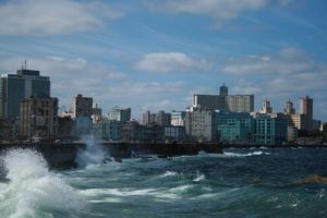
De los cuadrados que tiene el Malecón, el comprendido entre las calles San Nicolás y Manrique es por donde más fuerte baten las olas a causa de lo bajo del muro y del pequeño espacio que ocupan los arrecifes. El muro del Malecón que empieza en la calle Lealtad es más bajo que el resto.
En Prado y San Nicolás vivió el cronista Enrique Fontanills, aquel que, si la ocasión lo merecía, remataba sus notas para el Diario de la Marina con un rotundo “asistiré” que atraía sobre el suceso la atención de los lectores. En la esquina de Perseverancia residió hasta su muerte, en 1956, el coronel Cosme de la Torriente, excanciller en tiempos de Menocal, y presidente de la Sociedad de Amigos de la República (SAR) desde donde condujo, a nombre de la oposición política, el llamado Diálogo Cívico con personeros de la tiranía batistiana. En la esquina de Lealtad se alzaba la casa de Octavio Averoff, ministro de Machado y rector de la Universidad de La Habana, “visitada” por el pueblo y saqueada a la caída de la tiranía. En el número 605 radicaba doña Regla Socarrás, capitana del Ejército Libertador y madre del presidente Carlos Prío. El mandatario llamaba a esa morada “la casa de mamá”.
¿Y la glorieta del Malecón que tantos buenos momentos propició a nuestros a abuelos? En aquella pequeña glorieta de cemento, de discreto estilo griego, se situaba la banda municipal para ofrecer conciertos varias veces a la semana. Pero aquel lugar, que se convirtió en uno de los más concurridos de la ciudad, fue demolido en mayo de 1927. No quedó otro remedio cuando el Malecón empezó a extenderse hacia el puerto.
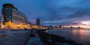
Frente a ella se alzaba el hotel Miramar. Pero se descomercializó y dejó de funcionar como establecimiento hotelero. El edificio fue demolido y en el espacio que ocupó, junto con el del primitivo Centro Vasco, se edificó el lujoso hotel Paseo del Prado.
 THINGS YOU DIDN’T KNOW ABOUT THE MALECÓN OF HAVANA, CUBA. PHOTOS.
The Malecon (officially Avenida de Maceo) is a wide esplanade, driveway, and boardwalk that stretches for 8 km (5 miles) along the coast in Havana, Cuba, from the mouth of the port of Havana in Old Havana, along the north side of the Centro Habana neighborhood and the Vedado neighborhood, which ends at the mouth of the Almendares River.
That avenue was built by sections and although each of them has its name, the Cubans have always known it by the generic name of Malecon.
The first section extended from the end of the Paseo del Prado to the Maceo park. This route was first given the name of Avenida del Golfo. Subsequently, and successively, this section received the names of Avenida de la República, in 1902, Avenida de General Antonio Maceo, in 1908 and in 1909 Avenida Antonio Maceo, which is its current official name.
From 1921 the Malecon would extend to the place occupied by the Maine monument, next to the National Hotel. That stretch was named Washington Avenue.
As of 1930, Carlos Miguel de Céspedes, Minister of Public Works of President Machado who was nicknamed El Dinmico for the pace he was able to print to the constructions, takes the Malecon to G Street or Avenida de Los Presidentes. This section was given the name of Pi Margall, in homage to the Spanish Republican politician who sympathized with the independence of Cuba.
Since 1950, with the governments of Prío and Batista, the Malecon extended to what is considered its natural term, that is, near the castle of La Chorrera, next to the mouth of the Almendares River. This section was called Aguilera Avenue. It measures about eight kilometers in total.
But the Malecon not only grew to the west. It also extended in the opposite direction, from Prado to the beginning of the docks, where the old Captaincy of the Port was located, which then disappears.
That section began in 1927 and was also the work of Carlos Miguel. It lacks the beauty of the open sea that the remaining sections give away, but it has the charm of the vegetation and its breadth that allows the Luz Caballero park to be extended, and where the Municipal Amphitheater is located, a beautiful outdoor auditorium of Greek-style This section is named after the Father of the Fatherland, Carlos Manuel de Céspedes.
Let’s see now some curiosities of the Malecón.
When a sea-level occurs, it is through Galiano Street where the water first penetrates due to a fairly deep slope that exists in that place. However, when the cyclone of 26, the water came, through Prado, to Colón Street. And when the cyclone of 19, came, by Bell Tower, to Ánimas Street, with the consequent alarm of the neighbors.
Of the squares that the Malecon has, the one between the streets San Nicolás and Manrique is where the waves beat harder because of the low wall and the small space occupied by the reefs. The wall of the Malecon that begins on Lealtad Street is lower than the rest.
In Prado and San Nicolás lived the chronicler Enrique Fontanills, the one who, if the occasion deserved it, finished off his notes for the Diario de la Marina with a resounding “I will attend” that attracted the attention of the readers on the event. In the corner of Perseverance resided until his death, in 1956, Colonel Cosme de la Torriente, former chancellor in the time of Menocal, and president of the Society of Friends of the Republic (SAR) from where he led, on behalf of the political opposition, the so-called Civic Dialogue with representatives of the Batista tyranny. On the corner of Loyalty was the house of Octavio Averoff, minister of Machado and rector of the University of Havana, “visited” by the people and sacked at the fall of the tyranny. At number 605 was Mrs. Regla Socarrás, captain of the Liberating Army and mother of President Carlos Prío. The president called that abode “mom’s house.”
And the roundabout on the Malecon that gave us so many good times to our grandparents? In that small cement gazebo, of discreet Greek style, the municipal band was located to offer concerts several times a week. But that place, which became one of the busiest in the city, was demolished in May 1927. There was no other choice when the Malecon began to spread to the port.
In front of her stood the Miramar hotel. But it de-commercialized and ceased to function as a hotel establishment. The building was demolished and in the space, it occupied, together with that of the primitive Basque Center, the luxury hotel Paseo del Prado was built.
Agencies/ RHC/ Ciro Bianchi/ Extractos/ Excerpts/ Internet Photos/ Arnoldo Varona/ www.TheCubanHistory.com
THE CUBAN HISTORY, HOLLYWOD.


