

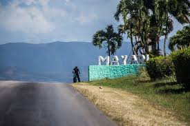
 MAYARÍ, CUBA, municipality and Town in the Holguin Province. * MAYARÍ, CUBA, municipalidad y Pueblo en la Provincia de Holguín. PHOTOS/VIDEOS.


MAYARÍ, CUBA, MUNICIPALITY, AND TOWN IN THE HOLGUIN PROVINCE. PHOTOS
HISTORY
The origins of the city date back to 1757 in Spanish Cuba, when the first farms were established here by immigrant colonists. On 19 January 1879, the city became the seat of the Mayarí Municipality.
GEOGRAPHY
The municipality is divided into the barrios and hamlets of Barajagua, Cabonico, Cajimaya, Chavaleta Norte, Chavaleta Sur, Guayabo, Juan Vicente, Mateo Sánchez, Punta de Tabaco, Río Frío, Sae-Tía, San Gregario Norte, San Gregorio Sur and Santa Isabel. Birán, the birthplace of the brothers Castro, was part of Mayarí until the 1976 reform, when it became part of the neighboring Cueto municipality.
https://youtu.be/fgmwwTEOf2E
Press ^ Here
MAYARI, CUBA JOURNEY (Documentary)
Among other barrios or neighborhoods in this municipality are Felton (on Cajimaya Bay, once the seaport for the Bethlehem Cuba Iron Mines Company -Bethlehem Steel-), Guaro, Guatemala (on Nipe Bay, previously named Preston and a central sugar mill operated by the United Fruit Company), Nicaro-Levisa (on Levisa Bay, originally named Lengua de Pajaro which translated into English means bird’s tongue -as viewed from an air ride-), El Purio, Santa Rita, La Italiana, Mandinga. The last two being on the road to the open mines named Mina Martí where nickel and cobalt exploitation started at the beginning of the twentieth century by Bethlehem Cuba Iron Mines Company (Bethlehem Steel) and Nicaro Nickel Company.
DEMOGRAPHICS
In 2004, the municipality of Mayarí had a population of 105,505. With a total area of 1,307 km2 (505 sq mi), it has a population density of 80.7/km2 (209/sq mi).

MAIN SIGHTS
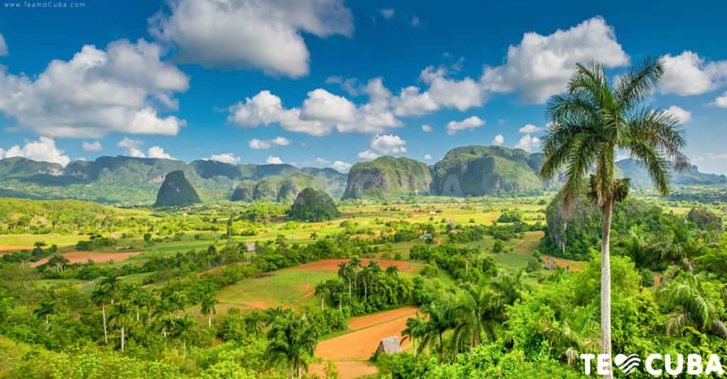
The Sierra Cristal National Park (Spanish: Parque Nacional Sierra Cristal) is partly located in the Mayarí Municipality and partly in the neighboring Sagua de Tánamo Municipality. Other attractions include Cayo Saetía, a scenic cay with beaches located within the municipality on the Bay of Nipe, north of the Mayarí city.
POPULAR CULTURE
The city’s name Mayarí is in the 1940s song “Voy para Mayarí” (“I’m going to Mayarí”), by Compay Segundo, and in his song “Chan Chan” on the Buena Vista Social Club album.
It also appears in the song “Las Mujeres de Mayarí” (“The women of Mayarí”) in the same album.
Area code(s) +53-24

* RECOMIENDENOS A SUS AMISTADES * PREFIERA A NUESTROS SPONSORS.*
![]()
MAYARÍ, CUBA, MUNICIPIO Y PUEBLO DE LA PROVINCIA DE HOLGUIN. FOTOS
HISTORIA
Los orígenes de la ciudad se remontan a 1757 en la Cuba española, cuando las primeras granjas fueron establecidas aquí por colonos inmigrantes. El 19 de enero de 1879, la ciudad se convirtió en la sede del municipio de Mayarí.
GEOGRAFÍA
El municipio está dividido en barrios y caseríos de Barajagua, Cabonico, Cajimaya, Chavaleta Norte, Chavaleta Sur, Guayabo, Juan Vicente, Mateo Sánchez, Punta de Tabaco, Río Frío, Sae-Tía, San Gregario Norte, San Gregorio Sur y Santa. Isabel. Birán, cuna de Fidel y Raúl Castro, fue parte de Mayarí hasta la reforma de 1976, cuando pasó a formar parte del vecino municipio de Cueto.
https://youtu.be/kuEH0o-EuGw
Presione ^ Aqui
MAYARI, CUBA VIAJES CORTO.
Entre otros barrios o barrios de este municipio se encuentran Felton (en la bahía de Cajimaya, otrora puerto marítimo de la Compañía de Minas de Hierro Bethlehem Cuba -Bethlehem Steel-), Guaro, Guatemala (en la bahía de Nipe, anteriormente llamado Preston y un ingenio central de azúcar operado por el United Fruit Company), Nicaro-Levisa (en la Bahía de Levisa, originalmente llamada Lengua de Pajaro que traducida al inglés significa lengua de pájaro -como se ve desde un paseo aéreo-), El Purio, Santa Rita, La Italiana, Mandinga. Los dos últimos se encuentran en el camino a las minas a cielo abierto denominada Mina Martí donde la explotación de níquel y cobalto inició a principios del siglo XX por la Compañía de Minas de Hierro Belén Cuba (Bethlehem Steel) y la Compañía Nicaro de Níquel.
DEMOGRAFÍA
En 2004, el municipio de Mayarí tenía una población de 105,505. Con una superficie total de 1.307 km2 (505 millas cuadradas), tiene una densidad de población de 80,7 / km2 (209 / mi2).

PRINCIPALES VISTAS
El Parque Nacional Sierra Cristal (en español: Parque Nacional Sierra Cristal) está ubicado en parte en el municipio de Mayarí y en parte en el vecino municipio de Sagua de Tánamo. Otras atracciones incluyen Cayo Saetía, un pintoresco cayo con playas ubicado dentro del municipio en la Bahía de Nipe, al norte de la ciudad de Mayarí.
CULTURA POPULAR
El nombre de la ciudad Mayarí está en la canción de los años 40 “Voy para Mayarí” (“Voy a Mayarí”), de Compay Segundo, y en su canción “Chan Chan” del disco Buena Vista Social Club.
También aparece en la canción “Las Mujeres de Mayarí” (“Las mujeres de Mayarí”) del mismo álbum.
Código (s) de área + 53-24
Agencies/ Wiki/ Internet Photos/ YouTube/ Arnoldo Varona/ www.TheCubanHistory.com
THE CUBAN HISTORY, HOLLYWOOD.
* RECOMIENDENOS A SUS AMISTADES * PREFIERA A NUESTROS SPONSORS.*
![]()
