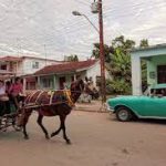
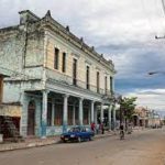
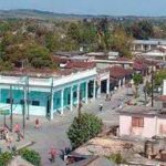
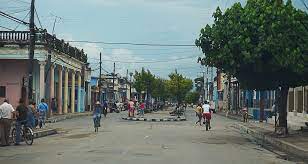
CUMANAYAGUA, CUBA, TOWN IN THE VALLEY NEAR THE ESCAMBRAY MOUNTAINS. VIDEOS. .
Cumanayagua (Spanish pronunciation: [kumanaˈʝaɣwa]) is a municipality and town in the Cienfuegos Province of Cuba. It is located in a valley near the Guamuhaya Mountains (usually these mountains are referred to as Escambray Mountains, 23 kilometers (14 mi) east of Cienfuegos, the provincial capital.
Cumanayagua was inhabited by Cuban Taino indigenous people when the Spanish arrived on the island. Though the meaning of the name is uncertain, is known it comes from Taino Arawak’s origin. Some scholars believe it means “The place filled with flowers of Royal Palms” others believe it could mean “The place of Cuma and Anayagua”, Cuma was the aboriginal chief ruler of the region, and Anayagua his daughter and heir to the chiefdom.
The village was established by Spanish and Cuban creole under Colonial times with a longer name; “San Felipe de Cumanayagua” which it retain until 1878 when it was changed into “Santa Cruz de Cumanayagua”, and finally at the turn of the 20th century got the definitive and shorter Taino name it has today.
GEOGRAPHY
Located in the south-eastern corner of the province, by the Caribbean Coast and at the borders with the province of Villa Clara and Sancti Spíritus; the municipal territory includes part of Escambray Mountain Range and the nature reserves of Topes de Collantes and Pico San Juan. The town lies the south of Avilés Reservoir and is crossed by the Hanabanilla River.
The municipality borders with the ones of Cienfuegos, Palmira, Cruces, Manicaragua and Trinidad. It counts several hamlets (villages and localities), as Arimao, Barajagua, Camilo Cienfuegos, Entronque de Minas, Gavillán, Guajimico, Hoyo de Padilla, La Clara, La Sierrita, Las Moscas, Playa El Inglés, Playa Yaguanabo, San Blas, San Francisco and San Juan.
In 2004, the municipality of Cumanayagua had a population of 51,435. With a total area of 1,099 km2 (424 sq mi), it has a population density of 46.8/km2 (121/sq mi).
ECONOMY
Citrus fruits and coffee are grown in the municipality of Cumanayagua.
Area code(s) +53-432
CUMANAYAGUA, CUBA, PUEBLO EN EL VALLE CERCA DE LAS MONTAÑAS DE ESCAMBRAY. VIDEOS..
Cumanayagua es un municipio y ciudad en la provincia de Cienfuegos de Cuba. Está ubicado en un valle cerca de las montañas de Guamuhaya (generalmente estas montañas se conocen como montañas del Escambray, a 23 kilómetros (14 millas) al este de Cienfuegos, la capital provincial.
Cumanayagua estaba habitada por indígenas taínos cubanos cuando los españoles llegaron a la isla. Aunque el significado del nombre es incierto, se sabe que proviene del origen de Taino Arawak. Algunos eruditos creen que significa “El lugar lleno de flores de Palmas Reales”, otros creen que podría significar “El lugar de Cuma y Anayagua”, Cuma era el principal gobernante aborigen de la región y Anayagua su hija y heredera del cacicazgo.
El pueblo fue establecido por criollos españoles y cubanos bajo la época colonial con un nombre más largo; “San Felipe de Cumanayagua” que conservó hasta 1878 cuando se transformó en “Santa Cruz de Cumanayagua”, y finalmente a principios del siglo XX obtuvo el nombre taíno definitivo y más corto que tiene hoy.
GEOGRAFÍA
Ubicado en el extremo sureste de la provincia, en la Costa Caribe y en los límites con la provincia de Villa Clara y Sancti Spíritus; el territorio municipal comprende parte de la Sierra del Escambray y los parques naturales de Topes de Collantes y Pico San Juan. La localidad se encuentra al sur del embalse de Avilés y está atravesada por el río Hanabanilla.
El municipio limita con los de Cienfuegos, Palmira, Cruces, Manicaragua y Trinidad. Cuenta con varios caseríos (pueblos y localidades), como Arimao, Barajagua, Camilo Cienfuegos, Entronque de Minas, Gavillán, Guajimico, Hoyo de Padilla, La Clara, La Sierrita, Las Moscas, Playa El Inglés, Playa Yaguanabo, San Blas, San Francisco y San Juan.
En 2004, el municipio de Cumanayagua tenía una población de 51.435 habitantes . Con una superficie total de 1.099 km2 (424 millas cuadradas), tiene una densidad de población de 46,8 / km2 (121 / millas cuadradas).
ECONOMÍA
Los cítricos y el café se cultivan en el municipio de Cumanayagua.
Código (s) de área + 53-432
Agencies/ Wiki/ Internet Photos/ YouTuba/ Arnoldo Varona/ VIDEOS – PHOTOS – LA HISTORIA DE CUBA
THE CUBAN HISTORY, HOLLYWOOD.


 CUMANAYAGUA, Cuba, Town in the Valley Near the Escambray Mountains. * CUMANAYAGUA, Cuba, Pueblo en el Valle cerca de las Montañas del Escambray. VIDEOS.