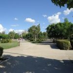
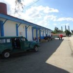
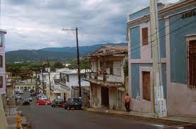
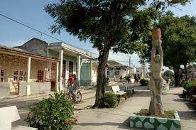
SAN GERMAN, (Urbano Noris), CUBA, OWES ITS NAME TO A LOCAL DISTINGUISHED GERMAN MANAGER
SAN GERMAN (Urbano Noris) is a municipality and city in the Holguín Province of Cuba. The municipal seat is located in the town of San Germán.
The town of San Germán is the urban center or historic center of the Urbano Noris municipality, it is located in the northeast region of the territory, at a distance of 38 km from the provincial head. Formerly called San Germán to all the zone that today includes this municipality.
HISTORY
Both the area and the lands where the current town of San Germán is located today were, in the late 19th century, covered with lush forests, virgin and rich in precious wood, to which a varied fauna was added.
On June 18, 1898, José Picasso Calvet, owner of the Guairajal farm, which occupied almost the entire area that today encompasses this territory, mortgaged it to a German company that used it to export wood. His manager, Germán Michelson, establishes a sawmill at the site. His name, due to the contributions made by him in favor of the employees who were settling in the place, was catching among them to the extreme of identifying, the incipient town, as San Germán.
EMERGENCE OF THE POPULATION COMPONENT
The crossing of the railroad through the area, the exploitation of wood and the construction of the factory or sugar industry, allowed the influx, to the territory, of hundreds of people who came in search of work. One of the first to arrive was the American Albert Penn Kerr, a soldier who fought in the war between Spain and the United States in 1898. This man buys the farm “Emmita”, belonging to the area, and becomes in one of the most powerful settlers in the area.
Starting in 1920, the largest population settlement began in the incipient town, the cause, the beginning of the first sugar harvest of the San Germán plant. Immigrants from Haiti, Jamaica, Spain, China, France, Lebanon, etc., made up what is now called “cultural ajiaco”. This is where the surnames that today are part of the cultural identity come from, the Hunts, the Fungs, the Lams, the Lópezes, the Cuervos, the Marro, the Dager, the Melik, the Poll, the Drigs and others. Most of these were dedicated to the business of commerce, cafes, inns, barber shops, shops and of course agriculture.
GEOGRAPHY
The municipality is located southeast of the province, neighboring the provinces of Granma and Santiago de Cuba; and borders with the municipalities of Jiguaní, Cauto Cristo, Cacocum, Holguín, Báguanos, Cueto, Mella, Palma Soriano and Contramaestre. It counts the town of San Germán and the villages of Algodones, Cruce San Francisco, Estrada, Flora, José A. Echeverría, La Caridad, La Ceiba, La Yaya, Las Cuarenta, Paraná, Rey Dos and Santa Cruz.
DEMOGRAPHICS
In 2004, the municipality of Urbano Noris had a population of 43,892. With a total area of 846 km2 (327 sq mi), it has a population density of 51.9/km2 (134/sq mi).
Area code(s) +53-24
SAN GERMAN, (Urbano Noris), CUBA, DEBE SU NOMBRE A UN DISTINGUIDO GERENTE ALEMÁN LOCAL
SAN GERMAN (Urbano Noris) es un municipio y ciudad de la provincia de Holguín de Cuba. La cabecera municipal está ubicada en la localidad de San Germán.
La localidad de San Germán es el centro urbano o centro histórico del municipio Urbano Noris, se ubica en la región noreste del territorio, a una distancia de 38 km de la cabecera provincial. Antiguamente llamado San Germán a toda la zona que hoy comprende este municipio.
HISTORIA
Tanto la zona como los terrenos donde hoy se ubica la actual localidad de San Germán estaban, a fines del siglo XIX, cubiertos de frondosos bosques, vírgenes y ricos en maderas preciosas, a las que se sumaba una variada fauna.
El 18 de junio de 1898, José Picasso Calvet, propietario de la finca Guairajal, que ocupaba casi toda la superficie que hoy abarca este territorio, la hipotecó a una empresa alemana que la utilizaba para exportar madera. Su gerente, Germán Michelson, establece un aserradero en el sitio. Su nombre, debido a los aportes que hizo a favor de los empleados que se iban asentando en el lugar, fue pillando entre ellos al extremo de identificar, al incipiente pueblo, como San Germán.
EMERGENCIA DEL COMPONENTE DE POBLACIÓN
El cruce del ferrocarril por la zona, la explotación de madera y la construcción de la fábrica o industria azucarera, permitió la afluencia, al territorio, de cientos de personas que acudían en busca de trabajo. Uno de los primeros en llegar fue el estadounidense Albert Penn Kerr, un militar que luchó en la guerra entre España y Estados Unidos en 1898. Este hombre compra la finca “Emmita”, perteneciente a la zona, y se convierte en una de las más Poderosos colonos de la zona.
A partir de 1920 se inicia en el incipiente poblado el mayor asentamiento poblacional, la causa, el inicio de la primera zafra azucarera de la planta San Germán. Inmigrantes de Haití, Jamaica, España, China, Francia, Líbano, etc., componían lo que ahora se llama “ajiaco cultural”. De aquí provienen los apellidos que hoy forman parte de la identidad cultural, los Hunts, los Fungs, los Lams, los Lópezes, los Cuervos, los Marro, los Dager, los Melik, los Poll, los Drigs y otros. La mayoría de estos se dedicaron al negocio del comercio, cafés, posadas, peluquerías, tiendas y por supuesto la agricultura.
GEOGRAFÍA
El municipio se ubica al sureste de la provincia, colinda con las provincias de Granma y Santiago de Cuba; y colinda con los municipios de Jiguaní, Cauto Cristo, Cacocum, Holguín, Báguanos, Cueto, Mella, Palma Soriano y Contramaestre. Cuenta la localidad de San Germán y las aldeas de Algodones, Cruce San Francisco, Estrada, Flora, José A. Echeverría, La Caridad, La Ceiba, La Yaya, Las Cuarenta, Paraná, Rey Dos y Santa Cruz.
DEMOGRAFÍA
En 2004, el municipio de Urbano Noris tenía una población de 43.892. Con una superficie total de 846 km2 (327 millas cuadradas), tiene una densidad de población de 51,9 / km2 (134 / mi2).
Código (s) de área + 53-24
Agencies/ Wiki/ Ecured/ Internet Photos/ YouTube/ Arnoldo Varona/ VIDEOS – PHOTOS> LA HISTORIA DE CUBA
THE CUBAN HISTORY, HOLLYWOOD.


 SAN GERMAN, (Urbano Noris), Cuba, owes its name to a local distinguished German Manager. * SAN GERMAN (Urbano Noris), Cuba, debe su nombre a un distinguido Manager Aleman Local. PHOTOS/VIDEOS.
