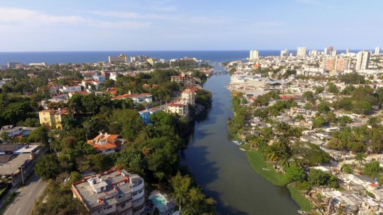
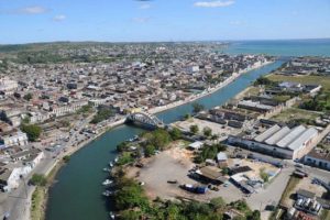
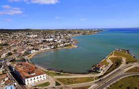
RIO ALMENDARES, LA HABANA, AÚN HOY CON SU SUCIO ASPECTO, CORAZON DE LA CAPITAL CUBANA. PHOTOS.
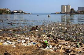
Aún hoy, con las principales industrias desactivadas, metales pesados no biodegradables y muy peligrosos como el plomo, el cobre, el cadmio y el zinc se encuentran en sus aguas a niveles alarmantes.
EL RIO ALMENDARES es curso fluvial cubano que recorre 45 km del oeste de la isla. Nace en las lomas al oeste de Tapaste, al este de la provincia de La Habana y fluye hacia el noroeste, desembocando en el estrecho de Florida. Actúa como un suplemento de agua dulce para La Habana. Su último tramo divide los municipios de Playa y Plaza de la Revolución.
Parte del valle del río forma el parque del Almendares o Parque Metropolitano de La Habana (PMH), a pocos kilómetros de su desembocadura. Los bancos que forma al final están ocupados por diversas industrias.
Ese río de nombre musical —como refirió en un poema Dulce María Loynaz—, ha sido y es muchas cosas para La Habana. De no ser por la importancia cardinal de la bahía, que recolocó a su vera el centro urbano fundacional, el Almendares hubiese sido el corazón de la capital, y a manera de columna vertebral hubiera articulado su crecimiento. No obstante, fue fuente de vida, de progreso industrial, reto a la ingeniería y oasis natural para el capitalino en el mismo centro de la urbe. Su significado, en cambio, queda actualmente solapado por su sucio aspecto, saturado de la ciudad que transformó su entorno natural y sin apenas actividad marinera.
HISTORIA DEL RIO ALMENDARES
Durante tres de los cinco siglos que marcan la existencia de La Habana, fue el Almendares su principal suministro de agua potable, una vez que se construyó la Zanja Real, primera obra hidráulica realizada por los españoles en América. Diseñada por el ingeniero militar Bautista Antonelli en 1566, permitió extender por gravedad, desde la represa del Husillo en Puentes Grandes, el agua del río hasta la bahía y La Habana Vieja.
En su trayecto se hicieron numerosos ramales que posibilitaron el riego de varias estancias de cultivo, lo que extendió la cuenca hidrográfica del Almendares y su utilidad. Fue importante para ingenios azucareros como el de San Antonio El Chiquito, en las proximidades del Castillo del Príncipe; y para las tenerías, mataderos y rastros de ganado ubicados en la zona del Cerro y Centro Habana.
En su curso se construyeron molinos y sierras que emplearon la energía hidráulica en su funcionamiento. Este fue el caso de los Molinos del Rey situados donde está hoy la Quinta de los Molinos, y que usaba la fuerza de la Zanja para hacer rapé o tabaco molido. También pasaba por la antigua estación de trenes de Villanueva, y en La Habana Vieja movía la sierra de agua del Arsenal y el molino de San Pedro el Molinillo. Durante varios siglos abasteció el matadero, la fundición de artillería y el puerto.
De esta forma, aún cuando el agua de la Zanja y del Almendares ya no era potable, el río seguía siendo útil para las industrias habaneras. Esto motivó que durante los siglos XIX y XX concentrara un gran número de espacios productivos alrededor. En el XIX, por ejemplo, se refiere en sus inmediaciones la presencia de canteras, tejares, fábricas de ladrillo, hornos de cal, una tenería, una fábrica de carbón animal, una de clavos, una de abonos, y una refinería de queroseno. Esta última, fundada en 1882, producía la marca Luz Brillante, nombre que en lo adelante fue empleado en Cuba para referirse a este popular producto utilizado como lubricante, disolvente y combustible para iluminar y cocinar.
INDUSTRIAS CREADAS EN SU CURSO
En 1897, acogió la fábrica de cerveza La Tropical, primera en implantar el sistema fabril en la industria cervecera cubana, y que empleó la energía hidráulica del Almendares. En 1901, albergó la segunda fábrica de cemento del país, que tuvo una fábrica de mosaicos anexa. Ambas industrias, llamadas como el río, también producían tubos de hormigón para acueducto y alcantarillado.
Entre 1904 y 1905, la Compañía Cubana de Electricidad construyó junto al río una planta eléctrica con cuatro generadores, máquinas de vapor y calderas que hacían uso de sus aguas. En 1930, esta instalación pasó a llamarse El Cocinero, una vez que, como propiedad de la Empresa Aceites Vegetales S.A., comenzó a producir aceite de soja, algodón y maní, y otros subproductos como torta de harina para pienso, jaboncillo y abonos químicos.
A estas le siguieron otras como la Papelera Cubana, el tejar Consuelo, la fábrica de colchones de Mayola e Iglesias y la de zunchos de goma para automóviles de la Cuban Ruber Tire Company, entre muchas que marcaron el entorno del río como una zona de apreciable actividad industrial. Paralelamente se construyó el Bosque de La Habana, en 1937, que ha quedado como la principal zona verde inserta en el tejido urbano de la ciudad. Un pequeño oasis, hoy muy descuidado e incluso desconocido en sus valores naturales, que conecta zonas de recreo como el Parque Almendares, los Jardines de La Tropical, el Jardín Zoológico y el Parque Forestal.
Durante el último siglo, el funcionamiento de las fábricas tuvo una fuerte incidencia en la degradación del río. El Almendares ha recibido los residuos de múltiples fuentes contaminantes industriales y residenciales sin procesamiento alguno, lo que ha ocasionado altos niveles de contaminación que afectan su ecosistema y ponen en peligro la cuenca subterránea. Aún hoy, con las principales industrias desactivadas, metales pesados no biodegradables y muy peligrosos como el plomo, el cobre, el cadmio y el zinc se encuentran en sus aguas a niveles alarmantes.
Por ende, casi un siglo atrás ha quedado la imagen del río como fuente de vida y esparcimiento de los capitalinos, las memorias de regatas y baños. No obstante, es después de la bahía, el segundo accidente natural que articula la ciudad, en cuyo derredor está el único bosque, la línea de agua que debe cruzarse por túneles y puentes para ir y venir del oeste, y que tan presente ha estado en el desarrollo de la capital y tan útil ha sido a su gente.
Todo lo que ha representado para La Habana, le mantiene íntimamente conectado a la identidad local, a pesar de haber sido sacrificado en pos del progreso. Y allí permanece, como escribió la Loynaz, ciñéndole a la ciudad brazo de amante.
RIO ALMENDARES, HAVANA, EVEN TODAY WITH ITS DIRTY ASPECT, THE HEART OF THE CUBAN CAPITAL. PHOTOS.
Even today, with the main industries deactivated, non-biodegradable, and very dangerous heavy metals such as lead, copper, cadmium, and zinc are found in its waters at alarming levels.
The Almendares River is a Cuban river course that runs 45 km from the west of the island. It is born in the hills to the west of Tapaste, to the east of the province of Havana, and flows to the northwest, ending in the Strait of Florida. It acts as a freshwater supplement for Havana. Its last section divides the municipalities of Playa and Plaza de la Revolución.
Part of the river valley forms the Parque del Almendares or Parque Metropolitano de La Habana (PMH), a few kilometers from its mouth. The banks it forms at the end are occupied by various industries.
That river with its musical name —as Dulce María Loynaz referred to in a poem— has been and is many things for Havana. If it were not for the cardinal importance of the bay, which relocated the founding urban center next to it, the Almendares would have been the heart of the capital, and as a backbone, it would have articulated its growth. However, it was a source of life, of industrial progress, a challenge to engineering, and a natural oasis for the inhabitants of the capital in the very center of the city. Its meaning, on the other hand, is currently overlapped by its dirty appearance, saturated with the city that transformed its natural environment and with hardly any marine activity.
HISTORY OF THE ALMENDARES RIVER
During three of the five centuries that mark the existence of Havana, the Almendares were its main supply of drinking water, once the Zanja Real was built, the first hydraulic work was carried out by the Spaniards in America. Designed by the military engineer Bautista Antonelli in 1566, it allowed the river water to extend by gravity from the Husillo dam in Puentes Grandes to the bay and Old Havana.
Along its route, numerous branches were made that made it possible to irrigate several farms, which extended the Almendares watershed and its usefulness. It was important for sugar mills such as San Antonio El Chiquito, near the Castillo del Príncipe; and for the tanneries, slaughterhouses, and cattle slaughterhouses located in the Cerro and Centro Habana area.
In its course, mills and saws were built that used hydraulic energy in their operation. This was the case of the Molinos del Rey located where the Quinta de los Molinos is today, and which used the force of the Zanja to make snuff or ground tobacco. It also passed through the old Villanueva train station, and in Old Havana, it moved the Arsenal water saw and the San Pedro el Molinillo mill. For several centuries it supplied the slaughterhouse, the artillery foundry, and the port.
In this way, even when the water from La Zanja and Almendares was no longer drinkable, the river continued to be useful for Havana’s industries. This led to the concentration of a large number of productive spaces around it during the 19th and 20th centuries. In the 19th century, for example, the presence of quarries, roof tiles, brick factories, lime kilns, a tannery, a charcoal factory, a nail factory, a fertilizer factory, and a kerosene refinery are reported in its vicinity. The latter, founded in 1882, produced the Luz Brillante brand, a name that was henceforth used in Cuba to refer to this popular product used as a lubricant, solvent, and fuel for lighting and cooking.
INDUSTRIES CREATED IN ITS COURSE
In 1897, he hosted the La Tropical brewery, the first to implement the manufacturing system in the Cuban brewing industry, which used hydraulic power from Almendares. In 1901, it housed the second cement factory in the country, which had a mosaic factory attached to it. Both industries, named after the river, also produced concrete pipes for aqueducts and sewage.
Between 1904 and 1905, the Cuban Electricity Company built a power plant next to the river with four generators, steam engines, and boilers that made use of its waters. In 1930, this facility was renamed El Cocinero, once, as the property of Empresa Aceites Vegetales S.A., it began to produce soybean, cottonseed, and peanut oil, and other by-products such as meal cake for animal feed, soap, and chemical fertilizers.
These were followed by others such as the Cuban Papelera, the Consuelo tile factory, the Mayola e Iglesias mattress factory and the Cuban Rubber Tire Company’s automobile rubber bands factory, among many that marked the area around the river as an area of appreciable industrial activity. At the same time, the Havana Forest was built in 1937, which has remained the main green area inserted in the urban fabric of the city. A small oasis, today very neglected and even unknown in its natural values, which connects recreational areas such as the Almendares Park, the Jardines de La Tropical, the Zoological Garden, and the Forest Park.
During the last century, the operation of the factories had a strong incidence in the degradation of the river. The Almendares has received waste from multiple industrial and residential polluting sources without any processing, which has caused high levels of contamination that affect its ecosystem and endanger the underground basin. Even today, with the main industries deactivated, non-biodegradable and very dangerous heavy metals such as lead, copper, cadmium, and zinc are found in its waters at alarming levels.
Therefore, almost a century ago the image of the river has remained as a source of life and recreation for the inhabitants of the capital, the memories of regattas and baths. However, it is after the bay, the second natural accident that articulates the city, around which is the only forest, the water line that must be crossed by tunnels and bridges to go to and from the west, and that has been so present in the development of the capital and has been so useful to its people.
Everything he has represented for Havana keeps him closely connected to the local identity, despite having been sacrificed in pursuit of progress. And there it remains, as Loynaz wrote, encircling the city with the arm of a lover.
Agencies/ DDC/ Yaneli Leal/ Wiki/ Extractos/ Excerpts/ Internet Photos/ Arnoldo Varona/ www.TheCubanHistory.com
THE CUBAN HISTORY, HOLLYWOOD.


 EL RIO ALMENDARES, La Habana, aún Hoy con su sucio aspecto, Corazón de la Capital. * RIO ALMENDARES, Havana, Even today with its Dirty Aspect, the Heart of the Cuban Capital. PHOTOS.


