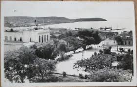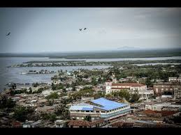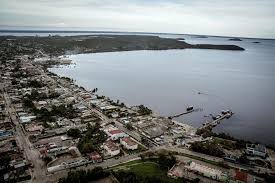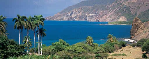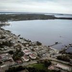
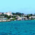
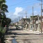
 NUEVITAS, ONE OF CUBA’S MOST IMPORTANT TOWNS. PHOTOS.
Nuevitas is a municipality and port town in the Camagüey Province of Cuba. The large bay was sighted by Christopher Columbus in 1492.
HISTORY
Founded in 1775, the city was moved to its present site in 1828. Before the 1977 national municipal reform, Nuevitas was divided into the barrios of Primero, Segundo, Tercero, Alvaro Reinoso, Lugareño, Redención, San Miguel and Senado.
https://youtu.be/QuyHCp6T1E8
(Press ^ Here)
Nuevitas, Camaguey.
GEOGRAPHY
Nuevitas is located on the Guincho peninsula on the north coast, and borders with the municipalities of Guáimaro, Minas, Manatí (in Las Tunas Province) and Morón (in Ciego de Ávila Province). The municipality includes the villages of Camalote, Pastelillo, Playa Santa Lucía, San Agustín, San Miguel de Bagá and Santa Rita.
Nuevitas is not a very large city but it is one of Cuba’s most important towns because of its commercial and industrial activities. Nuevitas is located southwest of Playa Santa Lucía, which is popular with tourists. Cayo Sabinal is located immediately north; other cays are Cayo Guajaba and Cayo Romano. The only waterway that separates Santa Lucia from Ensenada Playa Bonita is the canal of Nuevitas which connects the Bahia de Nuevitas to the Atlantic Ocean.
DEMOGRAPHICS
In 2004, the municipality of Nuevitas had a population of 44,882. With a total area of 415 km2 (160 sq mi), it has a population density of 108.1/km2 (280/sq mi).
TRANSPORT
Nuevitas is sheltered by a huge harbor, has two auxiliary ports, and is a major shipping point for Cuban sugar as well as other products from the surrounding agricultural region. It also possesses a diversified light industry and serves as a road and rail terminus. The principal road crossing the municipality is the state highway “Circuito Norte” (CN).
The railway station is the terminus of two lines: one from Camagüey, and a second from Santa Clara, through the Atlantic Coast and Morón.
PERSONALITIES
Emilia Bernal (1882–1964), poet; Enrique Cirules (1938–2016), writer; Armando Coroneaux (b. 1985), footballer.
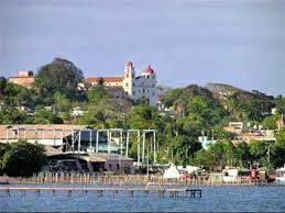 NUEVITAS, UNO DE LOS PUEBLOS MÁS IMPORTANTES DE CUBA. FOTOS.
Nuevitas es un municipio y ciudad portuaria de la provincia de Camagüey en Cuba. La gran bahía fue vista por Cristóbal Colón en 1492.
HISTORIA
Fundada en 1775, la ciudad fue trasladada a su sitio actual en 1828. Antes de la reforma municipal nacional de 1977, Nuevitas se dividió en los barrios Primero, Segundo, Tercero, Álvaro Reinoso, Lugareño, Redención, San Miguel y Senado.
GEOGRAFÍA
Nuevitas se ubica en la península de Guincho en la costa norte, y limita con los municipios de Guáimaro, Minas, Manatí (en la provincia de Las Tunas) y Morón (en la provincia de Ciego de Ávila). El municipio incluye los pueblos de Camalote, Pastelillo, Playa Santa Lucía, San Agustín, San Miguel de Bagá y Santa Rita.
https://youtu.be/dtk77r5OPJk
(Presione ^ Aqui)
Nuevitas, Camaguey.
Nuevitas no es una ciudad muy grande pero es una de las ciudades más importantes de Cuba por sus actividades comerciales e industriales. Nuevitas se encuentra al suroeste de Playa Santa Lucía, que es popular entre los turistas. Cayo Sabinal se ubica inmediatamente al norte; otros cayos son Cayo Guajaba y Cayo Romano. La única vía fluvial que separa a Santa Lucía de Ensenada Playa Bonita es el canal de Nuevitas que conecta la Bahía de Nuevitas con el Océano Atlántico.
DEMOGRAFÍA
En 2004, el municipio de Nuevitas tenía una población de 44.882. Con una superficie total de 415 km2 (160 millas cuadradas), tiene una densidad de población de 108,1 / km2 (280 millas cuadradas).
TRANSPORTE
Nuevitas está protegida por un enorme puerto, tiene dos puertos auxiliares y es un importante punto de envío para el azúcar cubano y otros productos de la región agrícola circundante. También posee una industria ligera diversificada y sirve como terminal de carreteras y ferrocarriles. La vía principal que cruza el municipio es la carretera estatal “Circuito Norte” (CN).
La estación de ferrocarril es el término de dos líneas: una desde Camagüey y una segunda desde Santa Clara, por la Costa Atlántica y Morón.
PERSONALIDADES
Emilia Bernal (1882-1964), poeta; Enrique Cirules (1938-2016), escritor; Armando Coroneaux (n. 1985), futbolista.
Agencies/ Wiki/ Internet Photos/ YouTube/ Arnoldo Varona/ www.TheCubanHistory.com
THE CUBAN HISTORY, HOLLYWOOD.


