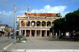
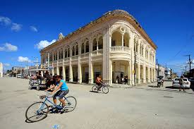
CAIBARIEN, CUBA “LA VILLA BLANCA (THE WHITE TOWN). CAIBARIENSES. PHOTOS/VIDEOS
Caibarién is a municipality city in the Villa Clara province of Cuba.
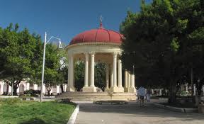
Caibarién is known as “La Villa Blanca” (The White Town) for its sands and beaches. They are famous for their “Parrandas” (Carnivals) along with Remedios (the neighboring town located 7 kilometers (4.3 mi) west) and Camajuani.
HISTORY
The town was founded on October 26, 1832, from a map designed by Estratón Bauza. For his constant concern and tenacity in their efforts, and because he offered some of his lands and also economic concessions to the founding of the town Don Narciso de Justa is considered the founder of Caibarién. In 1834 it was named Colonia de Vives, but in 1837 the original name (Caibarién) was restored. On September 19, 1873, it was awarded the title village.
https://youtu.be/0LR33hbhYPA
Press ^ Here
CAIBARIEN, CUBA TRIP
In 1878 the town already had stores, churches, schools, and newspapers. Founded in Caibarién on October 25 was the committee of the Cuban Liberal Party, and elections were prepared between the Liberal Party and the Constitutional Union.
On January 1, 1879, Caibarién emerged as an independent municipality of Remedios, and the first city council was established with Don Hipólito Escobar Martelo from the Liberal Party as its first Mayor. In 1891, Laureano López Cosío was chosen as Mayor.
In the second half of 1893, political turmoil began to increase, shedding elements from the Conservative Union to form a third political party called Reform. This year the mayor Cosío died and Damián Judez Celaya was elected. On January 18, 1895, Judez died and was succeeded by the Spanish merchant Antonio Imaz Llaguno.
Before the independence war of 1895, the village had achieved steady progress, showing an economic power that was a real surprise at the time.
The area was the scene of actions during the independence wars of the nineteenth century like the uprising of Carlos Roloff.
GEOGRAPHY
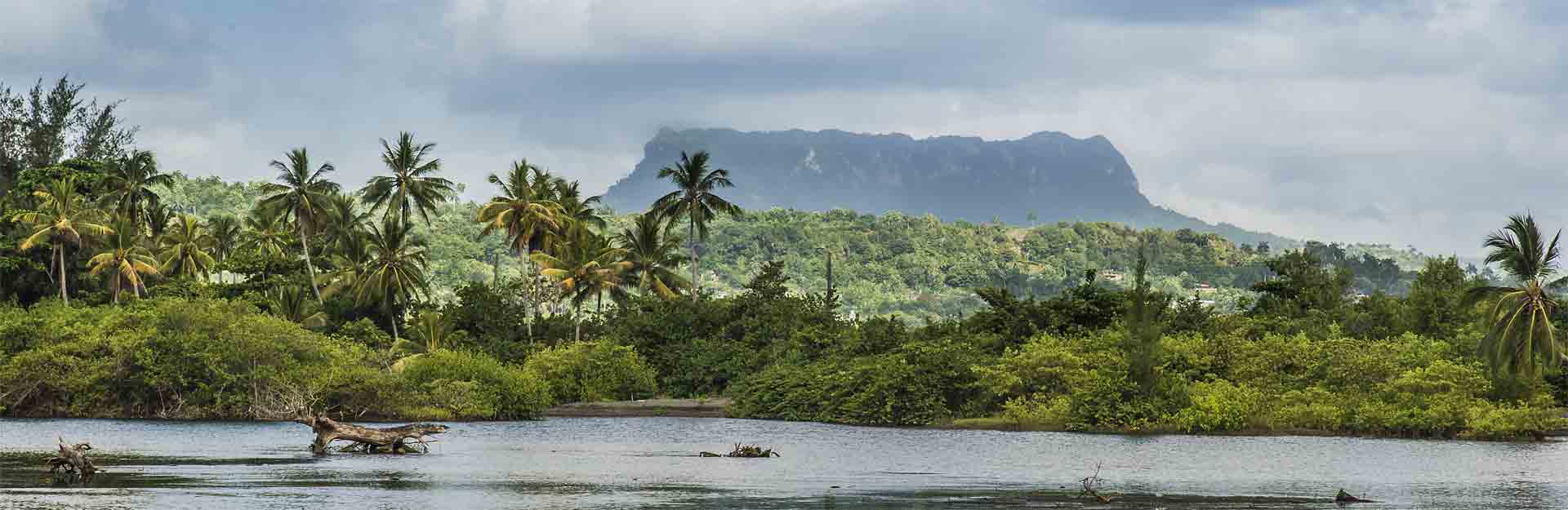
The city is situated on the north coast of Cuba, bordering the Bay of Buena Vista (Bahía de Buena Vista) of the Atlantic Ocean. It lies at the eastern extremity of the Villa Clara Province, close to the border with Sancti Spíritus Province. The town is served by the Caibarién Airport (IATA: -, ICAO: MUCB).
The municipality is divided into the barrios of Primero, Segundo, Tercero, Cuarto and Quinto.
CAYO CONUCO
Cayo Conuco is a tiny island located 7 kilometers (4 miles) from Caibarién, which is joined to the mainland by a stone causeway. It was recently covered only by thin, dry pasture, however, native plant species have resumed their original place. In 1948, the Asociación de Scouts de Cuba held its second national Jamboree in Cayo Conuco.
ECONOMY AND TOURISM
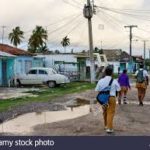
Caibarién once served as a shipping point for agricultural commodities, such as sugarcane, tobacco, and fruit. It also served as a sponge-fishing center. Its hotels are now destroyed by lack of care, and most concrete houses are crumbling onto its streets. The piers that once served as shipping points for agricultural commodities have fallen into the bay. The two sugar mills that used to send their sugar exports through the harbor are now closed and crumbling. The major sugar mill (Reforma) is now a museum for tourists.
The Parrandas carnivals take place twice a year in August–September, and mid-December. They last usually for about two weeks at a time.
The main center for tourists in Caibarién is “Los Cayos” (The keys) with such cays as Cayo Santa María, Cayo Fragoso, Cayo Las Brujas, etc. New Cuban reforms now allow Cuban citizens to enter the resorts and beaches that were once exclusive to tourists.
Area code(s) +53-42
DEMOGRAPHICS
In 2004, the municipality of Caibarién had a population of 38,064.[9] With a total area of 212 km2 (82 sq mi), it has a population density of 179.5/km2 (465/sq mi).
NOTABLE PEOPLE
Sebastian Arcos Bergnes,,Gustavo Arcos, Joe Carollo, Flores Chaviano, Manuel Corona, Miguel Cubiles, Dayexi Gandarela, Hanser García, Jorge García (kayaker), Asley González, Adela Hernández, Mario Inchausti, Aurelio Monteagudo, Manny Montejo, Santos Ojeda, Raquel Olmedo,Juan T. Vázquez Martín.

* RECOMIENDENOS A SUS AMISTADES * PREFIERA A NUESTROS SPONSORS.*
![]()
CAIBARIEN, CUBA “LA VILLA BLANCA (EL PUEBLO BLANCO). CAIBARIENSES. FOTOS / VIDEOS
Caibarién es una ciudad municipio de la provincia de Villa Clara en Cuba.
Caibarién es conocido como “La Villa Blanca” (El Pueblo Blanco) por sus arenas y playas. Son famosos por sus “Parrandas” (Carnavales) junto con Remedios (el pueblo vecino ubicado a 7 kilómetros al oeste) y Camajuani.
HISTORIA
El pueblo fue fundado el 26 de octubre de 1832, a partir de un mapa diseñado por Estratón Bauza. Por su constante preocupación y tenacidad en sus gestiones, y porque ofreció algunas de sus tierras y también concesiones económicas a la fundación del pueblo Don Narciso de Justa es considerado el fundador de Caibarién. En 1834 recibió el nombre de Colonia de Vives, pero en 1837 se restauró el nombre original (Caibarién). El 19 de septiembre de 1873, se le otorgó el título de villa.
https://youtu.be/hIU1unRdxnA
Presione ^ Aquí
VIAJE A CAIBARIEN, CUBA
En 1878 la ciudad ya contaba con tiendas, iglesias, escuelas y periódicos. Fundado en Caibarién el 25 de octubre fue el comité del Partido Liberal Cubano, y se prepararon elecciones entre el Partido Liberal y la Unión Constitucional.
El 1 de enero de 1879 surge Caibarién como municipio independiente de Remedios y se establece el primer ayuntamiento con Don Hipólito Escobar Martelo del Partido Liberal como primer alcalde. En 1891, Laureano López Cosío fue elegido alcalde.
En la segunda mitad de 1893, la agitación política comenzó a aumentar, despojándose de elementos de la Unión Conservadora para formar un tercer partido político llamado Reforma. Este año murió el alcalde Cosío y fue elegido Damián Judez Celaya. El 18 de enero de 1895 murió Judez y fue sucedido por el comerciante español Antonio Imaz Llaguno.
Antes de la guerra de independencia de 1895, el pueblo había logrado un progreso constante, mostrando un poder económico que fue una verdadera sorpresa en ese momento.
La zona fue escenario de acciones durante las guerras de independencia del siglo XIX como el levantamiento de Carlos Roloff.
GEOGRAFÍA
La ciudad está situada en la costa norte de Cuba, bordeando la Bahía de Buena Vista (Bahía de Buena Vista) del Océano Atlántico. Se encuentra en el extremo oriental de la provincia de Villa Clara, cerca de la frontera con la provincia de Sancti Spíritus. La ciudad es servida por el Aeropuerto de Caibarién (IATA: -, OACI: MUCB).
El municipio se divide en los barrios Primero, Segundo, Tercero, Cuarto y Quinto.
CAYO CONUCO
Cayo Conuco es una pequeña isla ubicada a 7 kilómetros (4 millas) de Caibarién, que está unida al continente por una calzada de piedra. Recientemente estuvo cubierto solo por pastos delgados y secos, sin embargo, las especies de plantas nativas han vuelto a su lugar original. En 1948, la Asociación de Scouts de Cuba celebró su segundo Jamboree nacional en Cayo Conuco.
ECONOMÍA Y TURISMO
Caibarién alguna vez sirvió como punto de envío de productos agrícolas, como caña de azúcar, tabaco y frutas. También sirvió como centro de pesca de esponjas. Sus hoteles están ahora destruidos por falta de atención y la mayoría de las casas de concreto se derrumban en sus calles. Los muelles que alguna vez sirvieron como puntos de envío de productos agrícolas han caído en la bahía. Los dos ingenios azucareros que solían enviar sus exportaciones de azúcar a través del puerto ahora están cerrados y desmoronándose. El principal ingenio azucarero (Reforma) es ahora un museo para turistas.
Los carnavales de Parrandas se llevan a cabo dos veces al año, de agosto a septiembre, ya mediados de diciembre. Suelen durar unas dos semanas seguidas.
El principal centro turístico de Caibarién es “Los Cayos” con cayos como Cayo Santa María, Cayo Fragoso, Cayo Las Brujas, etc. Nuevas reformas cubanas ahora permiten a los ciudadanos cubanos ingresar a los balnearios y playas que alguna vez fueron exclusivos a los turistas.
Código (s) de área + 53-42

DEMOGRAFÍA
En 2004, el municipio de Caibarién tenía una población de 38.064 habitantes. Con una superficie total de 212 km2 (82 millas cuadradas), tiene una densidad de población de 179,5 / km2 (465 millas cuadradas).
GENTE NOTABLE
Sebastian Arcos Bergnes, Gustavo Arcos, Joe Carollo, Flores Chaviano, Manuel Corona, Miguel Cubiles, Dayexi Gandarela, Hanser García, Jorge García (kayakista), Asley González, Adela Hernández, Mario Inchausti, Aurelio Monteagudo, Manny Montejo, Santos Ojeda, Raquel Olmedo, Juan T. Vázquez Martín.
Agencies/ Wiki/ Internet Photos/ YouTube/ Arnoldo Varona/ www.TheCubanHistory.com
THE CUBAN HISTORY, HOLLYWOOD.
* RECOMIENDENOS A SUS AMISTADES * PREFIERA A NUESTROS SPONSORS.*
![]()