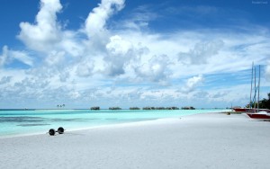
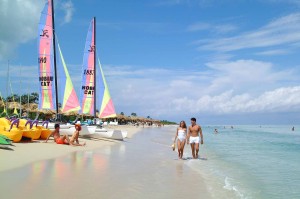
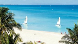
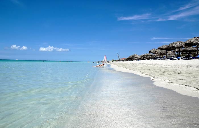
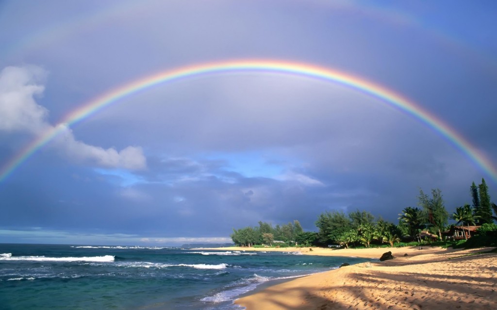
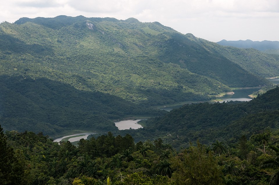
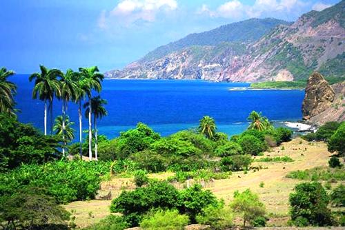
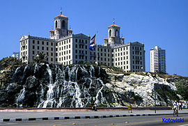
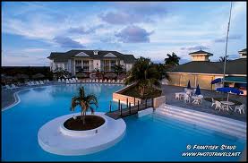
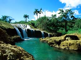
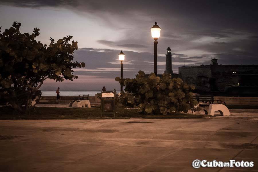
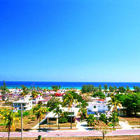
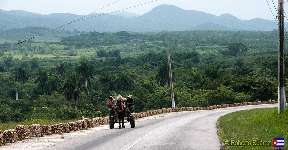
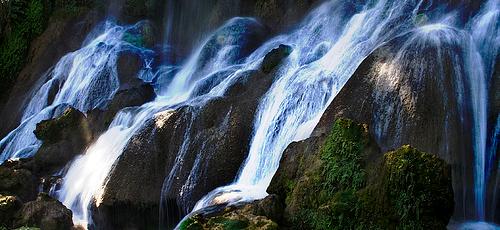
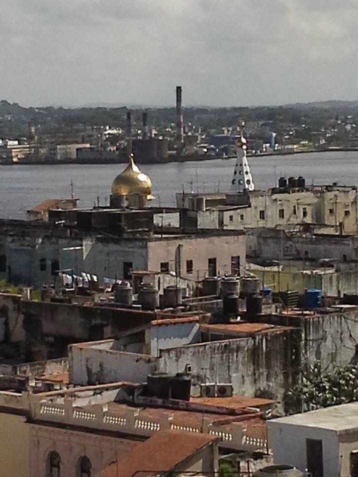
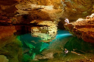
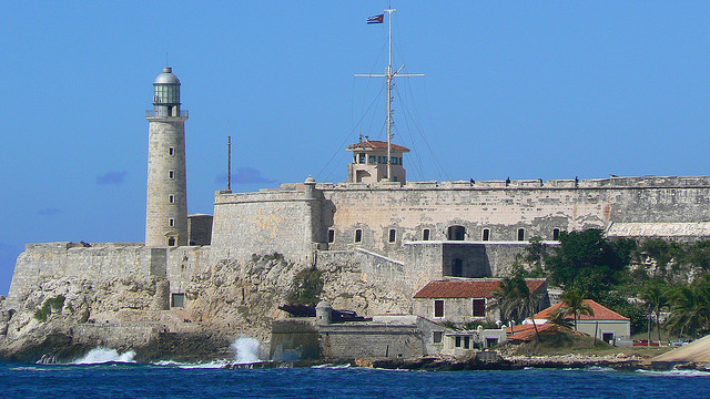
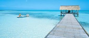
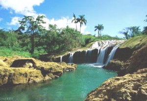
SOME OF THE MOST BEAUTIFUL BEACHES IN CUBA.
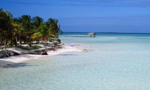
A selection of the five best beaches in Cuba is a difficult task when you consider that the island is made up of the majestic coastline extends 5,746 kilometers, and the division in 289 natural beaches.
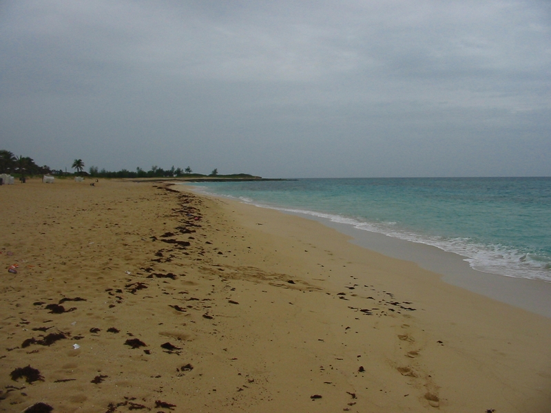
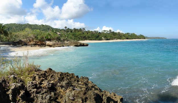
For example, the northern beaches of Cuba are characterized by fine golden sands and turquoise waves of the Atlantic Ocean, while the South are making them perfect for quiet periods of isolation.
Anyway, here are our top 5 beaches in Cuba:
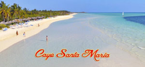
1.- Cayo Santa María is an island located north of Cuba in the Jardines del Rey archipelago.
Cay Santa Maria is also known as the White Rose of Jardines del Rey. The cay was named after the flagship of Christopher Columbus’s fleet on his maiden voyage to the New World. Legend has it that this strip of land-some 13 km long and 2 km in width- is haunted by the spirit of Rosa Maria Coraje, a woman who hid aboard a ship in a desperate attempt to find both paradise and her beloved. She landed on the cay and managed to survive hiding in the marshes, among the mangroves and feeding on fish, until she finally discovered her dearly-loved in a neighboring cay.
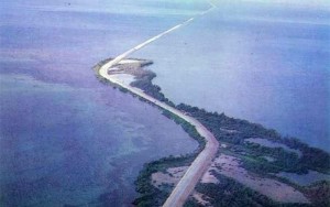
Cayo Santa Maria, renowned for their immaculate landscape of incredible beauty, with sugary-white sand beaches and crystal-clear waters, fringed by autochthonous vegetation and connected to Caibarien, a small fishing town on the Cuban mainland, by a 48 km causeway stretching over the sea -accorded an international prize for its harmonious combination of nature and engineering in an area declared a World Biosphere Reserve- thus enabling visitors to access the cays directly from Santa Clara City, site of the international airport.
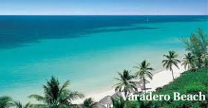
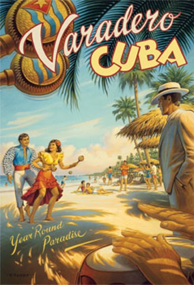
2. Varadero beach, is a resort town in the province of Matanzas, Cuba, and one of the largest resort areas in the Caribbean. Varadero is also called Playa Azul, which means “blue beach” in Spanish.
It is situated on the Hicacos Peninsula, between the Bay of Cárdenas and the Straits of Florida, some 140 km east of Havana, at the eastern end of the Via Blanca highway. The peninsula is only 1.2 km wide at its widest point and is separated from the island of Cuba by the Kawama Channel. This spit of land however extends more than 20 kilometers from the mainland in a northeasterly direction and its tip, Punta Hicacos, is the northernmost point of the island of Cuba. At the northeastern end of the peninsula there is a nature reserve with virgin forests and beaches.
Varadero is foremost a tourist resort town, boasting more than 20 km of white sandy beaches. The first tourists visited Varadero as early as the 1870s, and for years it was considered an elite resort. In 1910 the annual rowing regatta was started; five years later the first hotel, named Varadero and later Club Nautico, was built. Tourism grew in the early 1930s as Irénée du Pont Nemours, an American millionaire, built his estate on the peninsula. After the Cuban Revolution in 1959, many mansions were expropriated from their rich owners.
Juan Gualberto Gómez Airport, situated west of the peninsula, is Varadero’s airport. It is the second-most-important airport of the island after José Martí Airport in Havana, and serves international and domestic flights.
The 1990s brought the start of another hotel building campaign, mostly in the 4-star and 5-star segment. Many of the hotels are operated or co-owned by foreign businesses like Melia, Barcelo, TRYP, etc. (France’s Club Med used to have a property but has since left Varadero.) As a consequence, Varadero has lost much of its social and cultural life and its traditions. The central park, the cinema and various cultural meeting places were neglected in favor of a hotel-centred all-inclusive-tourism and finally closed. The International Carnival, an initiative of Cubans and foreigners started in the 1980s, also ceased.
http://youtu.be/CVvZCNcBy_Y
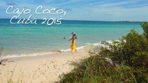
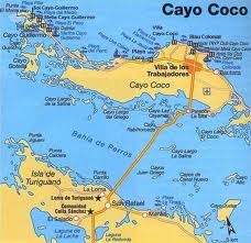
3.Cayo Coco, (Coco Key) is an island in central Cuba. It lies within the Ciego de Ávila Province and is part of a chain of islands called Jardines del Rey (“King’s Gardens”). It is named for the white ibis, locally called Coco (coconut) birds. It has a surface of 370 km². The island is made with 27 kilometers of some of the best beaches in Cuba. To the north, 9 snow white beaches, gently lapped by the Atlantic Ocean, to the south tropical mangroves, and wildlife refuges.
Used as a hideout by buccaneers in the early colonial period, the island was home to a small settlement of fishermen and charcoal producers until 1955 when the freshwater supply was exhausted and the market for charcoal. A causeway was built to the Cuban mainland in 1988, beginning the era of resort construction. The first resort, Guitart Cayo Coco (now the Blau Colonial), opened in 1993.
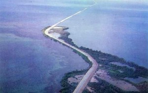
The causeway linking the cay to the mainland is 27 km long. The construction caused concern among environmentalists as it disturbed the tidal flow and thus life-cycle of waterlife. Despite fears, the wild flamingos still live in the shallow waters and can often be seen from the causeway although not as often as before the construction. A number of gaps were subsequently created in the causeway to restore water flow.
Still largely wild with swamps and scrubland populated by wild cattle. Beaches are very good and the massive coral reef off the north coast. Cayo Coco is linked by a short causeway to Cayo Guillermo to the west and by another short causeway to Cayo Romano to the east.
The island has its own international airport, the Jardines del Rey Airport (Aeropuerto Jardines del Rey) An earlier airport, the Cayo Coco Airport has been reclaimed as a small natural park called Parque Natural El Baga.
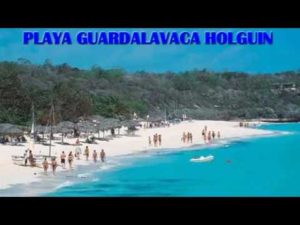
4.Guardalavaca is a town in the Holguín Province of Cuba. It is a well known location for years due to its white sandy beaches and warm waters with its 3 miles long is one of the smaller beaches in Cuba to enjoy. It is protected by a coral reef 300 meters, so it is a fascinating microclimate for marine life.
It is located on the northern shore of Cuba, bordering Bahia Naranjo (Orange Bay), on Cabo Lucrecia, and is part of the municipality of Banes. Beaches in Guardalavaca include Guardalavaca Beach, Playa Esmeralda, Don Lino and Bahia de Naranjo.
“Guardalavaca” literally means “guard the cow” in Spanish. There are several accounts as to how this name may have originated; one version maintains that Guardalavaca is a malapropism for its original name Guardalabarca, meaning “guard the ship”. The area was once heavily targeted by sea pirates, and Bahia Naranjo near what is now the town of Guardalavaca is a secluded shallow bay connected to the open sea by a narrow inlet, which made it a proper safe haven to guard ships against pirates. On the other hand, the name may have originated from pirates going after the cattle grazing in the area. As pirates were spotted, the local farmers would thus shout, “Guardalavaca” – guard the cow.
The Cuban government has attempted on several occasions to change the name of the area as they deem it not to be very appealing; they have so far been unsuccessful.
http://youtu.be/QPS9O45_UTA
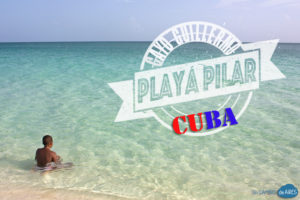
5. Cayo Guillermo is a kay of the Jardines del Rey archipelago. It is located on the northern coast of Cuba, between the Bay of Dogs (Bahia de Perros) and the Atlantic Ocean. It is part of the Ciego de Ávila Province, and lies in the Morón municipality. One of the country’s best beaches, the Playa Pilar (Pilar Beach) is located at the western end of Cayo Guillermo. This beach is named after Ernest Hemingway’s yacht, the cabin cruiser Pilar. The island provides the setting for the climax of Hemingway’s last novel Islands in the Stream.
Access to the island is possible through the Jardines del Rey Airport (Aeropuerto Jardines del Rey) as well as by means of a long causeway from mainland Cuba to Cayo Coco leading to a second shorter causeway to Cayo Guillermo, connecting the two kays.
Sparsely inhabited in early years by fishermen and charcoal producers, the island gained fame in the 1960s with deep sea fishermen. The first resort was built in 1993 in an era known as “Tourist apartheid” as Cuban citizens were not allowed on the island unless they worked at the resorts serving tourists. However this restriction was lifted after 2000 and Cubans who can afford motor transport often visit Playa Pilar on the island. Many staff who work in the hotels commute from the distant mainland town of Morón.
Cayo Guillermo (Playa Pilar)
Wiki/internetphotos/StandardyoutubeLicense/FairUse/thecubanhistory.com
The Cuban History, Hollywood.
Arnoldo Varona, Editor.
BELLAS PLAYAS DE CUBA
Una selección de las cinco mejores playas de Cuba es una tarea difícil si tenemos en cuenta que la isla está formada con una majestuosa costa que se extiende 5.746 kilometros, y con una división en 289 playas naturales.
Por ejemplo, las playas del norte de Cuba se caracterizan por arenas finas y doradas y olas turquesas del Océano Atlántico, mientras que el Sur se hace perfecta por sus bellas arenas blancas.
De todos modos, aquí están los 5 mejores playas de Cuba:
1 -. Cayo Santa María es una isla situada al norte de Cuba, en Jardines del Rey archipiélago.
Cayo Santa María es también conocida como la rosa blanca de Jardines del Rey. El cayo fue nombrado después de que el buque insignia de la flota de Cristóbal Colón en su primer viaje al Nuevo Mundo. La leyenda cuenta que esta franja de tierra a unos 13 km de largo y 2 km de ancho-es perseguido por el espíritu de Rosa María Coraje, una mujer que escondió a bordo de un barco en un intento desesperado de encontrar tanto el paraíso y su amado. Ella aterrizó en el cayo y logró sobrevivir escondiéndose en las marismas, los manglares y se alimentan de peces, hasta que finalmente la descubrió caro querido en un cayo cercano.
Cayo Santa María, famoso por su paisaje inmaculado de increíble belleza, con playas de arena blanca-blanca y aguas cristalinas, rodeado de vegetación autóctona y conectado a Caibarién, un pequeño pueblo de pescadores en la península cubana, por una calzada 48 kilometros se extiende más el mar otorga un premio internacional por su armoniosa combinación de naturaleza e ingeniería en una zona declarada Reserva Mundial de la Biosfera, lo que permite a los visitantes acceder directamente los cayos de la ciudad de Santa Clara, sede del aeropuerto internacional.
2. Playa de Varadero, es una ciudad turística en la provincia de Matanzas, Cuba, y una de las mayores áreas de resorts en el Caribe. Varadero es también llamada Playa Azul, que significa “agua azul” en español.
Está situado en la península de Hicacos, entre la Bahía de Cárdenas y el Estrecho de Florida, a unos 140 km al este de La Habana, en el extremo oriental de la autopista Vía Blanca. La península está a sólo 1,2 km de ancho en su punto más ancho y está separada de la isla de Cuba por el Canal Kawama. Esta lengua de tierra sin embargo se extiende más de 20 kilómetros de la parte continental en dirección noreste y su punta, Punta Hicacos, es el punto más septentrional de la isla de Cuba. En el extremo noreste de la península hay una reserva natural con bosques vírgenes y playas.
Varadero es ante todo una ciudad turística, con más de 20 km de playas de arena blanca. Los primeros turistas visitaron Varadero ya en la década de 1870, y durante años fue considerado un resort de elite. En 1910, la regata de remo anual se inició, y cinco años más tarde, el primer hotel, llamado Varadero y posteriormente Club Náutico, fue construido. El turismo creció en la década de 1930 como Irénée du Pont de Nemours, un millonario americano, construyó su finca en la península. Después de la Revolución Cubana en 1959, muchas mansiones fueron expropiadas a sus propietarios ricos.
Juan Gualberto Gómez Airport, situado al oeste de la península, es el aeropuerto de Varadero. Es el segundo aeropuerto más importante de la isla, después de José Martí en La Habana, y recibe vuelos nacionales e internacionales.
La década de 1990 trajo el comienzo de otra campaña de construcción de hotel, sobre todo en el segmento de 4 estrellas y 5 estrellas. Muchos de los hoteles son operados o co-propiedad de las empresas extranjeras como Meliá, Barceló, TRYP, etc (Club Med de Francia solía tener una propiedad, pero desde entonces ha dejado Varadero.) Como consecuencia, La Habana ha perdido mucho de su valor social y la vida cultural y sus tradiciones. El parque central, el cine y diversos lugares de reunión culturales fueron abandonados en favor de un hotel centrado en el todo incluido el turismo y cerró finalmente. El Carnaval Internacional, una iniciativa de los cubanos y los extranjeros que se inició en la década de 1980, también cesó.
3. Cayo Coco Beach – Se utiliza como escondite por los bucaneros en el período colonial temprano, la isla fue el hogar de un pequeño asentamiento de pescadores y productores de carbón hasta 1955 cuando el suministro de agua dulce se había agotado y el mercado de carbón. Una calzada fue construida con la tierra firme de Cuba en 1988, comenzando la era de la construcción del centro turístico. El primer recurso, Guitart Cayo Coco (ahora el Blau Colonial), abrió sus puertas en 1993.
La calzada que une el cayo a la tierra firme se encuentra a 27 km. La construcción causó preocupación entre los ecologistas, ya que perturba el flujo de las mareas y de este modo el ciclo de vida de Waterlife. Pese a los temores, los flamencos salvajes siguen viviendo en las aguas poco profundas y con frecuencia se puede ver en la calzada, aunque no con tanta frecuencia como antes de la construcción. Una serie de lagunas fueron creados posteriormente en la calzada para restablecer el flujo de agua.
Todavía en gran parte salvaje de pantanos y matorrales pobladas por ganado salvaje. Las playas son muy buenas y el arrecife de coral masivo en la costa norte. Cayo Coco está unida por un corto terraplén hacia Cayo Guillermo, al oeste y por otro corto terraplén hacia Cayo Romano hacia el este.
La isla tiene su propio aeropuerto internacional, el Aeropuerto Jardines del Rey (Aeropuerto Jardines del Rey) Un aeropuerto antes, el aeropuerto de Cayo Coco se ha recuperado como un pequeño parque natural llamado Parque Natural El Baga.
4. Guardalavaca es una ciudad en la provincia de Holguín en Cuba. Es un lugar muy conocido por años, debido a sus playas de arena blanca y aguas cálidas, con sus 3 kilómetros de largo es una de las playas más pequeñas en Cuba para disfrutar. Está protegida por un arrecife de coral a 300 metros, por lo que es un microclima fascinante para la vida marina.
Se encuentra en la costa norte de Cuba, bordeando Bahía Naranjo (Orange Bay), en Cabo Lucrecia, y es parte del municipio de Banes. Las playas de Guardalavaca incluyen Playa Guardalavaca, Playa Esmeralda y Don Lino y Bahía de Naranjo.
“Guardalavaca” significa literalmente “guardia de la vaca” en español. Hay varias cuentas de cómo este nombre puede tener su origen, una versión sostiene que Guardalavaca es una malapropism por su Guardalabarca nombre original, que significa “protector de la nave”. El área fue una vez fuertemente el blanco de los piratas del mar, y Bahía Naranjo cerca de lo que hoy es la ciudad de Guardalavaca es una pequeña y recóndita cala poco profunda conectada con el mar abierto por un estrecho, lo que hizo un buen refugio seguro para protegerse contra los barcos piratas. Por otro lado, el nombre puede tener su origen en los piratas que van después de la cría de ganado en la zona. Como los piratas fueron vistos, los agricultores locales así gritaba: “Guardalavaca” – proteger a la vaca.
El gobierno cubano ha intentado en varias ocasiones para cambiar el nombre de la zona, ya que lo considera no ser muy atractivo, que hasta ahora han sido infructuosos.
El acceso a la isla es posible a través del Aeropuerto Jardines del Rey (Aeropuerto Jardines del Rey), así como por medio de una larga calzada de tierra firme Cuba a Cayo Coco conducen a un segundo puente más corto para Cayo Guillermo, que conecta los dos cayos.
Escasamente habitada en los primeros años por los pescadores y productores de carbón vegetal, la isla ganó fama en la década de 1960 con los pescadores de alta mar. El primer complejo fue construido en 1993 en una era conocida como “apartheid turístico” como ciudadanos cubanos no estaban permitidos en la isla a menos que trabajaban en las estaciones de servicio de los turistas. Sin embargo, esta restricción fue levantada a partir de 2000 y los cubanos que pueden pagar el transporte del motor suelen visitar Playa Pilar en la isla. Muchos miembros del personal que trabajan en el trayecto hoteles de la ciudad continente distante de Morón.
5. Cayo Guillermo es un kay del archipiélago de Jardines del Rey. Se encuentra en la costa norte de Cuba, entre la Bahía de Perros (Bahía de Perros) y el Océano Atlántico. Forma parte de la provincia de Ciego de Ávila y se encuentra en el municipio de Morón. Una de las mejores playas del país, la Playa Pilar está ubicada en el extremo oeste de Cayo Guillermo. Esta playa lleva el nombre del yate de Ernest Hemingway, el crucero de cabina Pilar. La isla es el escenario para el clímax de la última novela de Hemingway Islands in the Stream.
El acceso a la isla es posible por el Aeropuerto Jardines del Rey, así como por una larga calzada desde Cuba hasta Cayo Coco, que conduce a una segunda calzada más corta hacia Cayo Guillermo, conectando los dos kays.
Sparsely habitada en los primeros años por los pescadores y los productores de carbón, la isla ganó fama en la década de 1960 con pescadores de aguas profundas. El primer complejo fue construido en 1993 en una época conocida como “apartheid turístico”, ya que los ciudadanos cubanos no estaban permitidos en la isla a menos que trabajaran en los complejos que sirven a los turistas. Sin embargo, esta restricción se levantó después de 2000 y los cubanos que pueden permitirse el transporte de motor a menudo visitan Playa Pilar en la isla. Muchos empleados que trabajan en los hoteles conmutan desde el lejano continente de Morón.
THE FAMOUS BAR “SLOPPY JOE”, LA HAVANA, CUBA.
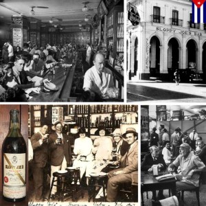
It was Ernest Hemingway, regular at this bar in Havana, who suggested the name Joe Russell for “Sloppy Joe” Key West in 1933.
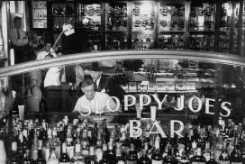
In the first decades of the twentieth century among the habaneros bars already destaba the “Floridita”, but the “Sloppy Joe’s”, located on the busy corner of Zulueta and Animas streets, was higher sales.
Its founder was José Abeal, a Spaniard who came to Cuba in 1904 to start as a waiter in a restaurant in Galiano corner Ditch. After three years he left to run better in New Orleans. He worked for six years until he moved to Miami for a living as a bartender and returned to Havana in 1918. With its vast experience in turning, he soon employment. He was hired as a clerk in a cafe called “The Bucket Greasy” where he saved enough to buy an old tavern in Animas Street, one block from Central Park and steps from the Hotel Plaza money.
In 1919 the Puritans declared Prohibition in the United States and as in the cases of all prohibitions, always finds ways to circumvent it … and Havana was very close. Some tourists who knew Abeal of when I lived in Miami, visited him at his tavern, somewhat shabby and quite dirty, and suggested that turned the place into a bar for American travelers, since Abeal spoke fluent English. He changed his name to “Joe”, and added the word “sloppy”, by the look of the place. Over the years would become one of the most famous bars in Cuba, frequented by American tourists soon put his foot in the Cuban capital.
Among his most famous visitors were Frank Sinatra, Clark Gable, Spencer Tracy, Don Ameche, Alice Faye, Tyrone Powers, Cesar Romero, John Wayne, John Barrymore, etc., etc …
One of his regular customers, Ernest Hemingway, who suggested to Joe Rusell the name of this bar for “Sloppy Joe” Key West in 1933.
Fabio Delgado, a Cuban bartender Sloppy, created a whopping 33 cocktails, one specifically dedicated to the star Errol Flynn. Among the highlights of his culinary stressed the “Ropa Vieja” and the fabulous Cuban sandwich.
The legendary and famous bar black mahogany Sloppy Joe’s, the longest in Cuba, disappeared mysteriously in the late 60s now, after a restoration process so famous, I was opened to the public again dreaming that will the continuation of that famous place that so many illustrious world of fun and the chance encounter gave this distinguished name … The Sloppy Joe!
EL FAMOSO BAR “SLOPPY JOE”, La Habana, Cuba.
Ernest Hemingway, asiduo de este bar de La Habana, es quien sugiere a Joe Rusell el nombre para el “Sloppy Joe” de Cayo Hueso, en 1933.
En las primeras décadas del siglo XX entre los bares habaneros ya se destaba el “Floridita”, pero el “Sloppy Joe’s”, ubicado en la céntrica esquina de las calles Zulueta y Ánimas, era el de mayores ventas.
Su fundador fue José Abeal, un gallego que llegó a Cuba en el año 1904 para comenzar como camarero en un restaurante de Galiano esquina a Zanja. A los tres años se fue a correr mejor suerte en Nueva Orleans. Allí trabajó por seis años hasta que se trasladó a Miami para ganarse la vida como cantinero y regresó a la capital cubana en 1918. Gracias a su vasta experiencia en el giro, no demoró en conseguir empleo. Lo contrataron como dependiente en un café llamado “El Cucharón Grasiento”, donde ahorró dinero suficiente para comprar un viejo bodegón en la calle Ánimas, a una cuadra del Parque Central y a pocos pasos del Hotel Plaza.
En 1919 los puritanos declararon la Ley Seca en Estados Unidos y como en los casos de todas las prohibiciones, siempre se encuentra la manera de burlarla… y La Habana estaba bien cerca. Unos turistas que conocían a Abeal de cuando vivía en Miami, lo visitaron en su bodegón, un tanto destartalado y bastante sucio, y le sugirieron que convirtiera el lugar en un bar para viajeros norteamericanos, puesto que Abeal hablaba correctamente el inglés. Cambió su nombre por el de “Joe”, y le agregó la palabra “sloppy”, por el aspecto del lugar. Con los años llegaría a convertirse en uno de los más famosos bares de Cuba, muy frecuentado por cuanto turista norteamericano pusiera sus pies en la capital cubana.
Entre sus más ilustres visitantes estuvieron Frank Sinatra, Clark Gable, Spencer Tracy, Don Ameche, Alice Faye , Tyrone Powers, César Romero, John Wayne, John Barrymore, etc., etc…
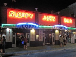
SLOPPY JOE EN CAYO HUESO, U.S.
Uno de su clientes habituales, Ernest Hemingway, es quien sugiere a Joe Rusell el nombre de este bar para su “Sloppy Joe” de Cayo Hueso, en 1933.
Fabio Delgado, un barman cubano del Sloppy, creó la friolera de 33 cocteles, uno especialmente dedicado al astro Errol Flynn. Entre los platos fuertes de su oferta gastronómica destacaba la “Ropa Vieja” y el fabuloso sándwich cubano.
La mítica y famosa barra de caoba negra del Sloppy Joe’s, la más larga de toda Cuba, desapareció misteriosamente a fines de los años 60. Ahora, despues de un proceso de restauración de tan famoso lugar, se abrio de nuevo al público soñando que será la continuación de aquel famoso lugar que tantas figuras ilustres del mundo de la diversión y el encuentro casual dió tan distinguido nombre… El Sloppy Joe!
MEMORIASDeCuba/ Derubin Jacomé/InternetPHotos/www.thecubanhistory.com
The Cuban History, Hollywood.
Arnoldo Varona, Editor.
CUBA BEACHES: AMONG THE MOST BEAUTIFUL OF THE WORLD.
Playas de Cuba: Entre las Más Bellas del Mundo.
Arias Productions/youTube/www.thecubanhistory.com
The Cuban History, HOLLYWOOD.
-Cuba Hoy- Cuba Today.
Arnoldo Varona, Editor.
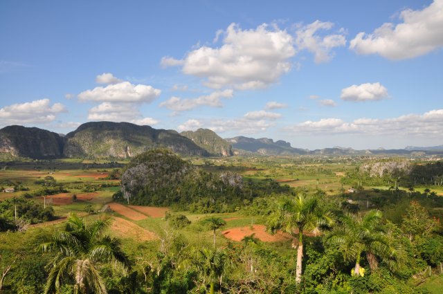
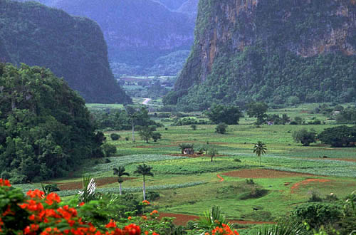
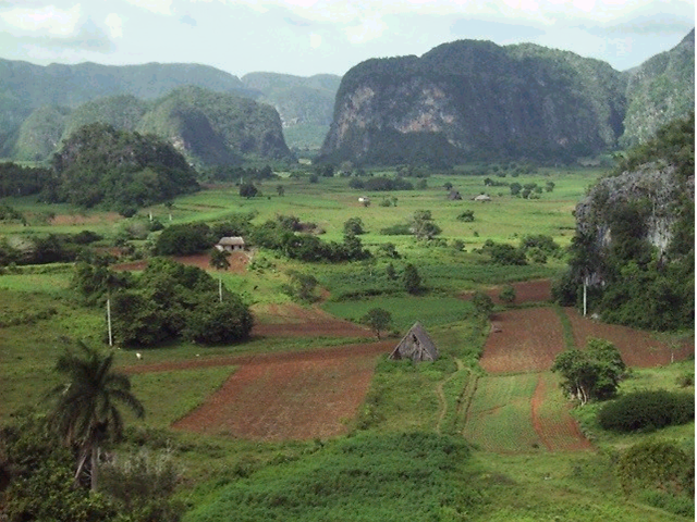
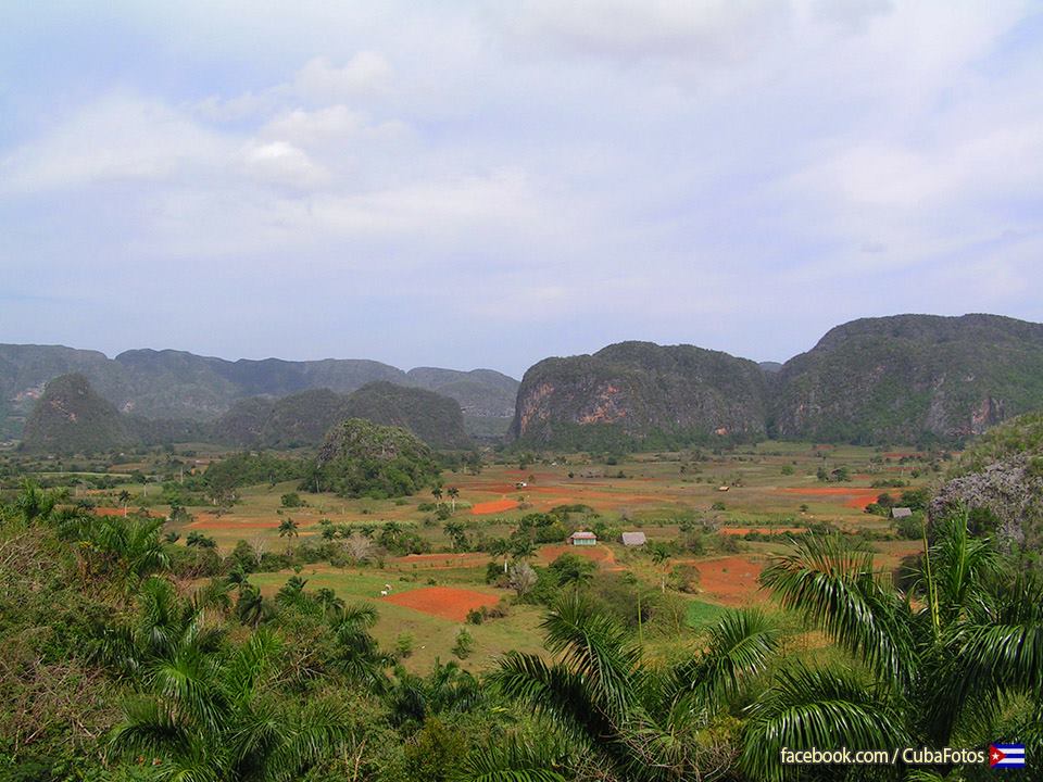
VALLE DE VIÑALES.
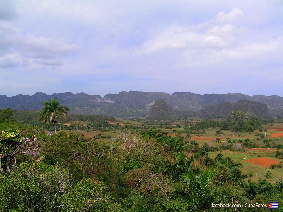
Located in the foothills of Guaniguanico corresponds to a National Park agricultural valleys and cultivation of snuff, home to huge rock formations rounded tips, known as hummocks. Declared a World Heritage Site by UNESCO because of its rich cultural landscape.
Situado en la cordillera de Guaniguanico, corresponde a un Parque Nacional de valles agrícolas y cultivo de tabaco, hogar de enormes formaciones rocosas de puntas redondeadas, conocidas como mogotes. Declarado Patrimonio de la Humanidad por la Unesco dada la riqueza de su paisaje cultural.
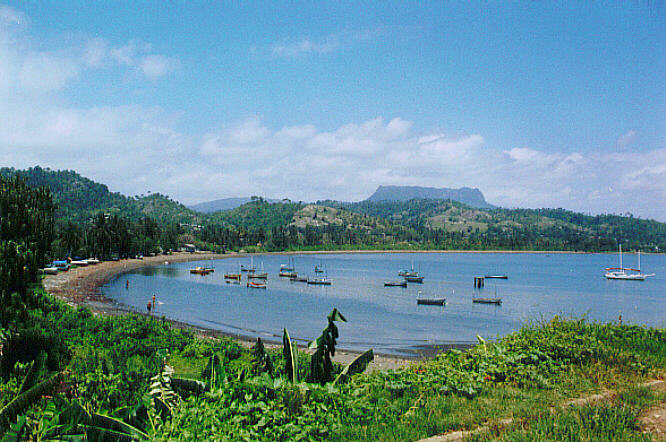
BARACOA.
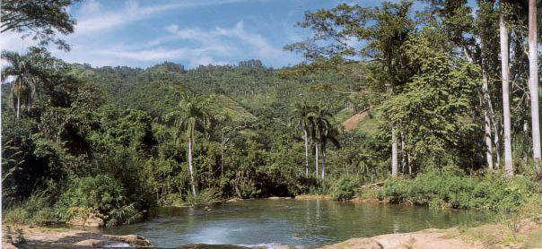
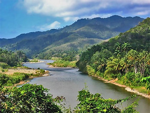
Baracoa has beautiful natural landscapes, between routes Toa River and waterfalls, tropical forests, the open sea and the mountains of El Yunque.
Baracoa tiene hermosos paisajes naturales, entre las rutas del Río Toa y sus cascadas, los bosques tropicales, el mar abierto y las montañas del Yunque.
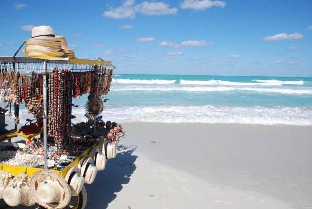
VARADERO.
Varadero is one of the most popular beaches of Cuba, is located on the north coast of Cuba, just two hours by bus from Havana. Famous for its white sand and crystal clear water.
Varadero es una de las playas más populares de Cuba, se encuentra en la costa norte de Cuba, a sólo dos horas en autobús desde La Habana. Famosa por su arena blanca y agua cristalina.
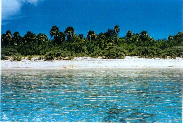
PARQUE NACIONAL GUANAHACABIBES.
Declared a Biosphere Reserve by UNESCO, the Guanahacabibes National Park is located on the peninsula of Guanahacabibes in the westernmost end of the island and 5 hours from the capital Havana.
Declarado Reserva de la Biósfera por la UNESCO, el parque nacional Guanahacabibes se encuentra localizado en la península de Guanahacabibes en el extremo más occidental de la isla y a 5 horas de la capital La Habana.
Agencies/InternetPhotos/www.thecubanhistory.com.
The Cuban History, Hollywood.
Arnoldo Varona, Editor.
VARADERO BEACH.
Varadero located on the north coast of the province of Matanzas, Hicacos Peninsula was not always the world famous Caribbean beach to which everyone wants to visit. Between the Bay of Cárdenas and the Straits of, some 140 km east of Havana, at the eastern end of the Via Blanca highway. The peninsula is only 1.2 km wide at its widest point and is separated from the island of Cuba by the Kawama Channel. This spit of land however extends more than 20 kilometers from the mainland in a northeasterly direction and its tip, Punta Hicacos, is the northernmost point of the island of Cuba. At the northeastern end of the peninsula there is a nature reserve with virgin forests and beaches.
The first to discover the wonders of the area were the Aborigines, judging by the existence of pictograms that seem to reproduce the image of the Spanish conquistador. And although no one knows certainly when was the arrival of the conquistadors to the beach, and in 1555 a French geographer Testu map reflects clearly and accurately about the current territory of Havana, in Spanish term that marks the site where the ships dock to be repaired.
The salt marshes of the north end attracted the greed of the newcomers. With the wealth of this salt was possible to supply – from the early sixteenth century – all the needs of the island and the Fleet of Spain in the New World. The chronicler of the Indies Hicacos salt described as white, pure and better grain than Campeche and Yucatan. This created a kind of ¨ ¨ salt boom that lasted until the eighteenth century, which attracted pirates, privateers and pirates marauding Indian sea. The infinite coastal cays and countless caves and caverns of the coast of refuge to these players in the sea, and many times also Maroons – African slaves who escaped to the colonizer.
Esconómico development of the island, and especially of Cardenas, the nearest town, led to the founding of the town of Varadero, as a place of rest and relaxation. So began the trips in cars drawn by horses to the nearby beach, where the plagues of mosquitoes and gnats did not allow the final settlement of the town.
The first attempt to create a village dating from 1815, until finally in 1883 was created by ten families Cardenenses communal society known as ¨ ¨ decemvirs in partnership which acquired the site of the former hacienda of Don Bernardo Garcia Varadero Carrillo with purpose of promoting the village of Varadero. The original plane, which had forty apples, was approved in 1887.
However, the beautiful beach was virtually unknown in the rest of the island, mainly communications and because fashion was going to spend the summer in Europe.
In the rainy season the roads became impassable and travel by land was almost impossible, so a little steamers were used assisted by tugs to make the journey Cardenas Varadero. The steam · Charity · inaugurated this service. It came the news, the stranger, mail, drinking water, food.
From these early years of the foundation of the town, Trinidad was divided into two clearly defined areas: the north coast, the beach, inhabited by the founding families and by those who established the first guest houses to accommodate holidaymakers and foreigners, and the south coast , consigned mainly to fishermen. The abundance of snappers, groupers, shellfish, and crustaceans guarantee the livelihood of the poor local population and consumption.
Daily tours of steam, as well as boats, schooners and yachts led to the construction of a dock. Other activities of the vacationers were ball , swimming competition, hunting, fishing. However, it can be said that in the early years of the Republic (framed from 1902) was still little visited Varadero. In 1910 he started racing clubs between Varadero and Halley. This led to the founding of the Yacht Club and a competition that was traditional, with the participation of the aristocratic clubs canoes Havana and other cities of the country. In 1911 he completed work on the first road. But the wealthy classes preferred to continue traveled to Europe or Miami.
Since the first decade of the twentieth century, some Americans recognized the magnificent natural conditions of the beach of Varadero and are attracted to its benefits. Mr. Johnson, president of the Johnson Contracting Co. of Wayne, Pennsylvania, was the Chautaqua Cuba Resort Association, based in Philadelphia, to promote in the United States the charms of Varadero. This was the first American built his residence here: a beautiful wooden palace, rebuilt in 1917 with materials never before seen on the site. After dissolution of the company, years later, this land became property of the Cuban and American Miguel Llúria French origin Irenee Dupont de Nemours. The First World War European resorts closed, forcing the rich to turn their eyes Creole Varadero. Thus begins construction of numerous residences in the entire north coast, while the south coast continues bringing together fishermen, builders and workers.
In 1926, founded the company Dupont henequen Cardenas SA, and later replaced by the Company name Hicacos SA By this date acquired large tracts of land at throwaway prices and then selling at high prices. As the water was still brought from Cardenas, also built his aqueduct particular, the source came from Cardenas. Then, this aqueduct was extended to supply, at a high price, the new deals that were emerging. The residence of this wealthy millionaire was designed in 1929 by architects and Cobarrocas Govantes, at a cost of $ 400 000 and 200 000 furniture, his name was in honor of Xanadu English poem Samuel Taylor Coleridge, inspired by the legendary warrior Kubla Kham. This mansion, which today is the Varadero Golf Club, overlooking the Rocks Hicacos and is surrounded by beautiful gardens and its golf course.
It was not until World War II begins the real development of Varadero, with the emergence of countless distributions, most exclusive, with private police, limited entry, interior roads and extensive gardens: Sun Club, Kawama, etc.. whose category decreased as they approached the southern coast. Among the most notable houses of this period are: the Countess of Revilla Camargo, Sarra pharmaceutical millionaire, and the sugar magnate Julio Lobo. Dupont, meanwhile, continued their lucrative activities, including the sale of land for the hotel · International · Built in 1950 at a cost of $ 3 million, and the division of the so-called Dupont area, as of Kawama, began in the mid-40′s.
In 1956 he created the Tourist Center Authority Varadero (ACETVA), responsible to perform extensive travel plans. Among the works carried out is the new aqueduct, fed by springs in the south of Punta Hicacos, the marina for yachts, new deals, residences and facilities. The land of the south were included in the new development plans. Later in 1961 he built the amphitheater as a drive-in Varadero, finally transformed into an amphitheater in 1970. In this place there were important figures in the world and later started the popular annual Festival in Varadero. The Hicacos Point Natural Park is a 3.12 km2 (1.20 sq mi) ecological preserve established in 1974. It contains the 250 m (820 ft) long Cave of Ambrosio, Mangón Lake (home to 31 species of birds and 24 species of reptiles) and the ruins of the La Calavera (The Skull) Salt Works (one of the first salt works to be constructed by the Spanish in the New World). The cays developed off shore, such as Cayo Piedras and Cayo Cruz del Padre are the western most part of the Sabana-Camaguey Archipelago
Juan Gualberto Gómez Airport, situated west of the peninsula, is Varadero’s airport. It is the second-most-important airport of the island after José Martí Airport in Havana, and serves international and domestic.
Varadero was how he became a really popular. In the 80′s was one of the favorite beaches of Cuban families. There they gathered with their children on vacation, in a calm and confidence, until he decided to turn the beach in the tourist most important in Cuba, with a view to increasing foreign tourism. So far we have raised hundreds of hotels responding to the Sol Meliá, LTI, RIU, Horizons, Iberostar, Grand Caribbean, among others. Have been opened dive centers, supermarkets, restaurants, nightclubs, and resources are in place for the enjoyment of various water sports and land, rent of bicycles, motorcycles and cars.
Varadero Beach would have a better future when all going on in Cuba passed away. This is not a prediction, is reality.#
PLAYA DE VARADERO
Varadero está situado en la costa norte de la provincia de Matanzas, la Península de Hicacos no siempre fue la famosa playa del Caribe a la que todo el mundo quiere visitar. Entre la bahía de Cárdenas y el Estrecho de algunos 140 kilometros al este de La Habana, en el extremo oriental de la autopista Vía Blanca. La península está a sólo 1,2 km de ancho en su punto más ancho y está separada de la isla de Cuba por el canal de Kawama. Esta lengua de tierra pero se extiende más de 20 kilómetros de la costa en dirección noreste y su punta, Punta Hicacos, es el punto más septentrional de la isla de Cuba. En el extremo noreste de la península hay una reserva natural con bosques vírgenes y playas.
El primero en descubrir las maravillas de la zona fueron los aborígenes, a juzgar por la existencia de pictogramas que parecen reproducir la imagen del conquistador español. Y aunque no se sabe ciertamente cuándo fue la llegada de los conquistadores a la playa, y en 1555 un geógrafo francés Testu mapa refleja con claridad y precisión sobre el actual territorio de La Habana, en el término español que marca el sitio donde se atracan los barcos de la reparación .
Las marismas del extremo norte atrajo la codicia de los recién llegados. Con la riqueza de esta sal era posible que – a partir de principios del siglo XVI – todas las necesidades de la isla y la flota de España en el Nuevo Mundo. El cronista de la sal de las Indias de Hicacos, descrito como blanco, puro y mejor grano que Campeche y Yucatán. Esto creó una especie de ¨ ¨ boom de la sal que se prolongó hasta el siglo XVIII, que atrajo a los piratas, corsarios y los piratas del mar de la India. Los cayos y cuevas costeras infinitos innumerables cavernas de la costa de refugio a estos jugadores en el mar, y muchas veces también cimarrones-esclavos africanos que escaparon a los colonizadores.
El desarrollo Esconómico de la isla, y en especial de Cárdenas, la ciudad más cercana, condujo a la fundación de la ciudad de La Habana, como un lugar de descanso y relajación. Así comenzó los viajes en coches tirados por caballos a la playa cercana, donde las plagas de mosquitos y jejenes no permitió que la liquidación definitiva de la ciudad.
El primer intento de crear una aldea que data de 1815, hasta que finalmente en 1883 fue creado por diez familias cardenenses sociedad comunal conocido como ¨ ¨ decenviros en sociedad que adquirió el solar de la antigua hacienda de don Bernardo García Carrillo Varadero con el propósito de promover la aldea de Varadero. El plano original, que tenía cuarenta manzanas, fue aprobado en 1887.
Sin embargo, la hermosa playa era prácticamente desconocida en el resto de la isla, principalmente las comunicaciones y porque la moda iba a pasar el verano en Europa.
En la temporada de lluvias los caminos se hicieron intransitables y el viaje por tierra era casi imposible, por lo que unos vaporcitos se utilizaron con la asistencia de remolcadores para hacer el viaje Cárdenas Varadero. El vapor de agua · Caridad · inauguró este servicio. Llegó la noticia, el extraño, el correo, el agua potable, los alimentos.
A partir de estos primeros años de la fundación de la ciudad, Trinidad se dividió en dos zonas claramente definidas: la costa norte, la playa, habitado por las familias fundadoras y por los que establecieron las primeras casas de huéspedes para dar cabida a los turistas y extranjeros, y en el sur la costa, procedentes sobre todo a los pescadores. La abundancia de pargos, meros mariscos, crustáceos, y garantizar la subsistencia de la población pobre y el consumo local.
Salidas diarias de vapor, así como barcos, goletas y yates llevado a la construcción de un muelle. Otras actividades de los turistas eran pelota, natación de competición, la caza, la pesca. Sin embargo, se puede decir que en los primeros años de la República (enmarcado a partir de 1902) aún poco visitado Varadero. En 1910 comenzó a competir con los clubes entre Varadero y Halley. Esto llevó a la fundación del Club Náutico y una competencia que era tradicional, con la participación de los clubes aristocráticos Habana canoas y otras ciudades del país. En 1911 se terminó el trabajo sobre la primera calle. Sin embargo, las clases adineradas prefirieron continuar viaje a Europa o Miami.
Desde la primera década del siglo XX, algunos estadounidenses reconocieron las magníficas condiciones naturales de la playa de Varadero y se sienten atraídos por sus beneficios. El Sr. Johnson, presidente de la Contratante Johnson Co. de Wayne, Pennsylvania, fue el Chautaqua Cuba Resort Association, con sede en Filadelfia, para promover en los Estados Unidos los encantos de La Habana. Este fue el primer estadounidense construyó su residencia aquí: un hermoso palacio de madera, reconstruida en 1917 con materiales nunca antes vistos en el sitio. Después de la disolución de la empresa, años más tarde, esta tierra pasó a ser propiedad del cubano y americano Miguel Llúria origen francés Señor Dupont de Nemours. La Primera Guerra Mundial estaciones europeas cerraron, obligando a los ricos a dirigir la mirada criolla de Varadero. Así comienza la construcción de numerosas residencias en toda la costa norte, mientras que la costa sur sigue reuniendo a los pescadores, constructores y trabajadores.
En 1926, fundó la empresa Dupont henequén Cárdenas SA, y más tarde reemplazado por el Nombre de la empresa SA de Hicacos Para esta fecha adquirió grandes extensiones de tierra a precios irrisorios y luego vender a precios elevados. A medida que el agua se llevó aún de Cárdenas, también construyó su particular acueducto, la fuente de vino de Cárdenas. Entonces, este acueducto se extendió a la oferta, a un alto precio, las ofertas nuevas que estaban surgiendo. La residencia de este millonario ricos fue diseñado en 1929 por los arquitectos Govantes y Cobarrocas, a un costo de $ 400 000 200 000 y los muebles, su nombre era en honor de Xanadú Inglés poema de Samuel Taylor Coleridge, inspirada por el legendario guerrero de Kham Kubla. Esta mansión, que hoy es el Varadero Golf Club, con vistas a las Rocas de Hicacos y está rodeado de hermosos jardines y su campo de golf.
No fue sino hasta la Segunda Guerra Mundial comienza el verdadero desarrollo de Varadero, con la aparición de un sinnúmero de distribuciones más exclusivos, con policía privada, entrada limitada, caminos interiores y amplios jardines: Sun Club, Kawama, etc. cuya categoría disminuyó a medida que se acercaban a la costa sur. Entre las casas más notables de este periodo son: la Condesa de Revilla de Camargo, el millonario Sarra farmacéutica, y el magnate azucarero Julio Lobo. Dupont, por su parte, continuaron con sus actividades lucrativas, incluyendo la venta de terrenos para el hotel · Internacional · Construido en 1950 a un costo de $ 3 millones, y la división de la zona llamado Dupont, a partir de Kawama, comenzó a mediados de de los 40.
En 1956 se creó el Centro de Turismo de la Autoridad Varadero (ACETVA), responsable de llevar a cabo amplios planes de viaje. Entre los trabajos realizados es el nuevo acueducto, alimentado por manantiales en el sur de Punta de Hicacos, el puerto deportivo para yates, ofertas nuevas, residencias e instalaciones. La tierra del sur, fueron incluidos en los nuevos planes de desarrollo. Más tarde, en 1961 se construyó el anfiteatro como una unidad-en Varadero, finalmente transformado en un anfiteatro en el año 1970. En este lugar hubo figuras importantes en el mundo y más tarde comenzó la fiesta popular anual en Varadero. El Punto de Hicacos, el Parque Natural es un 3,12 km2 (1,20 millas cuadradas) reserva ecológica creada en 1974. Contiene los 250 m (820 pies) de largo Cueva de Ambrosio, el lago de Mangón (el hogar de 31 especies de aves y 24 especies de reptiles) y las ruinas de la Calavera de La (el cráneo) Obras de sal (la sal de una de las primeras obras de ser construido por los españoles en el Nuevo Mundo). Los cayos desarrollados de la costa, como Cayo Piedras y Cayo Cruz del Padre son la parte más occidental del Archipiélago Sabana-Camagüey
Juan Gualberto Gómez Aeropuerto, Situado al oeste de la península, es el aeropuerto de Varadero. Es el segundo aeropuerto más importante de la isla después de Aeropuerto José Martí en La Habana, y sirve internacional y nacional.
Varadero es la forma en que se convirtió en una muy popular. En los años 80 fue una de las playas favoritas de las familias cubanas. Allí se reunían con sus hijos en vacaciones, en un ambiente tranquilo y de confianza, hasta que decidió convertir la playa en el centro turístico más importante de Cuba, con el fin de incrementar el turismo extranjero. Hasta el momento hemos recaudado cientos de hoteles que respondieron a la Sol Meliá, LTI, RIU, Horizontes, Iberostar, Gran Caribe, entre otros. Se han abierto centros de buceo, supermercados, restaurantes, clubes nocturnos, y los recursos están en su lugar para el disfrute de deportes acuáticos y terrestres, alquiler de bicicletas, motocicletas y automóviles.
La playa de Varadero tendrá un futuro mejor cuando todo pase en Cuba.
Varadero Beach/Habana/InternetPhotos/TheCubanHistory.com
The Cuban History, Hollywood.
Arnoldo Varona, Editor.
GUANABO Beach, La Havana.
LA PLAYA DE GUANABO, La Habana.
http://youtu.be/MlXpw19uU-4
CJMcKinlay/StandardyoutubeLicense/FairUse/www.thecubanhistory.com
The Cuban History, Hollywood.
Arnoldo Varona, Editor.
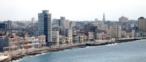
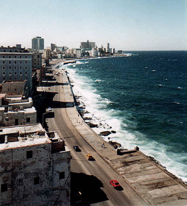
THE CITY OF HAVANA AND ITS ESSENTIAL “MALECÓN”.
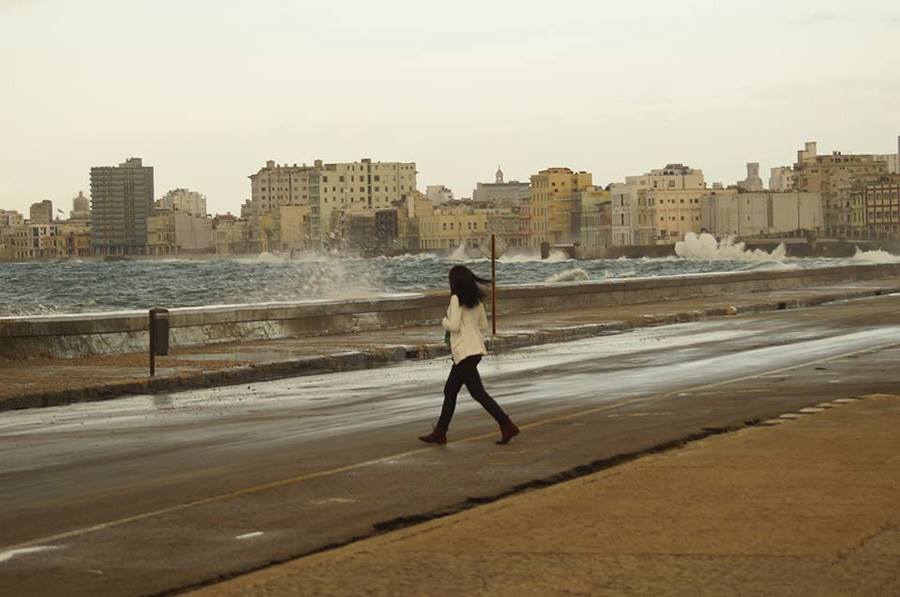
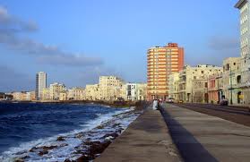
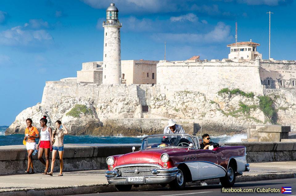
One of the most enjoyable place for the residents of Havana is “El Malecón”, a wall one meter high surrounding much of the Havana coastline.
Under the American interventionist government in 1901 it built the first section, which extended from the Castillo de la Punta to the street Crespo, that is, about 500 meters long, with lush trees and luminaries.
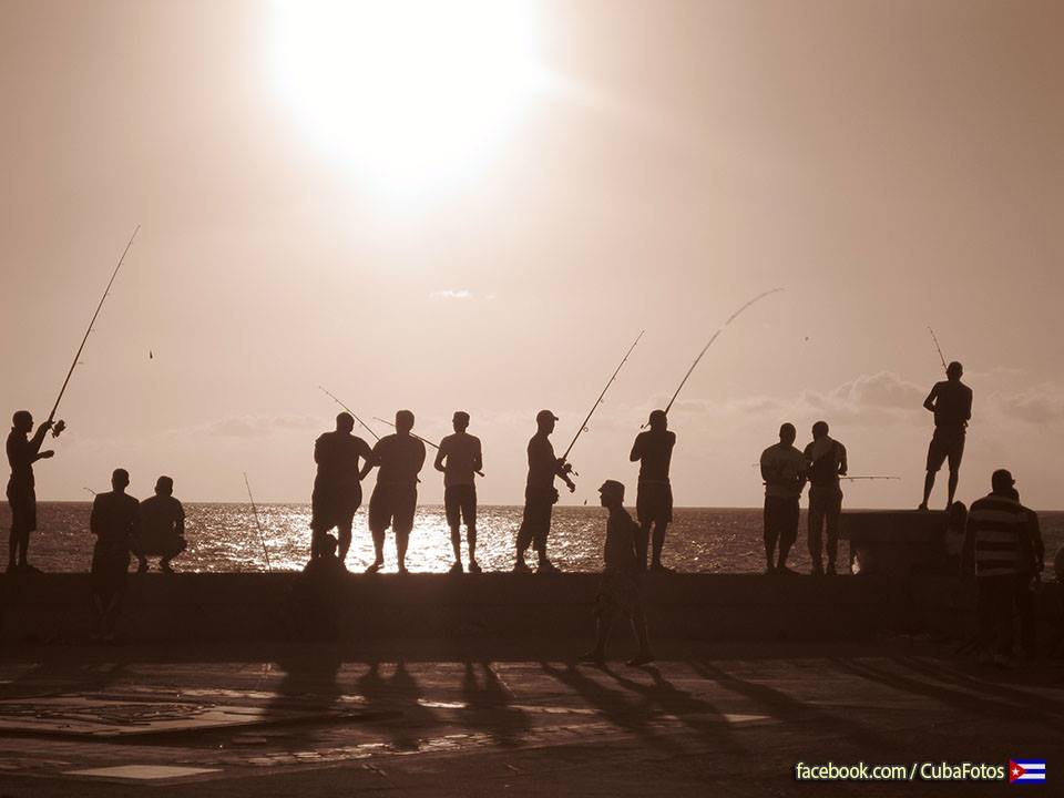
The main purpose of its construction was to defend the capital against the waters and called ¨ ¨ Norths, but actually served more to night walks of Havana, for lovers and especially for individual fishermen.
Havana Malecon history is really interesting.
To celebrate the opening of the first 500 meters of boardwalk, the US government built a beautiful gazebo on the corner of Paseo del Prado, as the architects of the time, was the first work of reinforced concrete, with cabillas- in our country. In front of the gazebo, where every Sunday a band playing Cuban melodies, the Miramar hotel, very fashionable rose for the first fifteen years of the republic for the first time and where the waiters wore tuxedo, golden-breasted vest without mustaches .
The Cuban government continued following the extension of the first section of the Malecón. It was in 1923 that could reach the mouth of the Almendares River, the height of the K streets and L Vedado, where the US Embassy, the famous Deportivo José Martí Park was built and beyond Hotel Rosita de Hornedo, today called Sierra Maestra.
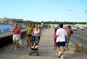
Currently, the Malecón habanero remains the busiest place of Cubans, especially the Cubans who lack the financial means to attend a nightclub for which payment is in foreign currency, or a hotel, all exclusive to foreigners.
Furthermore, it is well known that the Malecon is a source of income for very poor families, who performed during the evening hours fishing for their livelihoods.
Really depressing spectacles can also be seen on the Malecon, when police almost permanently monitors women and young men who go hunting for tourists to exercise the oldest profession humanity.
Despite being almost in ruins and valuable old buildings that are parallel to the Malecon, after being arrested on architectural development since the triumph of the Castro regime is still very beautiful coastline of the capital. Cubans and those who visit us, no longer visit and admire one of the most beautiful places in Havana.#
LA CIUDAD DE LA HABANA Y SU IMPRESCINDIBLE “MALECÓN”.
El lugar de mayor expansión para los habitantes de la capital cubana es El Malecón, un muro de un metro de alto que rodea gran parte del litoral habanero.
Bajo el gobierno interventor norteamericano se construyó en 1901 el primer tramo, que comprendía desde el Castillo de la Punta hasta la calle Crespo, o sea, unos 500 metros de largo, con una exuberante arboleda y numerosas luminarias.
El objetivo principal de su construcción fue para la defensa de la capital contra las aguas y los llamados ¨ Nortes ¨, pero en realidad, sirvió mucho más para paseos nocturnos de los habaneros, para los enamorados y sobre todo para pescadores particulares.
La historia del Malecón habanero es realmente interesante.
Para celebrar la inauguración de los primeros 500 metros de malecón, el gobierno de Estados Unidos construyó una bonita glorieta en la esquina del Paseo del Prado que, según los arquitectos de la época, fue la primera obra realizada de hormigón armado –con cabillas- en nuestro país. Frente a la glorieta, donde cada domingo una banda de música tocaba melodías cubanas, se levantó el hotel Miramar, muy de moda durante los primeros quince años de república y donde por primera vez los camareros vistieron de smoking, chaleco con abotonadura dorada y sin bigotes.
Los siguientes gobiernos cubanos continuaron la extensión del primer tramo del Malecón. Fue en 1923 que pudo llegar hasta la desembocadura del río Almendares y a la altura de las calles K y L del Vedado, donde se construyó la Embajada de Estados Unidos, el famoso Parque Deportivo José Martí y más allá el Hotel Rosita de Hornedo, hoy llamado Sierra Maestra.
En la actualidad, el Malecón habanero sigue siendo el lugar más concurrido de los cubanos, sobre todo por los cubanos de a pie que carecen de medios económicos para frecuentar una discoteca cuyo pago es en divisas, o un hotel, todos exclusivos para extranjeros.
Además, es conocido por todos que el Malecón es fuente de ingresos para familias muy pobres, que durante las horas nocturnas realizan la pesca como medio de subsistencia.
Espectáculos realmente deprimentes pueden verse también en el Malecón habanero, cuando la policía casi de forma permanente vigila a las mujeres y hombres jóvenes que andan a la caza de turistas para ejercer el oficio más antiguo de la humanidad.
A pesar de verse casi en ruinas las antiguas y valiosas edificaciones que van de forma paralela al Malecón, tras ser detenido el desarrollo arquitectónico a partir del triunfo del régimen castrista, aún es muy bello el litoral de la capital. Tanto los cubanos como aquellos que nos visitan, no dejan de visitar y admirar uno de los lugares más hermosos de La Habana.
Agencies/Tania Díaz Castro/InternetPhotos/wwww.thecubanhistory.com
The Cuban History, Hollywood.
Arnoldo Varona, Editor.
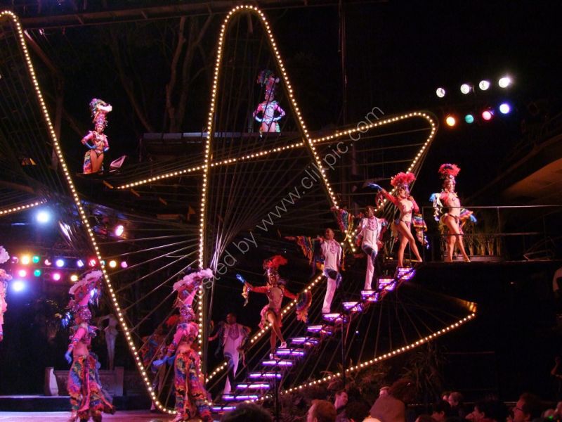
TROPICANA NIGHTCLUB.
The Tropicana had an impact in spreading Cuban culture internationally. New York’s Tropicana was a Latin music club launched in 1945 by two Cuban restaurateurs, the brothers Manolo and Tony Alfaro, who made it the most glamorous nightclub in the Bronx. On the TV series I Love Lucy, the character Ricky Ricardo (played by Cuban-born Desi Arnaz) was a singer and bandleader at Manhattan’s fictional Tropicana nightclub, now recreated in reality in Jamestown, New York at the Lucille Ball-Desi Arnaz Center’s Tropicana Room. In 2004, the Atlantic City Tropicana opened The Quarter,which attempts to recreate the architecture, atmosphere and cuisine of Old Havana during the 1940s. In its September 1956 issue, Show magazine displayed a four-page spread on Tropicana (1957), a Mexican musical comedy filmed on location at the cabaret and featuring some of the Tropicana’s performers.
History.
The spectacular showplace that became The Tropicana evolved out of a -era bohemian nightclub called Edén Concert, operated by Cuban impresario Victor de Correa. One day, two casino operators approached de Correa about opening a combination casino and cabaret on property on the outskirts of Havana rented from Guillermina Pérez Chaumont, known as Mina. The operators felt that the tropical gardens of her Villa Mina, would provide a lush natural setting for an outdoor cabaret. They cut a deal, and in December 1939, de Correa moved his company of singers, dancers and musicians into a converted mansion located on the estate. De Correa provided the food and entertainment, while Rafael Mascaro and Luis Bular operated the casino located in the chandeliered dining room of the estate’s mansion. Originally known as El Beau Site, de Correa decided to rename the club Tropicana, because of its tropical atmosphere and “na” after the last syllable of the original owner, Mina. With a fanfare from the Alfredo Brito Orchestra, the Club Tropicana, opened on December 30, 1939. Its popularity with tourists grew steadily until the outbreak of World War II, which sharply curtailed tourism to Cuba.
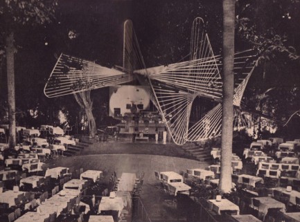
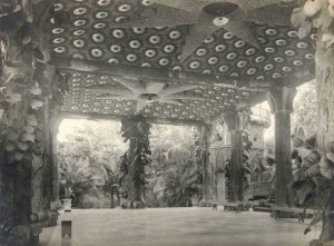
During this time, Martín Fox, a burly, gregarious and well-connected gambler, began renting table space in the casino.Eventually, by 1950, he would amass enough profits to take over the lease of what would become The Tropicana. Martin Fox came to Havana from the countryside. They nicknamed “Guajiro Fox” (Fox, the peasant or country bumpkin) and he was big in the numbers of racket. As a person born and raised in the country, he loved plants and become their most ardent keeper. He had no education whatsoever, but he was bold and has close relations with the more solvent groups. Thus, in a few years he toppled Victor de Correa and, together with Alberto Ardura and Oscar Echemendia, formed an entrepreneurial trilogy that made Tropicana one of the most famous nightclubs in the continent. Hanging in through tough times, which included a temporary ban on casino gambling, Fox bought out de Correa’s interest in 1951 and tapped Alberto Ardura and Oscar Echemendia to replace him. This is when Tropicana’s glory years really began. Ardura hired maverick choreographer Roderico “Rodney” Neyra away from his chief rival on the cabaret scene, the Club San Souci, and Fox contracted up-and-coming architect Max Borges-Recio, who created Tropicana’s Arcos de Cristal, a building composed of parabolic concrete arches and glass walls over an indoor stage. Construction continued through 1951. Giant fruit trees were left in situ during construction to punctuate the interior. When the indoor cabaret at the air-conditioned Arcos de Cristal opened on March 15, 1952, it had a combined total seating capacity of 1,700 for the interior and outside areas with furniture designed by Charles Eames. The Arcos de Cristal won numerous international prizes when it was built and was one of only six Cuban buildings included in the landmark 1954 Museum of Modern Art exhibit entitled “Latin American Architecture since 1945.”
But it was the arrival in Havana in 1946 of Floridian mobster Santo “Louie Santos” Trafficante Jr. that would alter the future of The Tropicana. Trafficante, Jr. had been sent by his father, Tampa godfather Santo Trafficante, Sr. (a man who always wanted to make it big in Cuba) to oversee La Cosa Nostra and Tampa Family casino and business interests there. Upon Trafficante, Sr.’s death in 1954, Santo, Jr. succeeded his father as boss of Tampa. That same year, as Trafficante, Jr.’s control of Tampa’s lucrative bolita racket had been threatened by congressional hearings on mob activities in the U.S., he officially settled in Havana along with Meyer Lansky. Lansky would become the top syndicate figure in Cuba, appointing Trafficante his second in command.
Within a few years, Trafficante owned or held stakes in both The Tropicana and The Sans Souci (the only casinos which been operating in Havana for several years prior to 1955). Both clubs served drinks and meals which just about covered the operating costs. The profits from gambling amounted to approximately $5,000 a day, after “deductions”. It was suspected that he also had behind-the-scenes interests in other syndicate owned Cuban gambling casinos namely those at, The Habana Riviera, The Nacional, The Sevilla-Biltmore, The Capri and the Havana Hilton. The newer casinos averaged even higher profits while the profits of the two original casinos remained more or less the same.Ironically, Lansky and Trafficante both avoided gambling. “Bartenders don’t drink, because they see the consequences,” Trafficante said at one point. “I know the odds are stacked against the players.” According to a 1958 Treasury Department investigation The Tropicana casino (along with those at The Capri and The Nacional) were rumored to be using “bust-out dice” and “rigged equipment.” According to their information the slot machines were “rigged for a very low pay off, due to the extremely high take off of the proceeds by officials.”
Martín Fox and his brother Pedro continued to own the nightclub until the day they left Cuba. The casino nonetheless bore the name of Harry “Lefty” Clark (aliases: William Gusto, William G. Buschoff, Frank Bischoff), an associate of Trafficante’s. There are disputing accounts of the extent of power that the Trafficante gang had over the club, but all records show that the Fox family maintained control over all operations of the club, even while hiring known mob figures to work at the casino, for example, Wilbur (no relation to Lefty) of Las Vegas’s Desert Inn.and Pierre Canavese who had been previously deported from the U.S. to Italy but had subsequently entered Cuba by means of a fraudulent passport and was closely associated with Lucky Luciano.
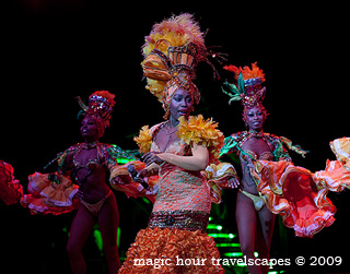
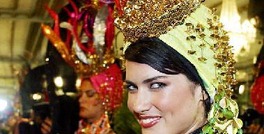
The showgirls at the Tropicana, known collectively as “Las Diosas de Carne” (or “Flesh Goddesses”), were renowned the world over for their voluptuousness, and the cabaret showcased a kind of sequin-and-feather musical theater that would be copied in Paris, New York, and Las Vegas. The lavish shows were staged by Neyra. Headliners included Xavier Cugat, Paul Robeson, Yma Sumac, Carmen Miranda, Nat King Cole, and Josephine Baker. Liberace never performed there officially, but took to the stage with mambo star Ana Gloria Varona on the one day in 1955 that he held a large party for the Cuban press corps. Heralded as a “Paradise Under the Stars,” the Tropicana became known for its showgirls, conga sounds, domino tournaments and flashy, spectacular productions. In “Tropicana Nights” Nat King Cole’s wife Maria paints a colorful portrait of the venue in its heyday: “It was breathtaking! My mouth just fell open…there was so much color, so much movement…and the orchestra! The house band had forty musicians…I said to Nat, ’that’s the house band? (Are there) that many showgirls?”
A Cabaret Guide issued in 1956 described The Tropicana as, “the largest and most beautiful night club in the world. Located on what was once a 36,000-square-meter estate, Tropicana has ample room for two complete sets of stages, table areas and dance floors, in addition to well-tended grounds extending beyond the night club proper. Tall trees rising over the tables and through the roof in some spots lend the proper tropical atmosphere which blends well with the ultra-modern architecture of the night club. Shows include a chorus line of 50 and the dancers often perform on catwalks among the trees. Rhythms and costumes are colorfully native, with voodooism a frequent theme. Top talent is imported from abroad. Minimum at tables is $4.50 per person, but this can be avoided by sitting at central bar which has a good view of both stages.”
An unpublished article sent to Cuban Information Archives around 1956-57 describes the club in detail, “So as not to waste anyone’s time, the gambling room at Tropicana is located right off the entrance lobby. The chandeliered room has ten tables for the usual fun and , plus 30 slot machines lining the walls. Beyond the gambling room are the nightclub’s two dining, dancing and show areas. The two areas are distinct: one is outdoors, with tall royal palms rising among and over the tables; the other is indoors and called the Crystal Arch. The Arch is indeed a huge, modernistic arch-like structure, and this area is used in inclement weather (and also when the outdoor area gets so crowded that there is no more room for customers). Tropicana’s total seating capacity: 1,750, but of course you can stand at the bar or at the crap table, and the management won’t object at all. Because of Tropicana’s bucolic surroundings, the producer of the shows, Rodrigo Neira (better known simply as Rodney), can really spread himself. A Tropicana production number is not complete unless it includes at least half the chorus line dancing on catwalks among the trees. The schoolteacher from Paducah is suitable impressed when he sees scantily clad lassies scampering in front of him, to his right, to his left and above him. This is as hard on the neck muscles as watching a tennis match.”
In 1956 Martín Fox arranged a special Club Tropicana tourist package: Cubana ‘ Tropicana Special began a round-trip that ferried club customers from Miami to the Tropicana and returned them to Florida at 4am the following morning. The plane featured a wet bar stocked with a bevy of cocktail selections, as well as a scaled-down version of Armando Romeu’s orchestra for anyone brave enough to dance in the aisles.
The club soon became “a magnet for international celebrities, musicians, beautiful women, and gangsters.”.The long list of stars who flocked to the Tropicana included Édith Piaf, Ernest Hemingway, Jimmy Durante, Pier Angeli, Maurice Chevalier, Sammy Davis, Jr. and Marlon Brando.
The history of the cabaret is detailed in Tropicana Nights: The Life and Times of the Legendary Cuban Nightclub (Harcourt, 2005) by Rosa Lowinger and Ofelia Fox. In Booklist, Mike Tribby reviewed: Lowinger and Fox tell the story of Havana’s notorious Tropicana nightclub, the template from which Las Vegas was made after the Batista government collapsed, and the Tropicana was closed. In its day the Tropicana was a prime site for gambling, elegance, seeing and being seen–a resort of choice for international gangsters and jet-setters. Readers who enjoyed Anthony Haden-Guest’s “biography” of Studio 54, The Last Party (1997), will enjoy comparing the differing modes of showmanship, decadence, and ostentation current in the Tropicana’s 1950s heyday to those of 1970s New York’s debauched disco scene. Fox married Tropicana owner Martin Fox in 1952 and helped him run it until 1962, when they decamped to Miami. She and Lowinger take pains to establish that the Tropicana was hardly a sleazy Mob hangout but rather a world-class entertainment venue that discriminating gangsters happened to enjoy frequenting. An excellent resource on Cuban popular culture, lavish entertainment, and everyday life just before and just after Castro, this is also an exciting and rewarding read.
The Cuban Revolution was to have serious repercussions for the mob’s involvement in Cuba. As early as December 31, 1956 a bomb exploded at The Tropicana. Set by communist rebels, the explosion was contained to the bar area and one woman lost an arm. Despite this, and as even as Castro’s rebels began to overthrow Havana two years later, Trafficante was heard to insist that the revolution was, “a temporary storm” that would “blow over.” Lansky, the son of Russian exiles, disagreed. “I know a communist revolution when I see one,” he said. He was correct. The new Cuban president, Manuel Urrutia Lleó closed the casinos and nationalized all the casino and hotel properties. This action essentially wiped out both Trafficante and Lansky’s asset base and revenue streams in Havana. Cutting his losses Lansky decided to flee Havana. Trafficante remained, hoping he could cut a deal with the new regime. But Castro was not interested. He wanted to make an example of the mob, and Trafficante was seen as someone involved with Batista. He was hunted down and arrested. On June 21, 1959, along with friends of his like Guiseppe di Giorgi and Jacob “Jake” Lansky, Meyer’s brother, Trafficante was interned in the Tiscornia camp in Havana.
Martín and his wife Ofelia Suárez, who had no children, fled to Miami. Martín died of a stroke in the mid-1960s. Ofelia moved to Los Angeles with her long-time companion Rosa Sanchez, and their Glendale house became a gathering place and social center for Cuban-American friends and neighbors who continued the Tropicana tradition of domino tournaments. Ofelia died at age 82 on January 2, 2006 of cancer and complications from diabetes at Burbank’s Providence St. Joseph Medical Center. Tropicana’s musical director is Chuchito Valdes, the son of Chucho Valdes.
Visiting.
The Tropicana continues to operate to this day, attracting tourists to its Cabaret Shows taking place at 9pm, Tuesday to Sunday, in the open-air Salon Bajo Las Estrellas (weather permitting). These days, foreign tour groups comprise the majority of patrons. The layout of the club means that from many of the seats the show is difficult to see, although no seats have a restricted view. Tickets begin at CUC$65.
TropicanaUnaHistoria/InternetPhotos/TheCubanHistory.com
Tropicana Night Club
The Cuban History,Hollywood.
Arnoldo Varona, Editor
EL CABARET TROPICANA, LA HAVANA, CUBA
El Tropicana tuvo un impacto en la difusión de la cultura cubana a nivel internacional. Tropicana de Nueva York era un club de música latina puso en marcha en 1945 por dos restauradores cubanos, hermanos Manolo y Alfaro, Tony, que le hizo el club nocturno más glamoroso en el Bronx. En la serie de televisión I Love Lucy, el personaje de Ricky Ricardo (interpretado por Desi Arnaz nacido en Cuba) fue un cantante y director de orquesta en el club nocturno de ficción de Manhattan Tropicana, ahora recreado en la realidad en Jamestown, Nueva York, en el Tropicana Lucille Ball-Desi Arnaz Centro habitación. En 2004, el Tropicana de Atlantic City abrió el último, que intenta recrear la arquitectura, la atmósfera y la cocina de La Habana Vieja durante los años 1940. En su edición septiembre 1956, la revista Mostrar muestra un diferencial de cuatro páginas sobre Tropicana (1957), una comedia musical mexicana filmada en la localización en el cabaret y con algunos de los artistas del Tropicana.
Historia
El escaparate espectacular que se convirtió en El Tropicana evolucionó a partir de un club nocturno de la época de bohemia llamado Edén Concert, operado por Cubana empresario Víctor de Correa. Un día, dos operadores de casino se acercó de Correa sobre la apertura de un casino de la combinación y el cabaret de la propiedad en las afueras de La Habana alquilados a Guillermina Pérez Chaumont, conocida como Mina. Los operadores consideraron que los jardines tropicales de su Mina Villa, que proporcionan un entorno natural exuberante de un cabaret al aire libre. Se llegó a un acuerdo, y en diciembre de 1939, de Correa se trasladó a su compañía de cantantes, bailarines y músicos en una antigua casa solariega situada en la finca. De Correa, siempre que la comida y el entretenimiento, mientras que Rafael Mascaró y Luis Bular operaba el casino localizado en el comedor de la mansión de candelabros de la finca. Originalmente conocido como El Beau Site, de Correa decidió cambiar el nombre del Tropicana Club, por su ambiente tropical y “na” después de la última sílaba del propietario original, Mina. Con una fanfarria de la orquesta de Alfredo Brito, el Club Tropicana, inaugurado el 30 de diciembre de 1939. Su popularidad entre los turistas creció en forma sostenida hasta el estallido de la Segunda Guerra Mundial, lo que redujo fuertemente el turismo hacia Cuba.
Durante este tiempo, Martín Fox, un jugador corpulento, sociable y bien comunicada, empezó a alquilar espacio de tabla en el casino.Eventually, en 1950, iba a acumular ganancias suficientes para hacerse cargo del contrato de arrendamiento de lo que se convertiría en el Tropicana. Martin Fox llegó a La Habana desde el campo. Ellos apodado “Guajiro Fox” (Fox, el patán campesino o país) y que era grande en el número de raqueta. Como una persona que nació y se crió en el país, que amaba las plantas y convertirse en su guardián más ardiente. No tenía ningún tipo de educación, pero era audaz y mantiene estrechas relaciones con los grupos más solventes. Así, en pocos años se cayó Víctor de Correa y, junto con Alberto Ardura y Oscar Echemendía, formaron una trilogía empresarial que hizo de Tropicana uno de los clubes nocturnos más famosos del continente. Colgando en los momentos difíciles, que incluían una prohibición temporal de juego de casino, Fox compró las acciones de Correa en 1951 y tocó Alberto Ardura y Oscar Echemendía para que lo sustituya. Esto es cuando los años de gloria de Tropicana comenzó realmente. Ardura contratado inconformista coreógrafo Roderico “Rodney” Neyra lejos de su principal rival en la escena del cabaret, el club de San Souci, y Fox contrajo up-and-coming arquitecto Max Borges Recio, quien creó Arcos Tropicana de Cristal, un edificio compuesto por parabólica arcos de hormigón y paredes de vidrio a través de una fase de interior. La construcción continuó hasta 1951. Los árboles gigantes de la fruta fueron dejados in situ durante la construcción de puntuar en el interior. Cuando el cabaret bajo techo en el aire acondicionado Cristal Arcos de abrir el 15 de marzo de 1952, tenía una capacidad combinada total de asientos de 1.700 para el interior y las áreas exteriores con mobiliario diseñado por Charles Eames. El Arcos de Cristal, ganó numerosos premios internacionales, cuando se construyó y fue uno de los seis edificios de cubanos incluidos en el punto de referencia 1954 Museo de Arte Moderno de exposición, titulada “Arquitectura de América Latina desde 1945.”
Pero fue la llegada a La Habana en 1946 de la Florida mafioso Santo “Louie Santos” Trafficante Jr., que alteraría el futuro de El Tropicana. Trafficante, Jr., había sido enviado por su padre, el padrino de Tampa Santo Trafficante, Sr. (un hombre que siempre quiso hacer algo grande en Cuba) para supervisar la Cosa Nostra y el casino de Tampa familia y los intereses comerciales en ese territorio. Tras la muerte de Trafficante, Sr. ‘s en 1954, Santo, Jr. sucedió a su padre como jefe de Tampa. Ese mismo año, como Trafficante, Jr. ‘s el control del tráfico lucrativo de Tampa bolita había sido amenazado por las audiencias del Congreso sobre las actividades de la mafia en los EE.UU., que oficialmente se estableció en La Habana junto a Meyer Lansky. Lansky se convertiría en la figura de sindicato de la parte superior en Cuba, el nombramiento de Trafficante su segundo al mando.
En pocos años, Trafficante propiedad o tenía participaciones en tanto El Tropicana y Sans Souci El (los casinos, que sólo estado operativo en La Habana durante varios años antes de 1955). Ambos clubes sirven bebidas y comidas, que casi cubrían los costos de operación. Los beneficios del juego ascendió a aproximadamente $ 5,000 al día, después de “deducciones”. Se sospechaba que él también tenía intereses detrás de las cámaras-en sindicato de otra propiedad de los casinos de juegos de azar es decir, aquellos cubanos menos, El Habana Riviera, La Nacional, El Sevilla Biltmore, Capri y el Habana Hilton. Los casinos más nuevos un promedio de ganancias aún mayores, mientras que las ganancias de los dos casinos originales se mantuvieron más o menos el same.Ironically, Lansky y Trafficante, tanto los juegos de azar evitarse. “Los camareros no bebe, porque no ven las consecuencias”, dijo Trafficante en un punto. “Sé que las probabilidades están en contra de los jugadores.” De acuerdo con una investigación de 1958 del Departamento del Tesoro el Tropicana Casino (junto con los de El Capri y Nacional El) se rumorea que está utilizando “Bust-a los dados” y “equipo de amañado”. De acuerdo con la información de las máquinas tragaperras son “aparejado un muy bajo sus frutos, debido a la extremadamente alta el despegue de los ingresos de los funcionarios”.
Martín Fox y su hermano Pedro siguió dueño de la discoteca hasta el día que salió de Cuba. El casino sin embargo, llevaba el nombre de Harry “El Zurdo”, Clark (alias: Gusto William, William G. Buschoff, Frank Bischoff), un asociado de Trafficante. No se disputan las cuentas de la medida de la energía que la banda de Trafficante tenía sobre el club, pero todos los registros muestran que la familia Fox mantuvo el control sobre todas las operaciones del club, aunque la contratación de figuras conocidas mafia para trabajar en el casino, por ejemplo, Wilbur (sin relación con el Zurdo) del desierto de Las Vegas Canavese Inn.and Pierre, quien había sido deportado de los EE.UU. a Italia, pero posteriormente había entrado en Cuba por medio de un pasaporte falso y se asoció estrechamente con Lucky Luciano.
Los coristas en el Tropicana, conocidas colectivamente como “Las Diosas de Carne” (o “Diosas carne”), fue reconocida en todo el mundo por su voluptuosidad, y el cabaret mostró una especie de teatro de lentejuelas y plumas de musical que se copian en París, Nueva York y Las Vegas. Los espectáculos fastuosos fueron organizadas por Neyra. Cabezas de cartel incluye Xavier Cugat, Paul Robeson, Yma Sumac, Carmen Miranda, Nat King Cole y Josephine Baker. Liberace no se realizó oficialmente, pero se subió al escenario con la estrella de mambo Ana Gloria Varona en el primer día en 1955 que él llevó a cabo una gran fiesta para el cuerpo de prensa de Cuba. Aclamado como un “Paraíso Bajo las Estrellas”, se convirtió en el Tropicana conocida por sus coristas, sonidos conga, torneos de dominó y producciones llamativos, espectaculares. En “Tropicana Nights” María, Nat King Cole, la esposa pinta un retrato colorido de la sede en su apogeo: “Ha sido impresionante! Mi boca sólo se abrió … había mucho color, mucho movimiento … y la orquesta! La banda de la casa tenía cuarenta músicos … me dije a Nat, “esa es la banda de la casa? (¿Hay) que muchas bailarinas? ”
Una guía Cabaret emitió en el año 1956 se describe como El Tropicana “, el club nocturno más grande y más hermoso del mundo. Ubicado en lo que antes era una finca de 36.000 metros cuadrados, Tropicana tiene un amplio margen de dos juegos completos de las etapas, las áreas de mesa y pistas de baile, además de los bien cuidados terrenos que se extienden más allá de la discoteca Los árboles altos adecuadas. se levantan sobre las mesas y por las nubes en algunos puntos de prestar el ambiente adecuado tropical que combina bien con la arquitectura ultra-moderna de la discoteca. Espectáculos incluir una línea de coro de 50 y los bailarines se realizan a menudo en las pasarelas entre los árboles. Ritmos y costumbres son coloridas nativo, con el vudú un tema frecuente. mejor talento ha sido importada desde el extranjero. mínimo en las mesas es de $ 4.50 por persona, pero esto puede ser evitado al sentarse en el bar central que tiene una buena vista de ambas etapas. ”
Un artículo inédito enviado a los Archivos de Información de Cuba alrededor de 1956 a 1957 el club se describe en detalle, “Para no perder el tiempo a nadie, la sala de juego en el Tropicana está situado justo fuera del vestíbulo de entrada. La sala cuenta con diez mesas de candelabros para la diversión habitual . y, además de 30 máquinas tragamonedas que recubren las paredes más allá de la sala de juegos de azar son el club nocturno de dos restaurantes, el baile y áreas muestran las dos zonas son distintas: una es al aire libre, con sus palmeras reales crecientes entre y sobre las mesas, y el otro es en el interior. y el Arco de Cristal. El arco es de hecho un enorme modernista del arco-como la estructura, y esta área se utiliza en las inclemencias del tiempo (y también cuando la parte exterior se pone tan lleno que no hay más espacio para los clientes). total de asientos de Tropicana capacidad: 1.750, pero por supuesto usted puede estar parado en el bar o en la mesa de dados, y la gestión no se opondrá en absoluto debido a un ambiente bucólico de Tropicana, el productor de los espectáculos, Rodrigo Neira (mejor conocido simplemente como Rodney). , realmente se propague. Un número de producción Tropicana no es completa si no incluye al menos la mitad de la línea de coro bailando en las pasarelas entre los árboles. El maestro de escuela de Paducah es adecuado impresionada cuando ve a jovencitas con poca ropa correteando delante de él, a su derecho, a su izquierda y por encima de él. Esto es tan duro en los músculos del cuello como ver un partido de tenis. ”
En 1956, Martín Fox organizó un especial del Club Tropicana paquete turístico: Tropicana Cubana ‘Especial comenzó un ida y vuelta que los clientes del club transportaban desde Miami a la Tropicana y los devolvió a la Florida a las 4 am de la mañana siguiente. El avión presentaba un bar surtido con un grupo de selecciones de cócteles, así como una versión reducida de la orquesta de Armando Romeu para cualquier persona suficientemente valiente como para bailar en los pasillos.
El club pronto se convirtió en “un imán para las celebridades internacionales, músicos, mujeres hermosas, y las mafias.”. La larga lista de estrellas que acudieron a la Tropicana incluye Édith Piaf, Ernest Hemingway, Jimmy Durante, Pier Angeli, Maurice Chevalier, Sammy Davis, Jr. y Marlon Brando.
La historia del cabaret se detalla en el Tropicana Nights: La vida y obra del legendario cabaret cubano (Harcourt, 2005) por Rosa Lowinger y Fox Ofelia. En Lista de libros, Mike Tribby revisión: Lowinger y Fox cuenta la historia de club nocturno famoso Tropicana de La Habana, la plantilla de la que Las Vegas se hizo después de que el gobierno de Batista colapsó, y el Tropicana estaba cerrado. En su día, el Tropicana era un sitio prioritario para los juegos de azar, la elegancia, ver y ser visto – un centro turístico de elección para los gángsteres internacionales y jet setters. Los lectores que disfrutaron de Anthony Haden-Guest “biografía” de Studio 54, The Last Party (1997), podrán disfrutar de la comparación de los diferentes modos de talento para el espectáculo, la decadencia, y la ostentación de corriente en el apogeo de 1950 el Tropicana con los de escena del disco libertino década de 1970 en Nueva York. Fox se casó con el propietario de Tropicana Martin Fox en 1952 y le ayudó a funcionar hasta 1962, cuando se fueron a Miami. Ella y Lowinger se esfuerzan en demostrar que el Tropicana era apenas un lugar de reunión mafia de mala calidad, sino más bien un mundo de clase centro de entretenimiento que la discriminación de pandilleros pasó a disfrutar de frecuentar. Un excelente recurso en la cultura popular cubana, entretenimiento abundante, y la vida cotidiana justo antes y justo después de que Castro, esto también es una lectura emocionante y gratificante.
La revolución cubana iba a tener repercusiones graves para la participación de la mafia en Cuba. Ya en el 31 de diciembre 1956 una bomba explotó en el Tropicana. Fijado por los rebeldes comunistas, la explosión se contuvo en la zona del bar y una mujer perdió un brazo. A pesar de ello, y como aun cuando los rebeldes de Castro comenzó a derrocar a La Habana dos años después, Trafficante, se escuchó a insistir en que la revolución era “una tormenta temporal” que “volar otra vez.” Lansky, el hijo de exiliados rusos, no estuvo de acuerdo. “Sé que una revolución comunista cuando lo veo”, dijo. Estaba en lo cierto. El nuevo presidente de Cuba, Manuel Urrutia Lleó cerró los casinos y nacionalizó todas las propiedades del casino y el hotel. Esta acción erradicado tanto Trafficante y la base de Lansky de activos y flujos de ingresos en La Habana. Corte sus pérdidas Lansky decidió huir de La Habana. Trafficante se mantuvo la esperanza de que pudiera hacer un trato con el nuevo régimen. Pero Castro no estaba interesado. Quería hacer un ejemplo de la multitud, y Trafficante era visto como alguien involucrado con Batista. Él fue perseguido y arrestado. El 21 de junio de 1959, junto con amigos de su como Giuseppe di Giorgi y Jacob “Jake” Lansky, hermano de Meyer, Trafficante, fue internado en el campo de Tiscornia en La Habana.
Martín y su esposa Ofelia Suárez, quien no tuvo hijos, huyó a Miami. Martín murió de un derrame cerebral a mediados de los años 1960. Ofelia se mudó a Los Ángeles con su compañera desde hace mucho tiempo Rosa Sánchez, y su casa de Glendale se convirtió en un lugar de reunión y un centro social para los cubano-americanos de amigos y vecinos que continuaron la tradición de los torneos de dominó Tropicana. Ofelia murió a los 82 años el 2 de enero de 2006 de cáncer y las complicaciones de la diabetes en la Providencia de Burbank Centro Médico St. Joseph. Director musical de Tropicana es Chuchito Valdés, hijo de Chucho Valdés.
Visita
El Tropicana sigue funcionando hasta nuestros días, que atrae a los turistas a su Cabaret lleva a cabo a las 9 pm, de martes a domingo, en el aire libre Salón Bajo las Estrellas (el tiempo lo permite). En estos días, los grupos turísticos extranjeros constituyen la mayoría de los clientes. El diseño del club significa que muchos de los asientos de la serie es difícil de ver, aunque no los asientos tienen una visión restringida. Entradas comienzan en $ 65 CUC.
TropicanaUnaHistoria/InternetPhotos/www.TheCubanHistory.com
Tropicana Night Club
The Cuban History, Hollywood.
Arnoldo Varona, Editor.
THE CITY OF CIENFUEGOS, “PEARL OF THE SOUTH”.
Cienfuegos is a city on the southern coast of Cuba, capital of Cienfuegos Province. It is located about 250 km (160 mi) from Havana, and has a population of 150,000. The city is dubbed La Perla del Sur (Pearl of the South). Cienfuegos literally translates to “Hundred fires”.
The area was called the Cacicazgo de Jagua by the early Spaniards, and was settled by indigenous people.
Located in The South coast of the central region of Cuba, Cienfuegos has a singular history which is present in the Castle of Our Mother of Los Angeles of Jagua, a fortress erected in 1745 for protection against Caribbean pirates which is loaded of legend for 250 years has been the only access defending the best sea to one of bays of raft of The Hispanic America. Their excellence as far as depth, defense and the inner presence of keys and coves turned the bay into a refuge against storms of the Caribbean Sea for the navigators of long ago the City of Cienfuegos, capital of the province with the same name, was designed in its definitive layout by French colonos in 1819.
Those pioneers coming from Bordeaux and La Luisiana, led by Don Louis de Clouet, on April 22, 1819. Its original name was Fernardina de Jagua, in honor of Ferdinand VII of Spain. The settlement became a town (Spanish: Villa) in 1829, and a city in 1880. The city was subsequently named Cienfuegos, sharing the name with Cienfuegos, a Captain General in this time, in the island which laid the urbanistic foundations of civil architecture that gives singularity to the city, and attest their refinement. The perfect layout of their streets, harmonically conjugated with multiple constructions and other elements of high architectural value, reveals the splendor of a cosmopolitan culture with a strong French accent, and allows the visitor to breathe the neoclassic atmosphere that distinguishes this large city, raised at the border of a bay of strongly rooted marine traditions, in a region also equipped with innumerable natural attractiveness and a vast culinary culture.
Cienfuegos, one of the chief seaports of Cuba, is a center of the sugar trade, as well as coffee and tobacco. While sugarcane is the chief crop, local farmers grow coffee.
The downtown contains 6 buildings from 1819–50, 327 buildings from 1851–1900, and 1188 buildings from the 20th century. There is no other place in the Caribbean which contains such a remarkable cluster of Neoclassical structures.
In 2004, the municipality of Cienfuegos had a population of 163,824. With a total area of 333 km2 (129 sq mi), it has a population density of 492.0 /km2 (1,274 /sq mi).
Near Cienfuegos was the scene of a battle on May 11, 1898, between American marines who attempted to sever underwater Spanish communication lines and the Spanish defenders.
During the Cuban Revolution the city saw an uprising against Fulgencio Batista and was bombed, on September 5, 1957.
In 2005, UNESCO inscribed the Urban Historic Centre of Cienfuegos on the World Heritage List, citing Cienfuegos as the best extant example of the 19th-century early Spanish Enlightenment implementation in urban planning.
In 2005, Hurricane Dennis made its second landfall near Cienfuegos at about 1:00PM AST (17:00 UTC) with winds of 232 km/h (144 mph), and gusts reaching 285 km/h (177 mph).
One of the turrets on the moonlit roof of Palacio de Valle
Castillo de Nuestra Señora de los Ángeles de Jagua – fortress
Arco de Triunfo – the only Arco de Triunfo in Cuba
Cathedral de la Purisma Concepción – cathedral with stained glass work, built 1833-1869.
Delfinario – dolphins and sea lions in a saltwater lagoon
Jardín Botánico de Cienfuegos – 97 hectares of botanic garden
Museo Provincial – furniture and porcelain museum
Palacio de Valle – built 1913–1917 in neo-gothic style
Palmira Yorubá Pantheon – museum of religious afro-catholic syncretism
Parque José Martí – park in Plaza de Armas
University of Cienfuegos “Carlos Rafael Rodríguez” (UCF) – the province’s secondary education institution.
Famous residents
Benny Moré, Cuban singer.
Cristóbal Torriente, Cuban-born Hall of fame Baseball player.
Gina Pellón, Cuban painter, lives in exile in Paris.
María Conchita Alonso, Cuban-Venezuelan-American singer was born here.
Luis Posada Carriles, Cuban anti-Castro commando was born here.
Joe Azcue, MLB player for the Cincinnati Reds, Kansas City Athletics, Cleveland Indians, Boston Red Sox, California Angels, and the Milwaukee Brewers.#
LA CIUDAD DE CIENFUEGOS ‘LA PERLA DEL SUR’
Cienfuegos es una ciudad en la costa sur de Cuba, capital de la provincia de Cienfuegos. Se encuentra a unos 250 kilómetros (160 millas) de La Habana, y tiene una población de 150.000 habitantes. La ciudad se llamó La Perla del Sur (Perla del Sur). Cienfuegos se traduce literalmente como “Cien fuegos”.
El área fue llamada el cacicazgo de Jagua por los primeros españoles, y fue fundada por los pueblos indígenas.
Situado en la costa sur de la región central de Cuba, Cienfuegos tiene una historia singular que está presente en el Castillo de Nuestra Señora de Los Ángeles de Jagua, una fortaleza construida en 1745 para la protección contra los piratas del Caribe, que se carga de la leyenda de 250 años ha sido la única defensa de los mejores del mar hasta una de las bahías de bolsa de la América hispana. Su excelencia en cuanto a profundidad, la defensa y la presencia interior de las llaves y calas de la bahía se volvió en un refugio contra las tormentas del Mar Caribe para los navegantes de antaño de la ciudad de Cienfuegos, capital de la provincia con el mismo nombre, diseñado se en su trazado definitivo por colonos franceses en 1819.
Aquellos pioneros procedentes de Burdeos y La Luisiana, dirigida por Don Luis de Clouet, el 22 de abril de 1819. Su nombre original era Fernardina de Jagua, en honor de Fernando VII de España. El asentamiento se convirtió en una ciudad (en español: Villa) en 1829, y una ciudad en el año 1880. La ciudad fue nombrada posteriormente Cienfuegos, compartiendo el nombre con el Cienfuegos, capitán general en este momento, en la isla, que sentó las bases urbanísticas de la arquitectura civil que le da singularidad a la ciudad, y doy fe de su refinamiento. El diseño perfecto de sus calles, armónicamente conjugados con múltiples construcciones y otros elementos de gran valor arquitectónico, revela el esplendor de una cultura cosmopolita, con un fuerte acento francés, y permite al visitante respirar el ambiente de estilo neoclásico que distingue a esta gran ciudad, planteada en el borde de una bahía de tradiciones fuertemente arraigadas marinos, en la región también cuenta con atractivos innumerables natural y una gran cultura culinaria.
Cienfuegos, uno de los principales puertos marítimos de Cuba, es un centro del comercio del azúcar, así como café y tabaco. Mientras que la caña de azúcar es el principal cultivo, los agricultores locales cultivan café.
El centro consta de 6 edificios de 1819-50, 327 edificios de 1851-1900, y 1188 de los edificios del siglo 20. No hay otro lugar en el Caribe, que contiene un notable conjunto de estructuras neoclásicas.
En 2004, el municipio de Cienfuegos, tenía una población de 163.824. Con una superficie total de 333 km2 (129 millas cuadradas), tiene una densidad poblacional de 492,0 / km 2 (1.274 / km ²).
Cerca de Cienfuegos fue el escenario de una batalla el 11 de mayo de 1898, entre los infantes de marina estadounidenses que intentaron romper las líneas de comunicación españoles bajo el agua y los defensores españoles.
Durante la Revolución Cubana, la ciudad vio un levantamiento contra Fulgencio Batista y fue bombardeada, el 5 de septiembre de 1957.
En 2005, la UNESCO inscribió al Centro Histórico Urbano de Cienfuegos en la Lista del Patrimonio Mundial, citando a Cienfuegos como el mejor ejemplo existente del siglo 19 la pronta aplicación Ilustración española en la planificación urbana.
En 2005, el huracán Dennis hizo a tocar tierra cerca de Cienfuegos a unos AST 13:00 (17:00 UTC), con vientos de 232 km / h (144 mph) y ráfagas que llegan a 285 kmh (177 mph).
One of the turrets on the moonlit roof of Palacio de Valle
Castillo de Nuestra Señora de los Ángeles de Jagua – fortress
Arco de Triunfo – the only Arco de Triunfo in Cuba
Cathedral de la Purisma Concepción – cathedral with stained glass work, built 1833-1869.
Delfinario – dolphins and sea lions in a saltwater lagoon
Jardín Botánico de Cienfuegos – 97 hectares of botanic garden
Museo Provincial – furniture and porcelain museum
Palacio de Valle – built 1913–1917 in neo-gothic style
Palmira Yorubá Pantheon – museum of religious afro-catholic syncretism
Parque José Martí – park in Plaza de Armas
University of Cienfuegos “Carlos Rafael Rodríguez” (UCF) – the province’s secondary education institution.
RESIDENTES FAMOSOS
Benny Moré, la cantante cubana.
Cristóbal Torriente, nacido en Cuba, del Salón de la Fama del Béisbol.
Gina Pellón, pintor cubano, vive en el exilio en París.
María Conchita Alonso, cubano-venezolano-americano cantante nació aquí.
Luis Posada Carriles, el cubano anticastrista comando nació aquí.
Joe Azcue, jugador de MLB para los Rojos de Cincinnati, Atléticos de Kansas City, los Indios de Cleveland, Medias Rojas de Boston, Angelinos de California, y los Cerveceros de Milwaukee.
Wiki/Varona/InternetPhotos/TheCubanHistory.com
The Cuban History, Hollywood.
Arnoldo Varona, Editor.
TOURISM IN CUBA.
Tourism in Cuba attracts over 2 million people a year, and is one of the main sources of revenue for the island. With its favorable climate, beaches, colonial architecture and distinct cultural history, Cuba has long been an attractive destination for tourists. Having been Spain’s last, oldest, and closest colony until 1901, in the first part of the 20th century Cuba continued to benefit from big investments, creation of industries, and immigration. Its proximity and close relation to the United States also helped Cuba’s market economy prosper fairly quickly. As relations between Cuba and the United States deteriorated rapidly after the Cuban Revolution and the resulting expropriation and nationalisation of businesses, the island became cut off from its traditional market by an embargo and a travel ban was imposed on U.S. citizens visiting Cuba. The tourist industry declined to record low levels within two years of Castro’s accession to power. By the mid 1960s the Communist government had banned and eliminated all private property, outlawed the possession of foreign currency, and eliminated the tourist industry all together.
Until 1997, contacts between tourists and Cubans were de facto outlawed by the Communist regime. Following the collapse of Cuba’s chief trading partner the Soviet Union, and the resulting economic crisis known as the Special Period, Cuba’s government embarked on a major program to restore old hotels, remaining old pre-communism American cars, and restore several Havana streets to their former glory, as well as build beach resorts to bolster the tourist industry in order to bring in much needed finance to the island. To ensure the isolation of international tourism from the state isolated Cuban society, it was to be promoted in enclave resorts where, as much as possible, tourists would be segregated from Cuban society, referred to as “enclave tourism” and “tourism apartheid”.
By the late 1990s, tourism surpassed Cuba’s traditional export industry, sugar, as the nation’s leading source of revenue. Visitors come primarily from Canada and western Europe and tourist areas are highly concentrated around Varadero, Cayo Coco, the beach areas north of Holguin, and Havana. The impact on Cuba’s socialist society and economy has been significant. However, in recent years Cuba’s tourism has decreased due to the economic recession, escalating foreign investment conflicts and fears, and internal economic restrictions. Since its reopening to tourism in the mid 1990s Cuba has not met the projected growth, has had relatively little restoration, and slow growth. A lack of foreign investment has also had a negative effect. Since then, the Dominican Republic has surpassed Cuba in tourism, new development, and investment.
Cuba has long been a popular attraction for tourists. Between 1915 and 1930, Havana hosted more tourists than any other location in the Caribbean.The influx was due in large part to Cuba’s proximity to the United States, where restrictive prohibition on alcohol and other pastimes stood in stark contrast to the island’s traditionally relaxed attitude to leisure pursuits. Such tourism became Cuba’s third largest source of foreign currency, behind the two dominant industries of sugar and tobacco.
A combination of the Great of the 1930s, the end of prohibition, and World War II severely dampened Cuba’s tourist industry, and it wasn’t until the 1950s that numbers began to return to the island in any significant force. During this period, American organized crime came to dominate the leisure and tourist industries, a modus operandi outlined at the infamous Havana Conference of 1946. By the mid-1950s Havana became one of the main markets and the favourite route for the narcotics trade to the United States. Despite this, tourist numbers grew steadily at a rate of 8% a year and Havana became known as “the Latin Las Vegas”.
Hotel Nacional in Havana. The hotel’s guestlist includes Frank Sinatra, Winston Churchill and Ernest Hemingway, and also played host to the infamous Havana Conference in 1946.
Immediately upon becoming President of Cuba after the Cuban revolution of 1959, Manuel Urrutia ordered the closing of many bars and gambling halls associated with prostitution and the drug trade, thus effectively ending Cuba’s image as a hedonistic escape. A new governmental body, the National Institute of the Tourism Industry (INTUR), was established to encourage more tourism; taking over hotels, clubs, and beaches making them available to the general public at low rates. Tourist board chief Carlos Almonia announced a program of huge investment in hotels and the creation of a new airport. But fears of Cuba’s post-revolutionary status amongst Americans, who constituted 8 out of 10 of visitors,[6] meant a rapid decrease in travel to the island.
In January 1961, as relations between the nations deteriorated, tourism travel to Cuba was declared by the U.S. State Department to be contrary to U.S. foreign policy and against the national interest. Tourism that year dropped to a record low of a mere 4180, forcing a dramatic downsizing of Cuba’s tourist plans. Visitors to Cuba during the 1960s, 70s and 80s were comparatively rare. The number of tourists to the island did increase slowly, but it wasn’t until 1989 that they were to equal pre-Revolutionary numbers.
The collapse of the Soviet Union in 1991 caused a crisis in the Cuban economy. The Soviets were Cuba’s chief trading partner, and had effectively sheltered Cuba’s sugar industry with large subsidies for 30 years. The lack of economic diversification during this period, and the sudden loss of key markets sent the country into a deep economic known in Cuba as the Special Period. The crisis precipitated an urgent need to find new avenues of national income.
Policies were drawn up to satisfy the growing tourist markets of Canada and Europe with an aim to replace Cuba’s reliance on the sugar industry and gain much needed foreign currency rapidly. A new Ministry of Tourism was created in 1994, and the Cuban state invested heavily in tourist facilities. Between 1990 and 2000, more than $3.5 billion was invested in the tourist industry. The number of rooms available to international tourists grew from 12,000 to 35,000, and the country received a total of 10 million visitors over that period. By 1995 the industry had surpassed sugar as Cuba’s chief earner.
Today, travelers from around the world visit Cuba, especially Canada, Germany, the United Kingdom, Spain, Italy, France and Mexico. In recent years more than 600,000 Canadians, 200,000 Britons, 153,197 Spaniards and 114,000 Germans have visited Cuba annually. Each year, thousands of people from the US visit Cuba, even though the official U.S. trade policy usually does not permit travel there. According to TIME Magazine (May 11, 2007), 20,000 to 30,000 Americans illegally travel to Cuba every year. Americans usually reach Cuba via from Toronto, Montreal or Cancun.
FOREIGN INVESTMENTS
Foreign investment in the Cuban tourism sector has increased steadily since the tourism drive. This has been made possible due to constitutional changes to Cuba’s socialist command economy, to allow for the recognition of foreign held capital. By the late 1990s, twenty five joint foreign and domestic venture companies were working within Cuba’s tourist industry. Foreign investors and hoteliers from market based economies have found that Cuba’s centralized economy and bureaucracy has created particular staffing issues and higher costs then normal. An additional factor cited by foreign investors is the degree of state involvement at the executive level, which is far higher than average. Most of Cuban Hotels are control by foreign enterprises mainly Spanish as Iberostar, Melia, Barcelo, Paradisus, Trip, Occidental Royal, etc.. A reverse of the revolutionary process that started in 1959 that was bringing Democracy to the country.
Cuba has been a popular medical tourism destination for more than 40 years. Thousands of patients travel to Cuba, particularly from Latin America and Europe, attracted by the “fine reputation of Cuban doctors, the low prices and nearby beaches on which to recuperate.” In 2006, Cuba attracted nearly 20,000 medical tourists. Medical treatments included joint replacement, cancer treatment, eye surgery, surgery and addictions rehabilitation. Costs are about 60 to 80 percent less than US costs.
Cuba has hospitals for Cuban residents and others that focus on serving foreigners and diplomats. In the 2007 American documentary film, Sicko, which criticizes the US healthcare system, producer Michael Moore leads a group of uninsured American patients to Cuba to obtain more affordable medical treatment. Sicko has greatly increased foreigners’ interest in Cuban healthcare. A recent Miami Herald story focused on the high quality of health care that Canadian and American medical tourism patients receive in Cuba. The Cuban government has developed Cuban medical tourism to generate income for the country. Residents of Canada, the UK and most other countries can travel to Cuba without any difficulty, although a tourist visa is generally required. For Americans, however, because of the US trade policy towards Cuba, travelers must either obtain US government approval, or, more frequently, travel to Cuba from Canada, Mexico, the Bahamas, Jamaica or the Dominican Republic. Cuban immigration authorities do not stamp the passports of US visitors so that Americans can keep their travels a private matter. To date no Cuban facility has achieved JCI Accreditation.
The influx of foreign capital, and associated capitalist management methods, led outside observers to question whether Cuba’s socialist system could survive the resulting transformation. Fidel Castro responded in 1991, “In the conditions of a small country like Cuba… It is very difficult to develop… relying on one’s own resources. It is for this reason that we have no alternative but to associate ourselves with those foreign enterprises that can supply capital, technology, and markets.”
Castro was also of the belief that despite the undeniable influence of “capitalist ideology”, socialism would prevail both in Cuba and the wider “battle of ideas”. The Cuban government has established safeguards designed to ensure that tourism and other development do not result in significant environmental impacts. The development of new tourist facilities and related infrastructure in Cuba must, among other things, proceed in accordance with Cuban environmental laws and policies. In 1994 the Cuban government established the Ministry of Science, Technology, and Environment (CITMA) and in 1997 the National Assembly has enacted Law 81 of the Environment, one of the most comprehensive “framework” environmental laws in the region. Pursuant to that Law, the government adopted a number of decree laws and resolutions aimed at ensuring that future development (including tourism development) is sustainable. Of particular importance to tourism development is Decree Law 212,Coastal Zone Management, which establishes setbacks and other siting requirements for new facilities in coastal areas. CITMA Resolution 77/99 requires a thorough environmental assessment of major new construction projects and requires that project developers obtain an environmental license from CITMA.
As well as receiving traditional tourism revenues, Cuba attracts health tourists, generating revenues of around $40m a year for the Cuban economy. Cuba has been a popular health tourism destination for more than 20 years. In 2005 more than 19,600 foreign patients traveled to Cuba for a wide range of treatments including eye-surgery, neurological disorders such as multiple sclerosis and Parkinsons disease, and orthopaedics. Many patients are from Latin America although medical treatment for retinitis pigmentosa, often known as night blindness, has attracted many patients from Europe and North America. In Oct 2007 Miami Herald story addressed the high quality of health care that Canadian and American medical tourism patients receive in Cuba.
Some complaints have arisen that foreign “health tourists” paying with dollars receive a higher quality of care than Cuban citizens. Former leading Cuban neurosurgeon and dissident Dr. Hilda Molina asserts that the central revolutionary objective of free, quality medical care for all has been eroded by Cuba’s need for foreign currency. Molina says that following the economic collapse known in Cuba as the Special Period, the Cuban Government established mechanisms designed to turn the medical system into a profit-making enterprise, thus creating a disparity in the quality of healthcare services between Cubans and foreigners.
In the context of tourism a private residence in Cuba converted to allow paid lodging, usually on a short-term basis, akin to bed and breakfast residences elsewhere, is usually referred to as a “casa particular”, which simply means “private house”. They are typically a single-family residence, and are a very popular choice for tourists. Prices can range from 15 to 30 euros per night, or less for longer stays; the casas provide a more inexpensive option for young or independent tourists. A stay in a private casa allows tourists more opportunity to mix with local Cubans, and engage in Cuban cultural life.
IMPACT ON CUBAN SOCIETY AND TOURISM APARTHEID
“Cocotaxis” in Plaza de la Revolucíon, Havana. A popular form of transport for tourist sightseers. Due to the rapid growth of tourism in Cuba, taxi drivers can earn more than lawyers and doctors.
Cuba’s tourism policies of the early 90s, which were driven by the government’s pressing need to earn hard currency, had a major impact on the underlying egalitarianism espoused by the Cuban revolution. Two parallel economies and societies quickly emerged, their demarcation line was represented by access to the newly legalized U.S. dollar. Those having access to dollars through contact with the lucrative tourist industry suddenly found themselves at a distinct financial advantage over professional, industrial and agricultural workers.
Bar staff, hotel receptionists and taxi drivers became the coveted occupations in urban Cuba[citation needed] and, by 2006, permission to operate a private taxicab service could cost up to $500 in bribes. Musicians have also found a radical shift in their economic status. El Nuevo Herald reported that the $200 a month one band percussionist receives in tips performing to tourists in Old Havana is more than 30 times what he would receive from the Cuban government for the same work.
To ensure the isolation of international tourism from Cuban society, it was to be promoted in enclave resorts where, as much as possible, tourists would be segregated from Cuban society. This was not lost on the average Cuban citizen, and the government tourism policy soon began to be referred to as “enclave tourism” and “tourism apartheid”.
In 1992, as Cuba entered the period of severe economic austerity, Fidel Castro defended the newly instituted policies in a speech to the Cuban National Assembly. He described the moves as an economic necessity that would need to be maintained for as long as the country had a need for foreign currency. According to Castro, the government was “pondering formulas” that would allow Cubans to use some of the tourist facilities as a reward for outstanding work, but believed that giving Cubans access to amenities at the expense of paying foreign tourists would ultimately be a counterproductive move for the economy; “For every five Cubans staying two or three days in one of those hotels, the country would have one less ton of meat to distribute to the people,”.
Until 1997 contacts between tourists and Cubans were de facto outlawed, and Cubans seen in contact with tourists were regarded as potential thieves by police. Global human rights groups complaints, and the upcoming visit of Pope, helped cause an about-face, although such contacts are still frowned upon, with standard harassment such as police identification checks for any Cuban seen in contact with a tourist common. Tourist identification is usually not checked unless the tourist has dark skin and is mistaken for Cuban. Despite the restrictions, average Cubans thrive on Cuba’s tourist industry, and many simply see the policy as inevitable.
A street in the popular tourist district of Old Havana
Jineterismo, the sex tourism industry in Cuba, has been closely associated with tourism apartheid; with some claiming that the only Cubans allowed into the resorts as a group were prostitutes, the jineteras, whilst the Cuban government claimed that its restrictions on Cubans were part of its policy to combat prostitution and hustling. According to Elisa Facio, the government turns “a blind eye in hopes the dollars jineteras earned would help overcome the Revolution’s worst economic crisis.
Colin Crawford, of the Andrew Young School of Policy Studies at Georgia State University, has suggested that tourist apartheid might become a permanent regression to the pre-revolutionary state of Cuban society, while Saundra Amrhein and Tamara Lush point out the irony of the situation: “That tourism has brought exclusive resorts, segregated hotels and a general playground for foreigners swinging through the island looking for Caribbean romance. Ironically, these are precisely the circumstances the revolution worked 40 years to erase.”
The policy of restricting certain hotels and services to tourists was ended by the government of Raúl Castro in March 2008. As well as officially allowing Cubans to stay in any hotel, the change also opened access to previously restricted areas such as Cayo Coco. However, access remains very limited in practice, as the vast majority of Cubans do not have access to the hard currency needed to stay in such hotels.
Wiki/BeachesTourm./InternetPhotos/www.TheCubanHistory.com
Tourism in Cuba
The Cuban History,Hollywood.
Arnoldo Varona, Editor.
THE DUPONT MANSION “XANADÚ” IN VARADERO BEACH, CUBA..
Located on the Península de Hicacos, in the province of Matanzas, Varadero is a long, thin strip of land that juts into the sea.
In 1927, the French-American millionaire Irénée Dupont de Nemours, at the age of 49, he retired from the chemical empire chairmanship and started to look around for a quiet place to spend his retirement. Like many Americans, he found it in Cuba. That very same year he purchased 180 hectares of land on the Hicacos Peninsula for 90 000 pesos. The property included 8 km of virgin breaches, but he chose the rocky hills of the San Bernardino crags to build his dream house. The four store mansion, with 11 bedrooms and adjoining baths, three large terraces, seven balconies and a private dock, was named “Xanadu”, after the exotic Palace built by the legendary Chinese warrior and conqueror Kublai Khan, as described by the English poet Samuel Taylor. According to the legend, “Xanadu” was the ancient kingdom of the Tartars, extending from Central Asia to Western China and parts of Russia.
In 1932 Dupont installed the largest privately owned organ in all of Latin America, worth $11,000 dollars. The machinery was installed in the basement and the organ worked automatically and manually. Two shafts carried the music to the mirador and the lobby, without inconveniencing the guests in their rooms. The furniture, including the organ, paintings and piano, were supplied by Theodore Baily & Co. and Meras & Rico.
Precious woods were brought especially from Santiago de Cuba for the ceilings, stair rails and columns, while the floors and bathrooms were done in Cuban, Italian and Spanish marble. The actual construction was entrusted to the Frederick Sneard Corporation at a cost of 1 300 000 dollars and finished on 30 December 1930.
Dupont would stay at Xanadu for a few months each year from early January, sometimes inviting important company executives. Many Hollywood stars stayed here in the 1950s; Cary Grant, Esther Williams and Ava Gardner all visited Varadero regularly when it was still a little-known paradise with long. The “historians” of Cárdenas, were located, are proud to point out that Varadero was the first place where lightweight bathing suits were worn.
The Dupont estate grew to some 1328 acres, covering parts of what today is the municipality of Cardenas. The land had been bought at the ridiculous price of four cents per square meter, but the estate’s value increased years later when the road, power plant and aqueduct were built.
The gardens were planted with coconut trees. On the Eastern slopes they planted flowers and a vegetable garden, together with banana, avocado and papaya trees. Parrots and cockatoos were imported to make the place more tropically enchanting.
Although architect Herbert Strong designed the first golf course with 18 holes, it was later built with only 9 following a design by Sim Cuthrie. The first four holes were built on natural soil, while the others required refilling. The golf course was started in December 1931, and shortly after completion, in September 1933, was hit by a hurricane that swept away with greens and fairways from holes 5 to 9. From April to December 1934, over US$ 10 000 worth of soil had to be dumped on the land and the golf course was fully operational again in 1936.
DuPont set the whole peninsula astir. He sold off pieces of his land to wealthy Americans and made numerous donations to fund the construction of a church and the upkeep of a parochial school. He had to abandon his domain at the age of 85, when Fidel Castro nationalized his property and transformed it into the Las Américas restaurant.
In March 1957 Dupont visited Xanadu for the last time. On 12 December 1963, Xanadu opened as “Las Americas” Restaurant, with Russian astronaut Valentina Tereshkova as guest of honor. That same day, at the age of 85, Irenee Dupont passed away in the US.
His heirs in America still waiting for the moment to reclaim their properties in Cuba, one of the demands of the United State government in its differences with the government of Cuba.#
LA MAJESTUOSA MANSION DE LOS DUPONTS IN VARADERO BEACH, CUBA.
Ubicado en la Península de Hicacos, en la provincia de Matanzas, Varadero es una larga y estrecha franja de tierra que se adentra en el mar.
En 1927, el millonario Americano-Francés Irénée Dupont de Nemours, a la edad de 49 años, se retiró de la presidencia de su imperio químico y comenzó a mirar alrededor para un lugar tranquilo para pasar su jubilación. Al igual que muchos norteamericanos, lo encontró en Cuba. Ese mismo año compró 180 hectáreas de tierra en la península de Hicacos por 90 000 pesos. La propiedad incluye 8 km infracciones vírgenes, pero él escogió las colinas rocosas de San Bernardino riscos para construir su casa de ensueño. La mansión de cuatro tiendas, con 11 habitaciones y los baños contiguos, tres grandes terrazas, siete balcones y un muelle privado, fue nombrado “Xanadu”, después de que el Palacio exótico construido por el legendario guerrero chino y conquistador Kublai Khan, según lo descrito por el poeta Inglés Samuel Taylor. De acuerdo con la leyenda, “Xanadu” fue el antiguo reino de los tártaros, que se extiende desde Asia Central a China Occidental y partes de Rusia.
En 1932, Dupont instaló el órgano de propiedad privada más grande de toda América Latina, por valor de 11 000 dólares. La maquinaria se ha instalado en el sótano y el órgano trabajó de forma automática y manual. Dos pozos difundían la música al mirador y el vestíbulo, sin molestar a los huéspedes en sus habitaciones. Los muebles, incluidos los órganos, las pinturas y el piano, fueron suministrados por Theodore Baily & Co. y Meras y Rico.
Maderas preciosas fueron traídas especialmente desde Santiago de Cuba a los techos, barandas de escaleras y columnas, mientras que los pisos y los baños fueron hechos en mármol cubano, italiano y español. La construcción actual se encomendó a la Corporación Frederick Sneard a un costo de 1 300 000 dólares y terminó el 30 de diciembre de 1930.
Dupont se quedaría en Xanadu durante unos meses cada año desde principios de enero, a veces invitar a importantes ejecutivos de la compañía. Muchas estrellas de Hollywood nos alojamos aquí en la década de 1950, Cary Grant, Esther Williams y Ava Gardner todo visitaron Varadero regularmente cuando todavía era un paraíso poco conocido en mucho tiempo. Los “historiadores” de Cárdenas, se encuentran, se sienten orgullosos de señalar que Varadero fue el primer lugar donde se usaban trajes de baño ligeros.
La finca Dupont llegó a 1.328 hectáreas, que abarca partes de lo que hoy es el municipio de Cárdenas. La tierra había sido comprada al precio ridículo de cuatro centavos de dólar por metro cuadrado, pero el valor de la finca incrementado año más tarde, cuando se construyeron la carretera, planta de energía y acueducto.
Los jardines fueron plantados con árboles de coco. En las laderas orientales plantaron flores y un huerto, junto con el plátano, aguacate y árboles de papaya. Los loros y cacatúas fueron importados para hacer el lugar más encantador tropical.
Aunque el arquitecto Herbert Strong diseñó el primer campo de golf de 18 hoyos, que se construyó más tarde, con sólo 9 siguiendo el diseño de Sim Cuthrie. Los cuatro primeros hoyos fueron construidos en suelo natural, mientras que los otros deben rellenar. El campo de golf se inició en diciembre de 1931, y poco después de la finalización, en septiembre de 1933, fue golpeado por un huracán que arrasó con greens y fairways de hoyos 5 y 9. De abril a diciembre de 1934, más de 10 000 dólares EE.UU. por valor de suelo tuvo que ser abandonado en la tierra y el campo de golf era plenamente operativo de nuevo en 1936.
DuPont estableció en movimiento toda la península. Él vendió piezas de su tierra a los estadounidenses ricos e hizo numerosas donaciones para financiar la construcción de una iglesia y el mantenimiento de una escuela parroquial. Tuvo que abandonar su dominio a la edad de 85, cuando Fidel Castro nacionalizó su propiedad y lo transformó en el restaurante Las Américas.
En marzo de 1957 Dupont visitó Xanadu por última vez. El 12 de diciembre de 1963, Xanadú abrió como restaurante “Las Américas”, con el astronauta rusa Valentina Tereshkova como invitado de honor. Ese mismo día, a la edad de 85, Irenee Dupont falleció en los EE.UU.
Sus herederos en América todavia esperan por el momento de reclamar sus propiedades en Cuba, una de las exigencias del gobierno de los Estados Unidos en sus diferencias con el gobierno de Cuba. .
VaraderoHistory/InternetPhotos/YouTube/TheCubanHistory.com
The Cuban History, Hollywood.
Arnoldo Varona, Editor.
CITY OF TRINIDAD
Trinidad was founded on December 23, 1514 by Diego Velázquez de Cuéllar under the name Villa De la Santísima Trinidad. A town in the province of Sancti Spíritus, central Cuba.
Together with the nearby Valley of the Sugar Mill (Valle de los Ingenios),it has been one of UNESCOs World Heritage sites since 1988. The valley had around 70 long-standing sugar mills which are reminder of the importance of sugar to the Cuban economy over the centuries. Although most of the sugar mills are in ruins, intact structures endure at some sites, including Guachinango, where the plantation house remains, and the plantation of Manaca Iznaga, where the owner’s house, a tower and some barracones, the original slave quarters, still stand. Although the barracones are now used as housing and are in poor repair, the house (which has been converted into a restaurant) and the “Iznaga Tower” are well maintained. The 45 metre (147 ft) tower was constructed sometime in 1816 by the owner, Alejo Maria Iznaga y Borrell. According to experts, the bell that formerly hung on top of the tower announced the beginning and the end of the work day for the slaves, as well as the times for prayers to the Holy Virgin in the morning, midday and afternoon.
It was also used to sound an alarm in case of fire or slave escape. The height and magnificence of the tower served to display Iznaga’s power over his slaves and his stature in the sugar industry and local society; at one time it was the tallest structure in Cuba. A recognised landmark of the region, the Iznaga Tower testifies to the area’s flourishing material culture in the Spanish colonial period. The large bell now rests at the foot of the tower. Francisco Iznaga, a rich Basque landowner in the southern portion of Cuba during the first 30 years of the colonization of Cuba, was elected Mayor of Bayamo in 1540. Iznaga was the originator of a powerful lineage that finally settled in Trinidad where the Torre Iznaga is. A 45 meter tower built by Alejo Iznaga Borrell in 1816. The Iznaga family and his descendents fought for the Independence of Cuba from 1820 to 1900. Trinidad is one of the best preserved cities in the Caribbean from the time when the sugar trade was the main industry in the region
UNESCO declared Trinidad (the third Spanish settlement in Cuba) to be a part of world cultural heritage because of its colonial architecture, which dates from the 18th, 19th and early 20th centuries. The oldest part of the city (55 blocks in size, with 1211 buildings). In 2004, the municipality of Trinidad had a population of 73,466. With a total area of 1,155 km2 (446 sq mi), it has a population density of 63.6 /km2 (165 /sq mi).
The municipality is divided into the barrios of Primero, Segundo, Tercero, Aguacate, Cabagán, Caracusey, Casilda, Guaniquical, Río de Ay, San Francisco, San Pedro and Táyaba.
Twenty km from the city is Topes de Collantes, one of Cuba’s premier ecotourism centers, built during Pres. Batista government. Topes de Collantes is a nature reserve park in the Escambray Mountains range in Cuba. It also refers to the third highest peak in the reserve, where a small settlement and tourist center is located, all sharing the same name. Topes de Collantes, literally Collantes’ Highs, almost 800 metres (2,600 ft) above sea level, along with Potrerillo peak, 931 metres (3,054 ft) and tallest San Juan peak, 1,140 metres (3,740 ft) are located in the Escambray range.
These mountains are shared by the three central provinces of the island; Villa Clara Province to the north, Cienfuegos Province and Sancti Spiritus Province to the east and west respectively. The wet winds coming off the Atlantic Ocean have made the north face of the mountains a luxurious refugee for plants and animals, while the drier south face hosts important ecosystems.
It contains beautiful churches (such as the Great Parish Church, a neoclassical edifice built in 1892) and public squares, the most important of which is Main Square-surrounded by buildings of great beauty and historic and architectural interest and considered the second most important square in the country, after Havana’s Cathedral Square.
UN AYER Y UN HOY..
Wiki/InternetPhotos/Youtube/www.TheCubanHistory.com
City of Trinidad
The Cuban History. Hollywood.
Arnoldo Varona, Editor
CIUDAD DE TRINIDAD
Trinidad fue fundada el 23 de diciembre 1514 por Diego Velázquez de Cuéllar con el nombre de Villa de la Santísima Trinidad. Una ciudad en la provincia de Sancti Spíritus, región central de Cuba.
Junto con el cercano Valle de la Fábrica de Azúcar (Valle de los Ingenios), ha sido uno de la Unesco de Patrimonio de la Humanidad desde 1988. El valle tenía alrededor de 70 ingenios azucareros de larga data que son recordatorio de la importancia del azúcar para la economía cubana a través de los siglos. Aunque la mayoría de los ingenios azucareros están en ruinas, las estructuras intactas soportar en algunos sitios, entre ellos Guachinango, donde la casa de la plantación se mantiene, y la plantación de Manaca Iznaga, donde la casa del propietario, una torre y barracones algunos, los barracones de los esclavos originales, todavía ponerse de pie. A pesar de los barracones ahora se utilizan como vivienda y se encuentran en mal estado, la casa (que se ha convertido en un restaurante) y la “Torre Iznaga” están bien mantenidos. El de 45 metros (147 pies) de la torre fue construida en algún momento de 1816 por el propietario, Alejo Iznaga y Borrell, María. Según los expertos, la campana que antes colgaba en la parte superior de la torre, anunció el inicio y el final de la jornada de trabajo de los esclavos, así como los tiempos para la oración a la Santísima Virgen en la mañana, mediodía y tarde.
También fue utilizado para hacer sonar una alarma en caso de incendio o fuga de esclavos. La altura y magnificencia de la torre sirvió para mostrar el poder Iznaga sobre sus esclavos y su estatura en la industria azucarera y de la sociedad local, a la vez que era la estructura más alta de Cuba. Un hito reconocido de la región, la Torre Iznaga da testimonio de la cultura material de la zona floreciente en la época colonial española. La gran campana ahora descansa a los pies de la torre. Francisco Iznaga, un rico terrateniente vasco en la porción sur de Cuba durante los primeros 30 años de la colonización de Cuba, fue elegido alcalde de Bayamo en 1540. Iznaga fue el origen de un linaje de gran alcance que finalmente se estableció en Trinidad, donde la Torre Iznaga es. Una torre de 45 metros construido por Alejo Iznaga Borrell en 1816. La familia Iznaga y sus descendientes lucharon por la Independencia de Cuba desde 1820 hasta 1900. Trinidad es una de las ciudades mejor preservadas en el Caribe desde el momento en que el comercio de azúcar fue la principal industria en la región
UNESCO declaró a Trinidad (el tercer asentamiento español en Cuba) para ser parte del patrimonio cultural mundial por su arquitectura colonial, que data de los siglos 18, 19 y 20. La parte más antigua de la ciudad (55 bloques de tamaño, con 1211 edificios). En 2004, el municipio de Trinidad tenía una población de 73.466. Con una superficie total de 1.155 km2 (446 millas cuadradas), tiene una densidad poblacional de 63,6 / km 2 (165 / millas cuadradas).
El municipio se divide en los barrios de Primero, Segundo, Tercero, Aguacate, Cabagan, Caracusey, Casilda, Guaniquical, Río de Ay, San Francisco, San Pedro y Tayaba.
Veinte kilómetros de la ciudad es Topes de Collantes, uno de los principales centros de turismo ecológico de Cuba, construido durante Pres. Batista gobierno. Topes de Collantes es un parque de reserva natural en la sierra del Escambray en Cuba. También se refiere a la tercera montaña más alta en la reserva, donde se encuentra un pequeño poblado y centro turístico, que comparten el mismo nombre. Topes de Collantes, literalmente Altísimos Collantes “, casi 800 metros (2.600 pies) sobre el nivel del mar, junto con el pico de Potrerillo, 931 metros (3.054 pies) y el más alto pico de San Juan, 1.140 metros (3.740 pies) se encuentran en la Sierra del Escambray.
Estas montañas son compartidos por las tres provincias centrales de la isla, provincia de Villa Clara, al norte, la provincia de Cienfuegos y Sancti Spíritus, al este y oeste respectivamente. Los vientos húmedos procedentes del Océano Atlántico han hecho de la cara norte de las montañas de un refugiado de lujo para las plantas y animales, mientras que la cara más seca al sur alberga importantes ecosistemas.
Contiene bellas iglesias (como la gran iglesia parroquial, un edificio neoclásico construido en 1892) y plazas públicas, el más importante de lo que es la plaza principal, rodeada de edificios de gran belleza e interés histórico y arquitectónico y considerada la segunda plaza más importante en el país, después de la Plaza de la Catedral de La Habana.
TRINIDAD: UN AYER Y UN HOY
Wiki/InternetPhotos/Youtube/www.TheCubanHistory.com
City of Trinidad
The Cuban History, Hollywood.
Arnoldo Varona, Editor.
HAVANA’S EAST BEACHES. TARARÁ BEACH.
Tarara (Spanish: Tarará) is a gated resort town in the municipality of Habana del Este in the city of Havana, Cuba. It is about 19 km east of the city centre and west of other beaches including Santa Maria del Mar and Guanabo.
The beaches east of Havana are known as “Playas del Este”. They are just 20 minutes from Havana’s downtown, and include from West to East: Bacuranao Beach, Tarara Beach, El Megano Beach, Santa Maria del Mar Beach, Boca Ciega Beach, Guanabo Beach, Veneciana Beach, Rincon Beach and Brisas del Mar Beach.
TARARÁ BEACH.
This resort community was built in the 1940s in Art Deco style on a hill facing the Atlantic Ocean. A small marina is located in an inlet west of the town. An amusement park was located across from this inlet, but now (2006) lies in ruins. While there’s hardly any evidence of its past existence on the ground, the aerial view reveals a pentagram shape.The Pentagram does not belong to Playa Tarara, but to Playa Celimar. It was built after 1959 as an amusement park for “Pioneros of Cuba” organization.
Tarara was developed in the 1940s by American Royal Sylvester Webster as a complete town, with a church (Santa Elena), a club known as the Tarara yacht Club, 400 residences, stores, a movie theatre, a marina, a public park and beach facilities. Many considered the Tarara beach to be one of the most beautiful on the island, with its boardwalk a popular weekend destination. Tarara was a fast and easy trip to Havana and the airport, with newly paved highways going directly to the resort. Mr. Webster lived there as well, as did all of his children. The entire Webster family, numbering twelve who were born on Cuba, and eight who were originally U.S. citizens, was forced to leave the island after Castro’s police confiscated their homes, personal property and business.
After the Cuban Revolution, in January 1959, Che Guevara went to live at a summer villa in Tarara to recover from a violent asthma attack. While there he started the Tarara Group, a group that debated and formed the new plans for Cuba’s social, political, and economic development. In addition, Che began to write his book Guerrilla Warfare while resting at Tarara. Che returned to Tarara in June 1959 for his honeymoon after his marriage to his second wife Aleida March.
At the height of tight Cuban-Soviet relations, the town housed Russian officials stationed in Cuba, and for a while (early 1990s) functioned as a recovery resort for Ukrainian children affected by the Chernobyl nuclear disaster. After 2000 (and the partial opening of Cuba to foreign investments), this was a place of choice for foreign companies representatives that were doing business in Cuba, with the residences functioning as rental villas.
In 2005, the town was turned into a recovery resort for blind patients from Venezuela, part of a deal between Fidel Castro and Hugo Chávez, in which Cuba offered medical expertise in return for Venezuelean oil.
In 2007, the town began to receive Chinese students, especially high school graduates. This is under a project in which the Cuban government provides scholarships and facilities for those Chinese to learn Spanish.
The Tarara beach houses can now be leased for a minimum one year from the government for foreign and embassy employees. In previous years Canadians, Italians and Spanish visitors rented the beach houses for long stay vacations for 1–6 months, but this has not been re-established yet as of 2009. Many houses have been renovated recently again due to interior destruction from the Venezuelan visitors according with cuban officials. #
PLAYA DE TARARÁ Y LAS DEL ESTE DE LA HABANA.
Tarará es una ciudad turística privada en el municipio de Habana del Este en la ciudad de La Habana, Cuba. Se trata de 19 km al este de la ciudad y al oeste de otras playas como Santa María del Mar y Guanabo.
El este de las playas de La Habana que se conoce como “Playas del Este”. Son sólo 20 minutos del centro de La Habana e incluye desde el Oeste hacia el Este: Bacuranao, Playa Tarará, El Mégano Playa, Santa María del Mar Beach, Boca Ciega, Playa Guanabo, Playa Veneciana, Playa Rincón y Brisas del Mar Beach.
PLAYA DE TARARÁ.
Este complejo turístico fue construido en la década de 1940 en estilo Art Deco en una colina frente al Océano Atlántico. Un pequeño puerto deportivo se encuentra en una entrada al oeste de la ciudad. Un parque de atracciones se encuentra al otro lado de esta entrada, pero ahora (2006) se encuentra en ruinas. Si bien casi no hay evidencia de su existencia en el pasado en el suelo, la vista aérea muestra un pentagrama pentagrama shape.The no pertenece a la Playa de Tarará, pero a Playa Celimar. Se construyó a partir de 1959 como un parque de diversiones para “Pioneros de Cuba” la organización.
Tarará se desarrolló en la década de 1940 por la American Royal Sylvester Webster como una ciudad completa, con una iglesia (Santa Elena), un club conocido como el Club de yates de Tarará, 400 residencias, tiendas, un cine, un puerto deportivo, un parque público y la playa instalaciones. Muchos consideraron que la playa de Tarará para ser uno de los más hermosos de la isla, con su paseo marítimo en un destino de fin de semana. Tarará fue un viaje fácil y rápida a La Habana y el aeropuerto, con las carreteras recién pavimentadas ir directamente a la estación. Sr. Webster vivía allí también, al igual que todos sus hijos. Toda la familia de Webster, numeración de doce años que nacieron en Cuba, y ocho que originalmente eran ciudadanos de Estados Unidos, se vio obligado a abandonar la isla después que la policía de Castro confiscó sus hogares, bienes personales y documentos profesionales.
Después de la Revolución Cubana, en enero de 1959, el Che Guevara se fue a vivir en una villa de verano en Tarará para recuperarse de un ataque de asma violento. Si bien no puso en marcha el Grupo de Tarará, un grupo que debatió y se formaron los nuevos planes para el desarrollo social, político y económico de Cuba. Además, el Che comenzó a escribir su libro La guerra de guerrillas mientras descansaba en Tarará. Che regresó a Tarará, en junio de 1959 para su luna de miel después de su matrimonio con su segunda esposa, Aleida March.
A la altura de estrechas relaciones cubano-soviéticas, la ciudad albergaba las autoridades rusas estacionadas en Cuba, y por un tiempo (principios de 1990) funcionó como un centro de recuperación para los niños ucranianos afectados por el desastre nuclear de Chernobyl. Después de 2000 (y la apertura parcial de Cuba a las inversiones extranjeras), éste era un lugar de elección de los representantes de las empresas extranjeras que hacen negocios en Cuba, con las residencias que funcionan como casas de alquiler.
En 2005, la ciudad se convirtió en un complejo de recuperación para los pacientes ciegos de Venezuela, parte de un acuerdo entre Fidel Castro y Hugo Chávez, en la que Cuba ofreció los conocimientos médicos a cambio de petróleo Venezuelean.
En 2007, la ciudad comenzó a recibir a los estudiantes chinos, graduados de la escuela, especialmente altas. Este es el marco de un proyecto en el que el gobierno cubano ofrece becas e instalaciones para los chinos para aprender español.
Las casas de playa Tarará ahora puede ser arrendada por un mínimo de un año desde el gobierno para los empleados extranjeros y la embajada. En años anteriores, canadienses, italianos y españoles a los visitantes alquilan las casas de playa para las vacaciones de larga estancia para 1-6 meses, pero esto no se ha restablecido aún a partir de 2009. Muchas casas han sido renovadas recientemente de nuevo debido a la destrucción del interior de un mal uso de los visitantes venezolanos según los funcionarios cubanos.
Wikipedia/InternetPhotos/TheCubanHistory.com
The Cuban History, Hollywood.
Arnoldo Varona, Editor.
“EL NICHO” Cascade, Escambray, Cuba. (Video)
Dozens of waterfalls and natural ponds in a pristine setting , tucked between the mountains , is the Niche, a marvel of nature.
http://youtu.be/3eOwGPqJ-Ms
El Nicho , located in the Guanayara Park , belonging to Mount Guamuhaya , also known as Sierra del Escambray , in the province of Cienfuegos , is a paradise where green vegetation combined , rivers , waterfalls and picturesque villages peasants. Located in an intricate mountain trails and usually end in natural viewpoints and waterfalls up to 25 or 30 feet high , is accessible by road ( steep slopes ) from the village. Undoubtedly the Niche is one of the most beautiful spots in Cuba .
YouTube/InternetPhotos/www.thecubanhistory.com
“EL NICHO” CASCADE, Escambray, Cuba
The Cuban History, Hollywood.
Arnoldo Varona, Editor
LA CASCADA “EL NICHO”, SIERRA DEL ESCAMBRAY, CUBA.
Decenas de cascadas y estanques naturales en un paraje prácticamente virgen, escondido entre las montañas, se encuentra el Nicho, una maravilla de la naturaleza.
http://youtu.be/3eOwGPqJ-Ms
El Nicho, ubicado en el Parque Guanayara, perteneciente al monte de Guamuhaya, conocido también como Sierra del Escambray, en la provincia de Cienfuegos, es un lugar paradisíaco donde se combina el verde de la vegetación, los ríos, las cascadas y los pintorescos pueblos campesinos. Localizado en una intricada de la montaña y con senderos que generalmente terminan en miradores naturales y cascadas de agua de hasta 25 ó 30 metros de altura, es accesible por carretera (con fuertes pendientes) desde el municipio. Sin lugar a dudas el Nicho es uno de los parajes más bellos de Cuba.
YouTube/InternetPhotos/www.thecubanhistory.com
“EL NICHO” CASCADE, Escambray, Cuba
The Cuban History, Hollywood.
Arnoldo Varona, Editor
THE BELLAMAR CAVES
Bellamar Caves are located on the north coast of Cuba, about five miles from the center of the city of Matanzas. Once inside the beautiful cave the visitor can see the effect of time on the beautiful stalactites, stalagmites and other formations.
The galleries and passages of the caves began to form about 30 million years. Originally the plain in which are the caves were under the sea, was part of the Bay of Matanzas. During the call failure Bellamar groundwater, in combination with carbon dioxide was dissolving the limestone and thus creating underground chambers in the subsoil under the seabed. While these caves remained under sea level were filled with water. Then, tectonic consequences (movements in the earth layers), this area was raised, forming marine terraces that are noted in the land in the city of Matanzas and its surroundings.
Eventually the caverns were drying; desaguándose even cavities that are deep under the sea level. After the leaks began among the rocks on the roof of the caves. The leaks of water with dissolved calcium carbonate were leaving waste where leaking, forming stalactites hanging from the ceiling and stalagmites on the floor. Stalactites are cylindrical at first, as its size increases take the conical shape. Stalagmites are usually conical or flattened, as melted. The stalactites and stalagmites grow well, forming columns when the two come together. In some cases several stalactites are relatively fences, and increase their proportions as they are united, resulting in the formations called formats. Other times are close to the wall, and those are the waterfalls. In Bellamar Caves are all these formations and even more interesting is that despite years old already have in terms of caves are relatively young, which in common language means that even these formations are springing up and the familiar , growing.
Something very interesting Bellamar Caves is that they also have crystal formations of transparent and shiny appearance. These formations do not originate from the same way stalactites and other structures described above. These crystals are caused by water-filled pockets. Even more interesting is that in certain pockets of sedimentary formations caves are covered by a crystalline layer. This indicates that after drying, re-flooding of these cameras completely, or at least partially. These caves have a rare beauty in the world of caves and many of the formations are bright due to the crystalline layer that covers them.
The entrance to the Caves of Bellamar cavity is called Gothic Hall. It’s a camera in a grid pattern and measures 80 meters long and 25 meters wide. In this room you have named some of the formations, among others is the Garden of Carrots, The Chapel of the Twelve Apostles, Doña Mamerta and perhaps the most famous is the Mantle of Columbus. But Bellamar Caves are not only this room, the cavity extends to the east and west achieved a length that exceeds three miles long, and is estimated to be much larger and still cameras completely flooded. There is also at least one other cavity almost parallel to the north. Other cavities are the Hall of Two Lakes, the Hall of the sponges, the Gallery of the Dwarves and the Hall of Megalocnus east of the Gothic Hall. In the other direction are the passage of Hatuey, the Ladies Room, Lake of the Dalias and American Bath (before the English).
These caves were discovered by chance. In February 1861 a slave lost his crowbar to open a hole in the ground trying to remove a lime rock. Apparently the slave, and even the overseer, imagined that the earth had swallowed Jimmy because that caused terror. Don Manuel Santos Parga, the owner of the farm where he was the quarry of these rocks were taken to a lime kiln was also at that location, ask explanations and two months after receiving no answer went to the place of the facts.
Joseph V. Betancourt, who narrated what happened in 1863, says: “It’s as if the foreman saw Parga did not obey his orders and consecutive two months, one day left him with people (the overseer and slaves) to the point that had disappeared (Jimmy) ordering is trabajase there, and had just opened a space of little more than a stick, came out of the hole made a draft of smell nasty, hot and as smoky, not retreated to Parga that, but on the contrary, continuing the work could be convinced that this was the entrance to a cave and courage bordering on recklessness continued to widen the opening and then ventured a descent using a scale that was necessary to lengthen and getting to the it seemed the ground was found wrapped in darkness. But as he was very convenient in point of mine, was not deterred and set out to explore the cave, however dominated by the idea that there was something: Columbus was glimpsing the New World … ”
This man Parga, as mentioned in the story, it was understood in matters of mines and caves. I immediately realized what the discovery meant and began preparing the cave for visitors could enjoy it. It took many stones were concrete stairs that are still in use, to the stairs was installed handrails, and soon became a reality, installed electricity. Then he or one of the guides under his employment took tourists through the passageways of the cave while explaining in detail what they were seeing. Remember that at that time was still Varadero beach in mosquitoes and salt. The cities were far less people and Henry Ford had to invent the assembly line, they had cars. Still, in the first two years Parga opened his cave to the public, over two thousand people visited. In those days, a tourist success both as a scientist. A success which already has over one hundred and forty years and still continues as Mr. Parga did.
Originally it was called La Cueva de Parga, which as we know was the owner of the property where the cave was discovered, the first to explore and the first to show them the world. Indeed, according to scientists is a single cave with several rooms, but as is the custom in the plural, and the present. Shortly after he changed the name to The Caves of Bellamar due to its proximity to the beach Bellamar, west of the city of Matanzas and the coast of the bay, where at that time had begun to build a summer house .
As mentioned, the sections that have been explored with a total length of 3.225 meters (just over three kilometers). There are several galleries running parallel and at various levels. In total they have a length of about twenty miles, which is considerable but not surprising in the underworld, the Mammoth Cave in Kentucky, USA, achieved about 580 kilometers. Sure, it is estimated that in the Caves of Bellamar there is still much more to know and Mammoth Cave is one of the most explored in the world. The one presented here is not the only one crystalline formations. The Jewel Cave in the Black Hills of South Dakota, United States, has much more asombrantes crystalline formations, but that does not take away the grace to Bellamar, which in itself is a beauty.
Some sections are within fifty feet below sea level. We understand that tourists are not allowed to go as deep, more like half that depth. The air is breathable, at least where he was allowed to reach the visitor. The temperature is relatively stable throughout the year, remaining at about 80 º F (26 º C).
Wiki/BellamarCaves/InternetPhotos/YouTube/www.TheCubanhistory.com
Bellamar Caves
The Cuban History, Hollywood.
Arnoldo Varona, Editor.
LAS CUEVAS DE BELLAMAR.
Las Cuevas de Bellamar se encuentran en la costa norte de Cuba, a unos cinco kilómetros del centro de la ciudad de Matanzas. Ya dentro de las hermosas cuevas el visitante puede apreciar el efecto del tiempo en sus bellas estalactitas, estalagmitas y otras formaciones.
Las galerías y pasadizos de estas cuevas comenzaron a formarse hace unos 30 millones de años. Originalmente la planicie en la cual están las cuevas se encontraban bajo el mar, era parte de la bahía de Matanzas. A lo largo de la llamada Falla de Bellamar el agua subterránea, en combinación con el carbón dióxido, fue disolviendo la roca calcárea y de esta forma creando cámaras subterráneas en el subsuelo; bajo el fondo del mar. Mientras que estas cavernas permanecieron bajo el nivel del mar se encontraban llenas de agua. Entonces, a consecuencias tectónicas (movimientos en las capas terrestres), esta zona se elevó; formando las terrazas marinas que se notan en los terrenos en la ciudad de Matanzas y sus alrededores.
Eventualmente las cavernas se fueron secando; desaguándose aun cavidades que están a gran profundidad bajo el nivel del mar. Después comenzaron las filtraciones por entre las rocas sobre el techo de las cuevas. Estas filtraciones de agua con carbonato de cal disuelto fueron dejando residuos donde goteaban, formándose las estalactitas que cuelgan del techo y las estalagmitas en el suelo. Las estalactitas al principio son cilíndricas, según su tamaño aumenta toman la forma cónica. Las estalagmitas usualmente son cónicas o aplanadas, como derretidas. Las estalactitas crecen y las estalagmitas también, formándose columnas cuando las dos se unen. En ciertos casos varias estalactitas están relativamente cercas, y según sus proporciones aumentan se van uniendo, dando lugar a las formaciones llamadas matos. Otras veces corren próximas a la pared, y esas son las cascadas. En las Cuevas de Bellamar se ven todas estas formaciones y aun más interesante es que a pesar que ya tienen sus añitos, en términos de cuevas son relativamente jóvenes; lo cual en leguaje común quiere decir que aun estas formaciones se están originando y las ya conocidas, creciendo.
Algo muy interesante de las Cuevas de Bellamar es que en ellas también hay formaciones cristalinas de aspecto transparente y brilloso. Estas formaciones no se originan de la misma manera que las estalactitas y otras estructuras mencionadas. Estos cristales tienen su origen en geodas llenas de agua. Aun más interesante es que en ciertas cavidades de las cuevas las formaciones sedimentarias son cubiertas por una capa cristalina. Lo cual indica que después de haberse secado, estas cámaras volvieron a inundarse totalmente, o al menos parcialmente. Estas cuevas presentan una belleza poco común en el mundo de las cavernas ya que muchas de las formaciones son resplandecientes debido a la capa cristalina que las cubre.
La entrada a las Cuevas de Bellamar es por la cavidad llamada Salón Gótico. Es una cámara de forma cuadricular y mide unos 80 metros de largo por unos 25 metros de ancho. En este salón se le han dado nombre a algunas de las formaciones; entre otras se encuentra El Huerto de las Zanahorias, La Capilla de los Doce Apóstoles, Doña Mamerta y tal vez el más famoso sea el Manto de Colón. Pero las Cuevas de Bellamar no son sólo este salón, la cavidad se extiende hacia el este y el oeste logrando una longitud que sobrepasa los tres kilómetros de largo; y se estima que sea mucho más grande y con cámaras aun totalmente inundadas. También hay al menos otra cavidad casi paralela al norte. Otras de las cavidades son la Galería de los Dos Lagos, el Salón de las Esponjas, la Galería de los Enanos y la Galería de los Megalocnus al este del Salón Gótico. En la otra dirección se encuentran el pasadizo de Hatuey, Salón de las Damas, Lago de las Dalias y el Baño de la Americana (antes de la Inglesa).
Estas cuevas fueron descubiertas por casualidad. En febrero de 1861 un esclavo perdió su barreta al abrir un hueco en el suelo tratando de remover una roca de cal. Aparentemente el esclavo, y aun del mayoral, se imaginaron que la tierra se había tragado la barreta porque aquello causo espanto. Don Manuel Santos Parga, el dueño de la finca donde se encontraba la cantera de estas rocas que eran llevadas a un horno de cal que también estaba en esa localidad, pido explicaciones y al cabo de dos meses al no recibir respuestas se dirigió al lugar de los hechos.
José V. Betancourt, quien narró lo sucedido en 1863, nos dice: “Es el caso que como Parga viese que el mayoral no obedecía sus órdenes ya corridos dos meses, un día se fue él con la gente (el mayoral y los esclavos) al punto en que había desaparecido aquella (la barreta) ordenando se trabajase allí; y apenas se había abierto un espacio de poco más de una vara, salió por el agujero practicado una gran corriente de aire repugnante de olor; caliente y como humoso; no retrajo a Parga eso, sino antes por el contrario, continuando el trabajo pudo convencerse de que aquello era la entrada de una cueva y con arrojo que rayaba en temeridad siguió ensanchando la abertura y después aventuró un descenso empleando una escala que fue preciso alargar y en llegando a lo que pareció el suelo se encontró envuelto en tinieblas. Mas como él fuese gran práctico en punto a minas, no se arredró y se propuso explorar la caverna, dominado sin embargo por la idea de que allí había algo: era Colón entreviendo el nuevo Mundo…”
Este señor Parga, como menciona el relato, era entendido en cosas de minas y cuevas. De inmediato se dio cuenta de lo que el descubrimiento significaba y comenzó a preparar la cueva para que los visitantes pudieran disfrutarla. Se sacaron muchas piedras; se hicieron escaleras de mampostería que aun están en uso; a las escaleras le instaló pasamanos; y tan pronto fue una realidad, instaló luz eléctrica. Entonces él o uno de los guías bajo su empleo llevaban a los turistas por los pasadizos de la cueva mientras con lujo de detalles explicaban lo que estaban viendo. Recuerde que en ese tiempo Varadero aun era una playa de mosquitos y salinas. También las ciudades tenían mucho menos habitantes y Henry Ford estaba por inventar la línea de ensamblaje, no habían automóviles. Aun así, en los dos primeros años que Parga abrió su cueva al público, más de dos mil personas la visitaron. En aquellos tiempos, un éxito rotundo tanto turístico como científico. Un éxito que ya tiene más de ciento cuarenta años y aun se sigue haciendo tal y como el señor Parga lo hacía.
Originalmente se le llamó La Cueva de Parga, que como ya sabemos era el dueño de la finca donde se descubrió la cueva, el primero en explorarlas y el primero en enseñárselas al mundo. Por cierto, de acuerdo a los científicos es una sola cueva con varios salones, pero como la costumbre la trata en plural, así la presentamos. Poco después se le cambió el nombre a Las Cuevas de Bellamar debido a su proximidad a la playa de Bellamar, al oeste de la ciudad de Matanzas y en la costa de la bahía, donde en aquel tiempo se había comenzado a edificar unas casas de verano.
Como ya mencionamos, las secciones que se han explorado tienen una longitud total de 3,225 metros (poco más de tres kilómetros). Son varias galerías que corren paralelas y a varios niveles. En total tienen un largo de unos veinte kilómetros, lo cual es considerable pero no asombroso en el mundo subterráneo; la Cueva Mammoth en Kentucky, Estados Unidos, logran cerca de 580 kilómetros. Claro, se estima que en las Cuevas de Bellamar aun hay mucho más por conocer y la Cueva Mammoth es una de las más exploradas en el mundo. La que presentamos aquí tampoco es la única con formaciones cristalinas. La Jewel Cave en las Black Hills de South Dakota, Estados Unidos, tiene formaciones cristalinas mucho más asombrantes, pero eso no le quita la gracia a las de Bellamar, que de por sí son una belleza.
Algunas secciones están a cincuenta metros bajo el nivel del mar. Tenemos entendido que a los turistas no se les permite ir tan profundo; más bien como hasta la mitad de esta profundidad. El aire es respirable, al menos donde se le permitía llegar al visitante. La temperatura es relativamente estable todo el año, manteniéndose a unos 80ºF (26ºC).
Wiki/BellamarCaves/ InternetPhotos/ YouTube/ TheCubanhistory.com
Las Cuevas de Bellamar
The Cuban History, Hollywood.
Arnoldo Varona, Editor.
CAYO COCO BEACHES
Cayo Coco is part of the Archipelago of Camagüey, an archipelago located in the northern coast of Cuba, inside the central sector of the island. It settles along about 250 Km. of longitude, in front of the so called Old Channel of Bahamas, in the Atlantic Ocean and it constitutes the main Cuban insular area formed by abundant keys, among which those most important are Cayo Roman (the biggest in Cuba, with 926 km2 of surface), Cayo Coco, Cayo Cruz, Cayo Guajaba, Cayo Sabinal and Cayo Guillermo.
Cayo Coco is one of the most paradisiacal places in Cuba and no doubts, of the world. It is located in the north area of Ciego de Ávila province and you may arrive by air or by sea. One of the best engineering works of the Cuban architecture is the embankment that joins the Isla de Turiguanó with the key. By car, the view is amazing: to both sides of the sea which has a blue that one can only observe in the warm waters that surround the island, the key stands to the front of your sight with an incredible vegetation, and from time to time you may observe groups of flamingos refreshing of the heat in the banks of the highway.
It was established as municipality (Spanish: municipio) at the administrative re-distribution of July 3, 1976 from territories previously part of Cárdenas. In August 2010, the Varadero municipality was abolished according to a Law approved by the Cuban National Assembly, becoming again part of the Cárdenas municipality.
In 2007, the municipality of Varadero had a population of about 20,000 between the Hicacos peninsula (7,000) and the two incorporated localities of Santa Marta and Boca de Camarioca. With a total area of 32 km2 (12 sq mi),it has a population density of 771.3 /km2 (1,998 /sq mi). Starting from January 2011, the Varadero municipality was abolished and incorporated into the neighbor municipality of Cardenas. Therefore, Varadero is now only acknowledged as the region in the Hicacos peninsula, properly the beach area.
Cayo Coco and Cayo Guillermo are one of the biggest tourist areas in Cuba. For their particularities as keys, the climate is excellent, they possess virgin beaches with a beauty hard to describe, beautiful coralline barriers and fishing areas very developed for all the people that love submarine fishing.
CubanBeaches/Wiki/InternetPhotos/www.TheCubanHistory.com
Cayo Coco
The Cuban History, Hollywood.
Arnoldo Varona, Editor
NACIONAL HOTEL, LA HAVANA, CUBA
This is an historic luxury hotel located on the Malecón in Havana, Cuba. It was designed by the famous New York firm McKim, Mead and White and features an eclectic mix of architectural styles. It opened in 1930, when Cuba was a prime travel destination for Americans, long before the embargo.
Among its first illustrious guests were artists, actors, athletes and writers such as Frank Sinatra, Ava Gardner, Mickey Mantle, Johnny Weissmuller, Buster Keaton, Jorge Negrete, Agustin Lara, Rocky Marciano, Tyrone Power, Rómulo Gallegos, Errol Flynn, John Wayne, Marlene Dietrich, Gary Cooper, Marlon Brando and Ernest Hemingway. The hotel’s reputation as a deluxe host is backed by patrons such as Winston Churchill, the Duke and Duchess of Windsor, scientist Alexander Flemming, and innumerable Ibero-American Heads of State and European monarchs. Minnesota (United States) Governor Jesse Ventura stayed at the hotel while visiting Cuba on a trade mission in 2002.
In 1933, after ‘s September 4, 1933 coup against the transitional government, it was the residence of Sumner Welles and was the site of a bloody siege, which pitted the Cuban Army officers who had been instrumental in the overthrow of Gerardo Machado (August 12. 1933), against the non-commissioned officers and ranks of the Cuban army who supported Batista.
In December 1946 it hosted an infamous mob summit run by Lucky Luciano and Meyer Lansky and attended by Santo Trafficante, Jr., Frank Costello, Albert Anastasia, Vito Genovese and many others. It was memorably dramatized by Francis Ford Coppola in his film The Godfather Part II.
By 1955, Lansky had managed to persuade Batista to give him a piece of the Nacional. That same year Pan Am’s Intercontinental Hotels Corporation took over management of the hotel. Lansky planned to take a wing of the 10-storey hotel and create luxury suites for high stakes players. Batista endorsed Lansky’s idea even though there were objections from American expatriates like Ernest Hemingway. Under Lansky’s impetus, a wing of the grand entrance hall was refurbished to include a bar, a restaurant, a showroom and a luxurious casino. It was operated by Lansky and his brother Jake, with Wilbur Clark as the front man.
The new wing of the elegant hotel, consisting of Clark’s famous Casino Internacional, the adjoining Starlight Terrace Bar and the Casino Parisién night club (home of the Famous Dancing Waters) opened for business January 1956 with a show by Eartha Kitt. The casino and clubs were an immediate success. According to an unpublished article sent to Cuban Information Archives around 1956-57, “The bar was tended by local bartenders, and the casino managed by gentlemen from Las Vegas.” By the spring of 1957 the casino, sublet by the hotel for a substantial rent to Lansky, was bringing in as much cash as the biggest casinos in Las Vegas.
The casino was closed by Fidel Castro in October 1960, nearly two years after the revolution. After years of neglect due to the disappearance of Cuba’s tourism following the Cuban revolution, the hotel was mainly used to accommodate diplomats and foreign government officials. After the collapse of the USSR the Cuban communist party soon reopened Cuba to tourists in search of monetary support. Despite its restoration during the 1990s the hotel no longer carries the status and impact it once did. But its remaining splendor and history serves as tangible remainder to Cuba’s past times.
The hotel has been depicted in several films and is a popular photographed and painted landmark. The last scene of the 2001’s movie Nada + (Nothing more) takes place in top of the Cascade Fountain in the Hotel grounds.
The Hotel after restoration has 8 floors with 457 rooms and 16 suites.
Most recently, the Colombian-born singer-songwriter Juanes was a guest of the hotel during his participation in the Concert for Peace 2 alongside other performers such as connational Shakira, Miguel Bosé and Nelly Furtado in 2009.
CiroBianchiRoss/InternetPhotos/ TheCubanHistory.com
El Hotel Nacional, Cuba
The Cuban History, Hollywood.
Arnoldo Varona, Editor
EL HOTEL NACIONAL, CUBA.
El es un histórico hotel de lujo ubicado en el Malecón de La Habana, Cuba. Fue diseñado por el famoso de Nueva York la firma McKim, Mead y White y cuenta con una ecléctica mezcla de estilos arquitectónicos. Abrió sus puertas en 1930, cuando Cuba era un destino turístico principal para los estadounidenses, mucho antes de que el embargo.
Entre sus ilustres invitados fueron los primeros artistas, actores, deportistas y escritores como Frank Sinatra, Ava Gardner, Mickey Mantle, Johnny Weissmuller, Buster Keaton, Jorge Negrete, Agustín Lara, Rocky Marciano, Tyrone Power, Rómulo Gallegos, Errol Flynn, John Wayne , Marlene Dietrich, Gary Cooper, Marlon Brando y Ernest Hemingway. La reputación del hotel como un anfitrión de lujo con el respaldo de los clientes, tales como Winston Churchill, el duque y la duquesa de Windsor, el científico Alexander Flemming, y un sinnúmero de Iberoamericana de Jefes de Estado y monarcas europeos. Minnesota (Estados Unidos) Gobernador Jesse Ventura alojamos en el hotel durante su visita a Cuba en una misión comercial en el año 2002.
En 1933, después del golpe del 04 de septiembre 1933 contra el gobierno de transición, fue la residencia de Sumner Welles y fue el escenario de un sangriento asedio, que enfrentó a los oficiales del ejército cubano que habían sido decisivos en el derrocamiento de Gerardo Machado (agosto 12. 1933), en contra de los suboficiales y soldados del ejército cubano que apoyó a Batista.
En diciembre de 1946 fue sede de una cumbre de la mafia infame dirigido por Lucky Luciano y Meyer Lansky y al que asistieron Santo Trafficante Jr., Frank Costello, Albert Anastasia, Vito Genovese y muchos otros. Fue dramatizado memorable de Francis Ford Coppola en su película El Padrino II.
En 1955, Lansky había logrado persuadir a Batista para darle un pedazo de la Nacional. Ese mismo año Intercontinental de Pan Am Hotels Corporation se hizo cargo de la gestión del hotel. Lansky planeaba tomar un ala del hotel de 10 plantas y crear suites de lujo para los jugadores de altas apuestas. Batista apoya la idea de Lansky, aunque hubo objeciones por parte de los expatriados norteamericanos como Ernest Hemingway. Bajo el impulso de Lansky, un ala del gran vestíbulo ha sido reformado para incluir un bar, un restaurante, una sala de exposición y un lujoso casino. Fue operado por Lansky y su hermano Jake, con Wilbur Clark como el líder.
La nueva ala del elegante hotel, que consiste en el famoso Casino Internacional de Clark, el vecino bar Starlight Terraza y el club Casino Parisién noche (hogar de los famosos Dancing Waters) abrió sus puertas enero 1956 con un espectáculo de Eartha Kitt. El casino y clubes fueron un éxito inmediato. De acuerdo con un artículo inédito enviado a los Archivos de Información de Cuba alrededor de 1956 a 1957, “El bar estaba atendido por camareros locales, y el casino administrado por señores de Las Vegas.” En la primavera de 1957, el casino, subarrendar por el hotel para una renta sustancial a Lansky, traía en efectivo, tanto como los más grandes casinos de Las Vegas.
El casino fue cerrado por Fidel Castro en octubre de 1960, casi dos años después de la revolución. Tras años de abandono debido a la desaparición del turismo en Cuba tras la revolución cubana, el hotel fue utilizado principalmente para dar cabida a los diplomáticos y funcionarios de gobiernos extranjeros. Después del colapso de la URSS, el Partido Comunista de Cuba poco tiempo después volvieron a Cuba a turistas en busca de apoyo monetario. A pesar de su restauración en la década de 1990 el hotel ya no lleva el estado y el impacto lo hizo una vez. Sin embargo, su esplendor y la historia que queda sirve como residuo tangible a los tiempos pasados de Cuba.
El hotel ha sido representada en varias películas y es un popular destino fotografiado y pintado. La última escena de la película de 2001 Nada + (Nada más) lleva a cabo en la parte superior de la Fuente de la cascada en el recinto del hotel.
El hotel después de la restauración tiene 8 plantas y dispone de 457 habitaciones y 16 suites.
Más recientemente, los de origen colombiano cantautor Juanes era un huésped del hotel, durante su participación en el Concierto por la Paz 2, junto a otros artistas como su connacional Shakira, Miguel Bosé y Nelly Furtado en el año 2009.
CiroBianchiRoss/InternetPhotos/www.TheCubanHistory.com
El Hotel Nacional, Cuba
TheCubanHistory, Hollywood.
Arnoldo Varona, Editor
TARARA BEACH, HAVANA
Tarara (Spanish: Tarará) is a gated resort town in the municipality of Habana del Este in the city of Havana, Cuba. It is about 19 km east of the city centre and west of other beaches including Santa Maria del Mar and Guanabo.
The beaches east of Havana are known as “Playa del Este”. They are just 20 minutes from Havana’s downtown, and include from West to East: Bacuranao Beach, Tarara Beach, El Megano Beach, Santa Maria del Mar Beach, Boca Ciega Beach, Guanabo Beach, Veneciana Beach, Rincon Beach and Brisas del Mar Beach.
Playa Tarara
This resort community was built in the 1940s in Art Deco style on a hill facing the Atlantic Ocean. A small marina is located in an inlet west of the town. An amusement park was located across from this inlet, but now (2006) lies in ruins. While there’s hardly any evidence of its past existence on the ground, the aerial view reveals a pentagram shape.The Pentagram does not belong to Playa Tarara, but to Playa Celimar. It was built after 1959 as an amusement park for “Pioneros of Cuba” organization.
Tarara was developed in the 1940s by American Royal Sylvester Webster as a complete town, with a church (Santa Elena), a club known as the Tarara yacht Club, 400 residences, stores, a movie theatre, a marina, a public park and beach facilities. Many considered the Tarara beach to be one of the most beautiful on the island, with its boardwalk a popular weekend destination. Tarara was a fast and easy trip to Havana and the airport, with newly paved highways going directly to the resort. Mr. Webster lived there as well, as did all of his children. The entire Webster family, numbering twelve who were born on Cuba, and eight who were originally U.S. citizens, was forced to leave the island after Castro’s police confiscated their homes, personal property and business records at gunpoint.
After the Cuban Revolution, in January 1959, Che Guevara went to live at a summer villa in Tarara to recover from a violent asthma attack. While there he started the Tarara Group, a group that debated and formed the new plans for Cuba’s social, political, and economic development. In addition, Che began to write his book Guerrilla Warfare while resting at Tarara. Che returned to Tarara in June 1959 for his honeymoon after his marriage to his second wife Aleida March.
At the height of tight Cuban-Soviet relations, the town housed Russian officials stationed in Cuba, and for a while (early 1990s) functioned as a recovery resort for Ukrainian children affected by the Chernobyl nuclear disaster. After 2000 (and the partial opening of Cuba to foreign investments), this was a place of choice for foreign companies representatives that were doing business in Cuba, with the residences functioning as rental villas.
In 2005, the town was turned into a recovery resort for blind patients from Venezuela, part of a deal between Fidel Castro and Hugo Chávez, in which Cuba offered medical expertise in return for Venezuelean oil.
In 2007, the town began to receive Chinese students, especially high school graduates. This is under a project in which the Cuban government provides scholarships and facilities for those Chinese to learn Spanish.
The Tarara beach houses can now be leased for a minimum one year from the government for foreign and embassy employees. In previous years Canadians, Italians and Spanish visitors rented the beach houses for long stay vacations for 1–6 months, but this has not been re-established yet as of 2009. Many houses have been renovated recently again due to interior destruction from the Venezuelan people’s misuse. The Cuban doctors now go to Venezuela to treat eye patients.
Wikipedia/Inernetphotos/www.TheCubanHistory.com
Tarara Beach, Havana
The Cuban History, Hollywood.
Arnoldo Varona, Editor
THE TROPICAL GARDEN
Sometimes there are sites that have their history and beauty related to ecology and yet lack a particular promotion or an attention to detail, which means insurance for those who lack these sites attract.
A case like that is in Havana, The Tropical Gardens, a space that is outside the proper tourist routes and yet has a beauty all its own.
Perhaps the most effective business strategy in the first half of the twentieth century was the construction of the gardens of La Tropical, fruit of an extraordinary Spanish-Cuban industry spurred industrial development in Cuba with their commitment and successful economic policy, so which reached great excellence, inside and outside Cuba, with its products and services. So says historian Leal Yaneli Eye of the Cross in his excellent work of the Tropical Gardens (unpublished), which also is provided valuable information that enhances the importance and scope of the Gardens in Cuban culture. Its design and development is owed to the Herrera family, owner and principal shareholder of La Tropical.
Thus, Cosme Blanco Herrera, then president of the company, bought La Tropical, formerly owned by Andres Fernandez, who expanded and modernized, inaugurating in 1897 and producing a beer of excellent quality. In the early twentieth century, also acquired the Havana Brewery, so the Tivoli brand went into production and marketed as the second largest brand in the New Ice Factory SA Well positioned as the industry’s first and largest of its kind in Cuba, the New Ice Factory SA, came to belong to more prestigious industrial organizations in the country, was awarded in several international exhibitions and became the main source of employment for hundreds of workers also well paid and their own association: in 1917 he created the Society of Employees of the New Ice Factory. In Palatine, No. 7, was founded Cosme Blanco Herrera School initiative of the factory owners for their children and those of its employees.
Mansion and gardens
The Tropical Gardens seek additional charm reminiscent of a palace buildings of the Alhambra Nasrid Granada, in Spain stage created by the manufacture of beer La Tropical in 1912, according to some data, some say in 1904.
The Havana market at that time in search of high quality cold drinks counter asked tropical climate with liquid of your choice and this was how La Tropical.
Their gardens are located on the east bank of the Almendares River, the largest extension that runs through the capital city and has 48.8 miles long.
That recreational complex has interesting architectural features integrated into the lush natural landscape still preserved in very good condition.
In an upper terrace area built a neo-Arabic style castle with decorated interiors and lavish ornamentation on ceilings and style capitals of the halls of the Alhambra in Granada.
Its exquisite designs and quality with which they were made to place him alongside the great exponents of international modernist landscape architecture. What was possible thanks to the ingenuity of their master builders, who put in such a work up your good offices, thereby refuting the attitudes of those who rejected them. ” That way, they were intensely enjoyed by the society of Havana, Cuba, and in the world, visiting the gardens of La Tropical became liable for any tourist itinerary, also guides and business directories at the time echoed his beauty and prestige of their industry.
At its source outside the water flowed in its original times, also completed an eclectic facade, rather we commemorates a medieval castle.
During the 90’s of last century the park had a repair and the castle was adapted to a restaurant, but then, economic difficulties were forgotten.
Despite this quirk of time and indifference of many human nature, even Gardens retain a very special rough charm that may well take advantage.
In its heyday, still retains many details, the set had caves, mazes, waterfalls, gazebos, cafe and a spacious ballroom with capacity for 500 couples.
The place is reached by the Avenue 51, Marianao neighborhood, near an area called Puentes Grandes. Also, not to be confused, there is the Salon Rosado de La Tropical, a space for dancers, as it always was, of Avenue 41.
Finally we can say that The Gardens, now part of the Metropolitan Park of Havana with plans to rescue and recover as ecological zone of the Almendares River.
Meanwhile, it has many values, undeniable beauty, intimacy typical of these places and the possibility of allowing professional and amateur photographers portray the nature and enjoy intelligently integrated structures to the landscape.
QuintaEsencia/Campos/Rodriguez/InternetPhotos/
YouTube/www.TheCubanHistory.com
Jardines de la Tropical
The Cuban History, Hollywood.
Arnoldo Varona, Editor
JARDINES DE LA TROPICAL, HABANA
A veces existen sitios que tienen su historia y belleza relacionadas con la ecología y sin embargo carecen de una promoción determinada o de un cuidado esmerado, lo que implica desconocimiento para quienes de seguro estos lugares atraerían.
Un caso por el estilo se encuentra en La Habana, la capital cubana: Los Jardines de la Tropical, espacio que está fuera de los itinerarios turísticos propiamente y sin embargo posee una belleza muy particular.
Quizás la estrategia comercial más efectiva de la primera mitad del siglo XX, fue la construcción de los Jardines de La Tropical, frutos de una extraordinaria industria hispano-cubana que estimuló el desarrollo fabril en Cuba con su empeño y su acertada política económica, por lo cual alcanzó gran excelencia, dentro y fuera de Cuba, con sus productos y servicios. Así lo afirma la historiadora Yaneli Leal del Ojo de la Cruz en su excelente trabajo Los Jardines de La Tropical (inédito), en el que además se aporta valiosa información que realza la importancia y alcance de los Jardines dentro de la cultura cubana. Su concepción y desarrollo se le debe a la familia Herrera, dueña y accionista principal de La Tropical.
Así, Cosme Blanco Herrera, entonces presidente de la compañía, compró La Tropical, antigua propiedad de Andrés Fernández, la cual amplió y modernizó, inaugurándola en 1897 y produciendo una cerveza de excelente calidad. A principios del siglo XX, adquirió también la Havana Brewery, por lo que la marca Tívoli empezó a producirse y comercializarse como la segunda marca más importante de la Nueva Fábrica de Hielo S.A. Bien posicionada como la primera y más grande industria de su tipo en Cuba, la Nueva Fábrica de Hielo S.A., llegó a pertenecer a las organizaciones industriales más prestigiosas del país, resultó premiada en varias exposiciones internacionales y devino principal fuente de empleo para cientos de obreros, además, bien remunerados y con su propia asociación: en 1917 se creó la Sociedad de Empleados de la Nueva Fábrica de Hielo. En Palatino Nº 7, se fundó la Escuela Cosme Blanco Herrera por iniciativa de los dueños de la fábrica para sus hijos y los de sus empleados.
Palacete y jardines
Los Jardines de la Tropical tienen por encanto adicional un palacete que recuerda los edificios nazaríes de la Alhambra de Granada, en España; escenario creado por la fabrica de la cerveza La Tropical en 1912, según unos datos, otros dicen en 1904.
El mercado habanero de ese entonces en busca de bebidas frías de máxima calidad pedía contrarrestar el clima tropical con líquidos de su gusto y así fue como surgió La Tropical.
Sus Jardines se encuentran en la ribera este del río Almendares, el de mayor extensión que atraviesa la ciudad-capital y posee 48,8 kilómetros de largo.
Ese complejo recreativo cuenta con interesantes objetos arquitectónicos integrados al exuberante paisaje natural que aun se conserva en muy buen estado.
En una terraza superior del área se edificó un castillo de estilo neoárabe con decorados interiores y una profusa ornamentación en techos y capiteles al estilo de los pabellones de La Alhambra de Granada.
La exquisitez de sus diseños y la calidad con que fueron realizados lo sitúan junto a los grandes exponentes de la arquitectura paisajista modernista internacional. Lo que fue posible gracias al ingenio de sus maestros de obras, que con tal obra pusieron en alza su buen oficio, rebatiendo con ello las actitudes de quienes los rechazaron”. De esa manera, fueron intensamente disfrutados por la sociedad habanera, cubana, y del mundo, pues la visita a los Jardines de La Tropical se convirtió en itinerario obligado para cualquier turista, igualmente, las guías y directorios comerciales del momento se hicieron eco de su belleza y del prestigio de su industria.
En su fuente exterior el agua brotaba, en sus tiempos originales, además de completarse con una ecléctica fachada, que más bien nos rememora un castillo medieval.
Durante los años 90 del pasado siglo tuvo este parque una reparación y el castillo se adaptó a restaurante, pero luego, las dificultades económicas hicieron el olvido.
Pese a esta peculiaridad del tiempo y el desamor de muchos humanos por la naturaleza, aun Los Jardines conservan un encanto en bruto muy especial que bien puede aprovecharse.
En sus buenos tiempos -aun conserva muchos detalles-, el conjunto poseía grutas, laberintos, saltos de agua, cenadores, cafeterías y un espacioso salón de baile con capacidad para 500 parejas.
Al lugar se accede por la Avenida 51, de barrio de Marianao, cerca de una zona llamada Puentes Grandes. También, y no se debe confundir, existe El Salón Rosado de La Tropical, que es un espacio para bailadores, como siempre lo fue, por la Avenida 41.
Finalmente se puede decir que Los Jardines, ahora forman parte del Parque Metropolitano de La Habana y existen planes de rescatarlo y recuperarlo como zona ecológica del Río Almendares.
Mientras tanto, tiene muchos valores, una belleza indiscutible, la intimidad propia de estos lugares y la posibilidad de permitir a fotógrafos profesionales o aficionados retratar la naturaleza y disfrutar estructuras integradas de manera inteligente al paisaje.
QuintaEsencia/Campos/Rodriguez/InternetPhotos/YouTube/TheCubanHistory.com
Jardines de la Tropical
The Cuban History, Hollywood.
Arnoldo Varona, Editor
GUARDA LA VACA BEACH
Holguin region treasures one of the most beautiful Cuban landscape: the beach of Guardalavaca. It is a paradise of white sand and blue water stretches along four kilometers of north eastern coast, which binds to the populous city of Holguin by a modern highway between the two points.
One of the stories about the origin of the name refers to the beach in the late nineteenth century, residents of the Banes area (municipality) used to swim in a beautiful sandy bend then known as Estero de la Piedra. Nearby was an intricate place was used by the mambises as a center for animal grazing or food used to fight in their struggle against Spain.
In order to approach the site, had used a password: Save the Cow. After the War of Independence, the settlers continued to bathe and others visiting the Estero de la Piedra, which was bigger and was popularly called Save the Cow.
Commercial interests in the early twentieth century, there set out to develop a residential area for vacationers original renaming Mambi, on the other it sound more attractive to prospective customers, thus resulting in the designation: Guarda la Barca. Officially recognized the name of Guardalavaca.
Wiki/Int.Photos/TheCubanHistory.com
The Cuban History, Hollywood.
Arnoldo Varona, Editor.
LA REGION DE Holguin guarda como tesoro uno de los paisajes más bellos de Cuba : la playa de Guardalavaca . Es un paraíso de arena blanca y agua azul se extiende a lo largo de cuatro kilómetros de la costa norte oriental , que se une a la populosa ciudad de Holguín por una moderna autopista entre los dos puntos .
Una de las historias sobre el origen del nombre se refiere a la playa a finales del siglo XIX, los habitantes de la zona Banes (municipio ) que se utiliza para nadar en una hermosa curva de arena entonces conocido como Estero de la Piedra. Cerca de allí había un lugar complejo fue utilizado por los mambises como un centro para el pastoreo de animales o alimentos utilizados para combatir en su lucha contra España .
Con el fin de acercarse al sitio, había utilizado una contraseña: Guarda la Vaca . Después de la Guerra de la Independencia , los colonos siguieron a bañarse y otros visitando el Estero de la Piedra , que era más grande y se llamó popularmente Guarda la Vaca .
Los intereses comerciales de principios del siglo XX, se propuso desarrollar una zona residencial para los vacacionistas Mambí cambiar el nombre original, en el otro que suene más atractivo para los clientes potenciales , lo que resulta en la designación : Guarda la Barca. Oficialmente reconocido el nombre de Guardalavaca .
Wiki/Int.Photos/TheCubanHistory.com
The Cuban History, Hollywood.
Arnoldo Varona, Editor.
SOME OF THE MOST BEAUTIFUL PLACES IN CUBA.
In the Sierra La Trinidad are El Nicho waterfalls , more precisely on the Parque El Nicho, in the Cuban province of Cienfuegos located in the central part of the island .
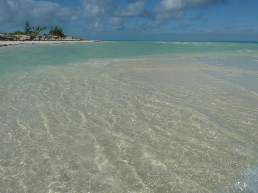
On the north coast of Cuba , one of the most beautiful coral reefs in the world , is one of the jewels of Camagüey Archipelago : Cayo Guillermo . This island is only 13 square miles which also include the highest dunes in the Caribbean islands with 15 meters high.

In the Holguín region lies one of the most beautiful corners of the Cuban landscape: Guardalavaca Beach , a paradise of white sand and blue waters extended along four kilometers of north eastern coast near the city of Holguin.
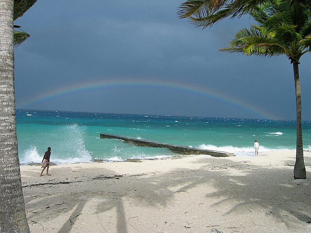
MARIA LA GORDA BEACH . Located in the province of Pinar del Rio, the westernmost tip of Cuba , one of the most virgin natural zones in the Cuban archipelago . Area declared a Biosphere Reserve , with 8 kilometers of fine white sand washed by the Caribbean Sea .
Various / YanitzaReb / InternetPhotos / www.thecubanhistory.com
The Cuban History, Hollywood.
Arnoldo Varona , Editor.
ALGUNOS DE LOS LUGARES MAS BELLOS DE CUBA

En la Sierra La Trinidad se encuentran las cascadas El Nicho, más precisamente el el Parque El Nicho, en la provincia cubana de Cienfuegos ubicada en la parte central de la isla.

En la costa norte de Cuba, en una de las más bellas barreras coralinas del mundo, se encuentra una de las joyas del archipiélago de Camagüey: Cayo Guillermo. Esta isla posee apenas 13 kilómetros cuadrados donde se destacan también las dunas más altas del Caribe insular con 15 metros de altura.

En la región de Holguín esconde uno de los rincones más bellos del paisaje cubano: la playa de Guardalavaca, un paraíso de arena blanca y aguas azules extendido a lo largo de cuatro kilómetros del litoral norte oriental cerca de la ciudad de Holguín.

PLAYA MARIA LA GORDA. Ubicada en la provincia de Pinar del Río, en el extremo más occidental de Cuba, una de las zonas naturales más vírgenes del archipielago cubano. Zona declarada Reserva de la Biósfera, con 8 kilómetros de blancas y finas arenas bañadas por el mar Caribe.
Various/YanitzaReb/InternetPhotos/www.thecubanhistory.com
The Cuban History, Hollywood.
Arnoldo Varona, Editor.
HABANA LIBRE HOTEL, CUBA.
Hotel Habana Libre, Havana’s most symbolic hotel, was built as the Habana Hilton, under the personal auspices of President Fulgencio Batista. This hotel, designed one by the Los Angeles firm Welton Becket & Associates in association with the Cuban firm Arroyo-Menéndez in the end of 50’s, was built by workers contracted through the pension plan of the Cuban Catering Workers’ Union and managed by Frederick Snare Corporation.
The inaugural process happened in the afternoon of Wednesday March 19, 1958. In the main entrance of the hotel, the guests luxurious automobiles were received by tall porters, very shavings until at the foot of sideburns, decked out with a impressive full-dress by helmet covered in cloths of colors, ended in suggestive feathers, elegant ties tight-fitting to the neck, sash of colors wound around to the waist and shiny , all that already enhanced the those youths’ regal personality chosen by their fine-looking to carry out that work, young men that didn’t require of any special effort to complete their functions properly. Everything had as the only one objective, to cause a striking majesty to all the visitors.
Also, it was prepared a grand banquet with tasty morsels and exotic liquors. The soiree was full of a select attendance, among those that were: Martha Fernández de Batista, wife of the President of the Cuba Republic; José Suárez Rivas, Secretary of the Work; Eusebio Mujal Barniol, Francisco Aguirre Vidaurreta and other personalities linked the government, as well as foreign visitors and wealthy Cuban families.
Hotel Habana Hilton opened on March 22, 1958, with Conrad Hilton himself in attendance and it was operated by the American Hilton Hotels group. Hotel Habana Hilton was Latin America’s tallest and largest hotel. It boasted a Trader Vic’s, as well as a casino, supper club, pool and rooftop bar.
Hotel Havana Hilton, in the small period that operated with the American Hilton Hotels group, José A. Menéndez was administrating, Conrad Hilton’s daughter’s husband and at the same time his godchild and protected. The adversity of the workers that inside the hotel, cooks, salesclerk of restaurants, cocktail bar, waiters, barmen, carpenters and others were contained according to their specialties; this kind of distribution would allow a bigger exploitation of this gastronomic sector.
The futures employees were underwent to four months of test to get the employment and of course, for the deserved promotions, all that which was published in the Ambiente Magazine.
Following the entry of Fidel Castro into Havana, on January 8, 1959, the Hotel Habana Hilton became his headquarters for 3 months. He took the suite 2324 as his central office. At this time Fidel offers press conferences, hold meetings and interview with leaders of the whole nation.
In these first years of the Cuban Revolution the managers of Hotel Habana Hilton came carrying out wholesale redundancies and wage claims to the Revolutionary Government under the pretext that the Hotel was bankrupt; so the cost problems and the workers’ wages happening constantly, threatening with a new staff cuts and block the way of the tourists in the country, this last one due to the influence of the company in the world. The number demanded by Hilton Group to the Revolutionary Government was two million pesos to be able, according to him, to finance the maintenance costs and to keep the Hotel working. It was granted! The hotel remained in operation as a Hilton for two more unsuccessful years as relations between the US and Cuba worsened, until October 1960, when all American hotels in Cuba were nationalized and the casinos permanently closed. The hotel was then renamed the Hotel Habana Libre.
Hotel Habana Libre in the first years of the Cuban Revolution, when losing the international tourism, begins to work hosting national guests; such as: cane cutters, Ana Betancourt Women’s Brigade, peasants’ women that came to Habana to gain qualification; students of the first school of arts and crafts, the first foreign technicians. A curious fact was that Soviet first Embassy worked for a while in two floors at the hotel. In the sixties Hotel Habana Libre was operated for the National Institute of the Tourism, INTUR; and it was when begins to recover the international tourism in 1974.
Hotel Habana Libre and their dependences suffered modifications starting from its nationalization, among them: the creation of a shop for foreigners administrated for Cubatur Company, the same one that had its offices in the left wing of the building, front of the street 23; they also settled two living rooms of national and international press and in the area where it occupies the cafeteria of L y 23 at the present days the Tespis Hall Theater of the University of Havana opened up. The shop and the theater worked there until 1977.
Starting from 1982 they are carried out renovation works for the building’s deterioration: from these works the Antilles Bar and Siboney hall were enlarged, and the last one was enabled to render services and support to the XIV Central America and Caribbean ’ staff. Once finished the same ones Siboney hall began to work as a restaurant with Creole meals. Also Polinesio restaurant was restored in that date.
In the nineties, due to the peak experienced for the tourism in Cuba, three hotel groups appeared: Gran Caribe, Horizontes Hotels and Isla Azul, this last one for national tourism. Hotel Habana Libre was operated then by Gran Caribe Hotel Group in association with Spanish Guitar Hotels Group.
In 1996 the Spanish Sol Meliá Hotel Group assumed management of the hotel in association with the Cuban government. It was placed in their Tryp division of urban hotels and renamed Hotel Tryp Habana Libre. It was renovated between 1996 and 1997. Among the highlights of the work was the restoration of an enormous original mural by artist Amelia Peláez over the main entrance which had spent decades hidden from public view.
Habana Libre new hotel opened its doors in December 1997 with the most representative works in the plastic one and the Cuban craftsmanship, completely renovated with work by Alfredo Sosabravo, located to the entrance of the Buffet-Restaurant, and those ones like the beautiful clepsydra in the lobby, Cuban Rita Longa’s work.
Hotel Habana Libre nowadays is still Havana’s most symbolic hotel. Waiting for the future.#
HOTEL HABANA LIBRE
Hotel Habana Libre, el hotel más emblemático de La Habana, fue construido como el Habana Hilton, bajo los auspicios personales del presidente Fulgencio Batista. Este hotel, diseñado uno por el de Los Angeles la firma vinatera de Welton & Associates en asociación con la empresa cubana Arroyo Menéndez en la final de los años 50, fue construida por los trabajadores contratados a través del plan de pensiones del Sindicato de Trabajadores de catering de Cuba y dirigido por Frederick Snare Corporation.
El proceso de toma de posesión ocurrió en la tarde del miércoles 19 de marzo de 1958. En la entrada principal del hotel, los automóviles de lujo invitados fueron recibidos por porteros alto, muy virutas hasta que a los pies de las patillas, decorado con una impresionante gala por el casco cubierto de telas de colores, terminados en plumas sugestivas, lazos elegantes ajustada al cuello, faja de colores enrollado alrededor de la cintura y brillante, todo lo que ya se mejoró la personalidad real de los jóvenes elegidos por su buen aspecto para llevar a cabo ese trabajo, los hombres jóvenes que no requieren de ningún daño especial esfuerzo para completar sus funciones correctamente. Todo tenía como único objetivo, causar una majestuosidad impresionante a todos los visitantes.
Además, se preparó un gran banquete con manjares y licores exóticos. La velada estuvo llena de una asistencia de selección, entre los que se fueron: Martha Fernández de Batista, esposa del Presidente de la República de Cuba, José Suárez Rivas, Secretario del Trabajo, Eusebio Mujal Barniol, Francisco Aguirre Vidaurreta y otras personalidades vinculadas al gobierno , así como los visitantes extranjeros y los ricos las familias cubanas.
Hotel Habana Hilton abrió el 22 de marzo de 1958, con Conrad Hilton en la asistencia a sí mismo y fue operado por el grupo estadounidense Hilton Hotels. Hotel Habana Hilton era el hotel más alto y más grande de América Latina. Se contaba con un Trader Vic, así como un casino, club de la cena, la piscina y bar en la azotea.
Hotel Habana Hilton, en el corto período que operaba con la American Hotels grupo Hilton, José A. Menéndez fue la administración, el marido de la hija de Conrad Hilton y al mismo tiempo, su ahijado y protegido. La adversidad de los trabajadores que en el interior del hotel, cocina, dependiente de restaurantes, cocktail bar, camareros, camareros, carpinteros y otros estaban contenidos en función de sus especialidades, este tipo de distribución que permiten una explotación más grande de este sector gastronómico.
Los futuros empleados fueron sometidos a cuatro meses de prueba para obtener el empleo y, por supuesto, de las promociones merecidas, todo aquello que fue publicado en la Revista Ambiente.
Tras la entrada de Fidel Castro en La Habana, el 8 de enero de 1959, el hotel Habana Hilton se convirtió en su cuartel general durante 3 meses. Tomó la suite 2324 en su oficina central. En este momento Fidel ofrece conferencias de prensa, reuniones de las bodegas y las entrevistas con los líderes de toda la nación.
En estos primeros años de la Revolución Cubana, los gerentes del Hotel Habana Hilton fue llevar a cabo despidos al por mayor y las reivindicaciones salariales al Gobierno Revolucionario, con el pretexto de que el hotel estaba en bancarrota, por lo que los problemas de costos y los salarios de los trabajadores pasa constantemente, amenazando con una nuevos recortes de personal y bloquear el camino de los turistas en el país, este último debido a la influencia de la empresa en el mundo. El número exigido por el Grupo Hilton al Gobierno Revolucionario fue de dos millones de pesos de poder, según él, para financiar los costos de mantenimiento y para mantener el hotel trabajando. Se le concedió! El hotel se mantuvo en funcionamiento como Hilton durante dos años más sin éxito a las relaciones entre los EE.UU. y Cuba empeoraron, hasta octubre de 1960, cuando todos los hoteles americanos en Cuba fueron nacionalizadas y los casinos permanentemente cerrados. El hotel ha pasado a denominarse el hotel Habana Libre.
Hotel Habana Libre, en los primeros años de la Revolución Cubana, al perder el turismo internacional, comienza a trabajar recibiendo a huéspedes nacionales, tales como: cortadores de caña, la Brigada de Ana Betancourt de la Mujer, las mujeres de los campesinos que llegaron a La Habana para obtener cualificación, estudiantes de la primera escuela de artes y oficios, los técnicos extranjeros de primera. Un dato curioso fue que la primera Embajada Soviética trabajó durante algún tiempo en dos plantas en el hotel. En los años sesenta Hotel Habana Libre fue operado por el Instituto Nacional del Turismo, INTUR, y fue cuando se empieza a recuperar el turismo internacional en 1974.
Hotel Habana Libre y sus dependencias sufrió modificaciones a partir de su nacionalización, entre ellos: la creación de una tienda para extranjeros administrados por la empresa Cubatur, el mismo que tenía sus oficinas en el ala izquierda del edificio, frente a la calle 23, que también se instalaron dos salas de estar de la prensa nacional e internacional y en la zona en la que ocupa la cafetería de L y 23 en los días de hoy el Teatro Sala Tespis, de la Universidad de La Habana se abrió. La tienda y el teatro trabajó allí hasta 1977.
A partir de 1982 se llevan a cabo obras de renovación por el deterioro del edificio: a partir de estos trabajos, el bar de las Antillas y la sala de Siboney se ampliaron, y el último fue habilitada para prestar servicios y apoyo a la región de América Central y el personal XIV del Caribe ‘. Una vez finalizado los mismos Siboney Hall comenzó a trabajar como un restaurante con comidas criollas. También Polinesio restaurante fue restaurado en esa fecha.
En la década de los noventa, debido a la alta experiencia para el turismo en Cuba, tres grupos hoteleros apareció: Gran Caribe, Hoteles Horizontes y Azul Isla, este último para el turismo nacional. Hotel Habana Libre fue operado luego de Gran Caribe Hotel Group en asociación con la guitarra española Hotels Group.
En 1996, la española Sol Meliá Hotel Group asumió la dirección del hotel en asociación con el gobierno cubano. Fue colocado en su división de hoteles urbanos Tryp y renombrado Hotel Tryp Habana Libre. Fue renovado entre 1996 y 1997. Entre los aspectos más destacados de la obra fue la restauración de un enorme mural original del artista Amelia Peláez sobre la entrada principal, que había pasado décadas oculto a la vista del público.
Habana Libre nuevo hotel abrió sus puertas en diciembre de 1997 con las obras más representativas de la plástica y la artesanía cubana, totalmente renovadas con el trabajo de Alfredo Sosabravo, situado a la entrada del Restaurante-Buffet, y en aquellos como la clepsidra hermosa el vestíbulo, obra cubana de Rita Longa.
Hotel Habana Libre es hoy en día sigue siendo el hotel más simbólico de La Habana. Espera al Futuro.
Wikipedia/ InternetPhotos/TheCubanHistory.com
The Cuban History, Hollywood.
Arnoldo Varona, Editor.
SOME OF THE MOST BEAUTIFUL BEACHES IN CUBA.
A selection of the five best beaches in Cuba is a difficult task when you consider that the island is made up of the majestic coastline extends 5,746 kilometers, and the division in 289 natural beaches.
For example, the northern beaches of Cuba are characterized by fine golden sands and turquoise waves of the Atlantic Ocean, while the South are making them perfect for quiet periods of isolation.
Anyway, here are our top 5 beaches in Cuba:
1.- Cayo Santa María is an island located north of Cuba in the Jardines del Rey archipelago.
Cay Santa Maria is also known as the White Rose of Jardines del Rey. The cay was named after the flagship of Christopher Columbus’s fleet on his maiden voyage to the New World. Legend has it that this strip of land-some 13 km long and 2 km in width- is haunted by the spirit of Rosa Maria Coraje, a woman who hid aboard a ship in a desperate attempt to find both paradise and her beloved. She landed on the cay and managed to survive hiding in the marshes, among the mangroves and feeding on fish, until she finally discovered her dearly-loved in a neighboring cay.
Cayo Santa Maria, renowned for their immaculate landscape of incredible beauty, with sugary-white sand beaches and crystal-clear waters, fringed by autochthonous vegetation and connected to Caibarien, a small fishing town on the Cuban mainland, by a 48 km causeway stretching over the sea -accorded an international prize for its harmonious combination of nature and engineering in an area declared a World Biosphere Reserve- thus enabling visitors to access the cays directly from Santa Clara City, site of the international airport.
2. Varadero beach, is a resort town in the province of Matanzas, Cuba, and one of the largest resort areas in the Caribbean. Varadero is also called Playa Azul, which means “blue beach” in Spanish.
It is situated on the Hicacos Peninsula, between the Bay of Cárdenas and the Straits of Florida, some 140 km east of Havana, at the eastern end of the Via Blanca highway. The peninsula is only 1.2 km wide at its widest point and is separated from the island of Cuba by the Kawama Channel. This spit of land however extends more than 20 kilometers from the mainland in a northeasterly direction and its tip, Punta Hicacos, is the northernmost point of the island of Cuba. At the northeastern end of the peninsula there is a nature reserve with virgin forests and beaches.
Varadero is foremost a tourist resort town, boasting more than 20 km of white sandy beaches. The first tourists visited Varadero as early as the 1870s, and for years it was considered an elite resort. In 1910 the annual rowing regatta was started; five years later the first hotel, named Varadero and later Club Nautico, was built. Tourism grew in the early 1930s as Irénée du Pont Nemours, an American millionaire, built his estate on the peninsula. After the Cuban Revolution in 1959, many mansions were expropriated from their rich owners.
Juan Gualberto Gómez Airport, situated west of the peninsula, is Varadero’s airport. It is the second-most-important airport of the island after José Martí Airport in Havana, and serves international and domestic flights.
The 1990s brought the start of another hotel building campaign, mostly in the 4-star and 5-star segment. Many of the hotels are operated or co-owned by foreign businesses like Melia, Barcelo, TRYP, etc. (France’s Club Med used to have a property but has since left Varadero.) As a consequence, Varadero has lost much of its social and cultural life and its traditions. The central park, the cinema and various cultural meeting places were neglected in favor of a hotel-centred all-inclusive-tourism and finally closed. The International Carnival, an initiative of Cubans and foreigners started in the 1980s, also ceased.
http://youtu.be/CVvZCNcBy_Y
3.Cayo Coco, (Coco Key) is an island in central Cuba. It lies within the Ciego de Ávila Province and is part of a chain of islands called Jardines del Rey (“King’s Gardens”). It is named for the white ibis, locally called Coco (coconut) birds. It has a surface of 370 km². The island is made with 27 kilometers of some of the best beaches in Cuba. To the north, 9 snow white beaches, gently lapped by the Atlantic Ocean, to the south tropical mangroves, and wildlife refuges.
Used as a hideout by buccaneers in the early colonial period, the island was home to a small settlement of fishermen and charcoal producers until 1955 when the freshwater supply was exhausted and the market for charcoal. A causeway was built to the Cuban mainland in 1988, beginning the era of resort construction. The first resort, Guitart Cayo Coco (now the Blau Colonial), opened in 1993.
The causeway linking the cay to the mainland is 27 km long. The construction caused concern among environmentalists as it disturbed the tidal flow and thus life-cycle of waterlife. Despite fears, the wild flamingos still live in the shallow waters and can often be seen from the causeway although not as often as before the construction. A number of gaps were subsequently created in the causeway to restore water flow.
Still largely wild with swamps and scrubland populated by wild cattle. Beaches are very good and the massive coral reef off the north coast. Cayo Coco is linked by a short causeway to Cayo Guillermo to the west and by another short causeway to Cayo Romano to the east.
The island has its own international airport, the Jardines del Rey Airport (Aeropuerto Jardines del Rey) An earlier airport, the Cayo Coco Airport has been reclaimed as a small natural park called Parque Natural El Baga.
4.Guardalavaca is a town in the Holguín Province of Cuba. It is a well known location for years due to its white sandy beaches and warm waters with its 3 miles long is one of the smaller beaches in Cuba to enjoy. It is protected by a coral reef 300 meters, so it is a fascinating microclimate for marine life.
It is located on the northern shore of Cuba, bordering Bahia Naranjo (Orange Bay), on Cabo Lucrecia, and is part of the municipality of Banes. Beaches in Guardalavaca include Guardalavaca Beach, Playa Esmeralda, Don Lino and Bahia de Naranjo.
“Guardalavaca” literally means “guard the cow” in Spanish. There are several accounts as to how this name may have originated; one version maintains that Guardalavaca is a malapropism for its original name Guardalabarca, meaning “guard the ship”. The area was once heavily targeted by sea pirates, and Bahia Naranjo near what is now the town of Guardalavaca is a secluded shallow bay connected to the open sea by a narrow inlet, which made it a proper safe haven to guard ships against pirates. On the other hand, the name may have originated from pirates going after the cattle grazing in the area. As pirates were spotted, the local farmers would thus shout, “Guardalavaca” – guard the cow.
The Cuban government has attempted on several occasions to change the name of the area as they deem it not to be very appealing; they have so far been unsuccessful.
http://youtu.be/QPS9O45_UTA
5. Cayo Guillermo is a kay of the Jardines del Rey archipelago. It is located on the northern coast of Cuba, between the Bay of Dogs (Bahia de Perros) and the Atlantic Ocean. It is part of the Ciego de Ávila Province, and lies in the Morón municipality. One of the country’s best beaches, the Playa Pilar (Pilar Beach) is located at the western end of Cayo Guillermo. This beach is named after Ernest Hemingway’s yacht, the cabin cruiser Pilar. The island provides the setting for the climax of Hemingway’s last novel Islands in the Stream.
Access to the island is possible through the Jardines del Rey Airport (Aeropuerto Jardines del Rey) as well as by means of a long causeway from mainland Cuba to Cayo Coco leading to a second shorter causeway to Cayo Guillermo, connecting the two kays.
Sparsely inhabited in early years by fishermen and charcoal producers, the island gained fame in the 1960s with deep sea fishermen. The first resort was built in 1993 in an era known as “Tourist apartheid” as Cuban citizens were not allowed on the island unless they worked at the resorts serving tourists. However this restriction was lifted after 2000 and Cubans who can afford motor transport often visit Playa Pilar on the island. Many staff who work in the hotels commute from the distant mainland town of Morón.
Cayo Guillermo (Playa Pilar)
Wiki/internetphotos/StandardyoutubeLicense/FairUse/thecubanhistory.com
The Cuban History, Hollywood.
Arnoldo Varona, Editor.
ALGUNAS DE LAS PLAYAS MÁS BELLAS DE CUBA
Una selección de las cinco mejores playas de Cuba es una tarea difícil si tenemos en cuenta que la isla está formada con una majestuosa costa que se extiende 5.746 kilometros, y con una división en 289 playas naturales.
Por ejemplo, las playas del norte de Cuba se caracterizan por arenas finas y doradas y olas turquesas del Océano Atlántico, mientras que el Sur se hace perfecta por sus bellas arenas blancas.
De todos modos, aquí están los 5 mejores playas de Cuba:
1 -. Cayo Santa María es una isla situada al norte de Cuba, en Jardines del Rey archipiélago.
Cayo Santa María es también conocida como la rosa blanca de Jardines del Rey. El cayo fue nombrado después de que el buque insignia de la flota de Cristóbal Colón en su primer viaje al Nuevo Mundo. La leyenda cuenta que esta franja de tierra a unos 13 km de largo y 2 km de ancho-es perseguido por el espíritu de Rosa María Coraje, una mujer que escondió a bordo de un barco en un intento desesperado de encontrar tanto el paraíso y su amado. Ella aterrizó en el cayo y logró sobrevivir escondiéndose en las marismas, los manglares y se alimentan de peces, hasta que finalmente la descubrió caro querido en un cayo cercano.
Cayo Santa María, famoso por su paisaje inmaculado de increíble belleza, con playas de arena blanca-blanca y aguas cristalinas, rodeado de vegetación autóctona y conectado a Caibarién, un pequeño pueblo de pescadores en la península cubana, por una calzada 48 kilometros se extiende más el mar otorga un premio internacional por su armoniosa combinación de naturaleza e ingeniería en una zona declarada Reserva Mundial de la Biosfera, lo que permite a los visitantes acceder directamente los cayos de la ciudad de Santa Clara, sede del aeropuerto internacional.
2. Playa de Varadero, es una ciudad turística en la provincia de Matanzas, Cuba, y una de las mayores áreas de resorts en el Caribe. Varadero es también llamada Playa Azul, que significa “agua azul” en español.
Está situado en la península de Hicacos, entre la Bahía de Cárdenas y el Estrecho de Florida, a unos 140 km al este de La Habana, en el extremo oriental de la autopista Vía Blanca. La península está a sólo 1,2 km de ancho en su punto más ancho y está separada de la isla de Cuba por el Canal Kawama. Esta lengua de tierra sin embargo se extiende más de 20 kilómetros de la parte continental en dirección noreste y su punta, Punta Hicacos, es el punto más septentrional de la isla de Cuba. En el extremo noreste de la península hay una reserva natural con bosques vírgenes y playas.
Varadero es ante todo una ciudad turística, con más de 20 km de playas de arena blanca. Los primeros turistas visitaron Varadero ya en la década de 1870, y durante años fue considerado un resort de elite. En 1910, la regata de remo anual se inició, y cinco años más tarde, el primer hotel, llamado Varadero y posteriormente Club Náutico, fue construido. El turismo creció en la década de 1930 como Irénée du Pont de Nemours, un millonario americano, construyó su finca en la península. Después de la Revolución Cubana en 1959, muchas mansiones fueron expropiadas a sus propietarios ricos.
Juan Gualberto Gómez Airport, situado al oeste de la península, es el aeropuerto de Varadero. Es el segundo aeropuerto más importante de la isla, después de José Martí en La Habana, y recibe vuelos nacionales e internacionales.
La década de 1990 trajo el comienzo de otra campaña de construcción de hotel, sobre todo en el segmento de 4 estrellas y 5 estrellas. Muchos de los hoteles son operados o co-propiedad de las empresas extranjeras como Meliá, Barceló, TRYP, etc (Club Med de Francia solía tener una propiedad, pero desde entonces ha dejado Varadero.) Como consecuencia, La Habana ha perdido mucho de su valor social y la vida cultural y sus tradiciones. El parque central, el cine y diversos lugares de reunión culturales fueron abandonados en favor de un hotel centrado en el todo incluido el turismo y cerró finalmente. El Carnaval Internacional, una iniciativa de los cubanos y los extranjeros que se inició en la década de 1980, también cesó.
http://youtu.be/CVvZCNcBy_Y
3. Cayo Coco, (Cayo Coco) es una isla en el centro de Cuba. Se encuentra en la provincia de Ciego de Ávila, y forma parte de una cadena de islas llamadas Jardines del Rey (“King Gardens”). Se llama así por el ibis blanco, localmente llamado Coco (coco) aves. Tiene una superficie de 370 km ². La isla se hizo con 27 kilómetros de algunas de las mejores playas de Cuba. Hacia el norte, 9 playas blancas como la nieve, suavemente bañadas por el Océano Atlántico, al sur de los manglares tropicales y refugios de vida silvestre.
Se utiliza como escondite por los bucaneros en el período colonial temprano, la isla fue el hogar de un pequeño asentamiento de pescadores y productores de carbón hasta 1955 cuando el suministro de agua dulce se había agotado y el mercado de carbón. Una calzada fue construida con la tierra firme de Cuba en 1988, comenzando la era de la construcción del centro turístico. El primer recurso, Guitart Cayo Coco (ahora el Blau Colonial), abrió sus puertas en 1993.
La calzada que une el cayo a la tierra firme se encuentra a 27 km. La construcción causó preocupación entre los ecologistas, ya que perturba el flujo de las mareas y de este modo el ciclo de vida de Waterlife. Pese a los temores, los flamencos salvajes siguen viviendo en las aguas poco profundas y con frecuencia se puede ver en la calzada, aunque no con tanta frecuencia como antes de la construcción. Una serie de lagunas fueron creados posteriormente en la calzada para restablecer el flujo de agua.
Todavía en gran parte salvaje de pantanos y matorrales pobladas por ganado salvaje. Las playas son muy buenas y el arrecife de coral masivo en la costa norte. Cayo Coco está unida por un corto terraplén hacia Cayo Guillermo, al oeste y por otro corto terraplén hacia Cayo Romano hacia el este.
La isla tiene su propio aeropuerto internacional, el Aeropuerto Jardines del Rey (Aeropuerto Jardines del Rey) Un aeropuerto antes, el aeropuerto de Cayo Coco se ha recuperado como un pequeño parque natural llamado Parque Natural El Baga.
4. Guardalavaca es una ciudad en la provincia de Holguín en Cuba. Es un lugar muy conocido por años, debido a sus playas de arena blanca y aguas cálidas, con sus 3 kilómetros de largo es una de las playas más pequeñas en Cuba para disfrutar. Está protegida por un arrecife de coral a 300 metros, por lo que es un microclima fascinante para la vida marina.
Se encuentra en la costa norte de Cuba, bordeando Bahía Naranjo (Orange Bay), en Cabo Lucrecia, y es parte del municipio de Banes. Las playas de Guardalavaca incluyen Playa Guardalavaca, Playa Esmeralda y Don Lino y Bahía de Naranjo.
“Guardalavaca” significa literalmente “guardia de la vaca” en español. Hay varias cuentas de cómo este nombre puede tener su origen, una versión sostiene que Guardalavaca es una malapropism por su Guardalabarca nombre original, que significa “protector de la nave”. El área fue una vez fuertemente el blanco de los piratas del mar, y Bahía Naranjo cerca de lo que hoy es la ciudad de Guardalavaca es una pequeña y recóndita cala poco profunda conectada con el mar abierto por un estrecho, lo que hizo un buen refugio seguro para protegerse contra los barcos piratas. Por otro lado, el nombre puede tener su origen en los piratas que van después de la cría de ganado en la zona. Como los piratas fueron vistos, los agricultores locales así gritaba: “Guardalavaca” – proteger a la vaca.
El gobierno cubano ha intentado en varias ocasiones para cambiar el nombre de la zona, ya que lo considera no ser muy atractivo, que hasta ahora han sido infructuosos.
http://youtu.be/QPS9O45_UTA
5. Cayo Guillermo es un kay del archipiélago Jardines del Rey. Se encuentra en la costa norte de Cuba, entre la Bahía de los Perros (Bahía de Perros) y el Océano Atlántico. Es parte de la provincia de Ciego de Ávila, y se encuentra en el municipio Morón. Una de las mejores playas del país, la Playa Pilar (Pilar Beach) se encuentra en el extremo oeste de Cayo Guillermo. Esta playa recibe su nombre de yate de Ernest Hemingway, el yate Pilar. La isla es el lugar para el clímax de las Islas última novela de Hemingway en el Golfo.
El acceso a la isla es posible a través del Aeropuerto Jardines del Rey (Aeropuerto Jardines del Rey), así como por medio de una larga calzada de tierra firme Cuba a Cayo Coco conducen a un segundo puente más corto para Cayo Guillermo, que conecta los dos cayos.
Escasamente habitada en los primeros años por los pescadores y productores de carbón vegetal, la isla ganó fama en la década de 1960 con los pescadores de alta mar. El primer complejo fue construido en 1993 en una era conocida como “apartheid turístico” como ciudadanos cubanos no estaban permitidos en la isla a menos que trabajaban en las estaciones de servicio de los turistas. Sin embargo, esta restricción fue levantada a partir de 2000 y los cubanos que pueden pagar el transporte del motor suelen visitar Playa Pilar en la isla. Muchos miembros del personal que trabajan en el trayecto hoteles de la ciudad continente distante de Morón.
Cayo Guillermo (Playa Pilar)
Wiki/internetphotos/StandardyoutubeLicense/FairUse/thecubanhistory.com
The Cuban History, Hollywood.
Arnoldo Varona, Editor.
SIBONEY BEACH, SANTIAGO DE CUBA.
It is a coastal town located 14 km from the city of Santiago de Cuba, bounded on the north by the mountains of the Gran Piedra, and Ramon of Las Yaguas area, south to the Caribbean Sea, east to the area Follow and west of the Urban District Abel Santamaría. It has an area of 113.80 km2.
The name comes from the word Siboney of the Arahuaco language of the Indians of the Caribbean. Cibo means precious stone, and ney people, are the people of the precious stone or pearl. It was felt that this beach was inhabited by Taino and Ciboney groups, so that this community is named for Siboney. With the arrival of the Spanish so far by 1550 the indians had been exterminated.
By 1884 there were only workshops, a warehouse and an aqueduct of the mining company Juraguá Iron Company, a few houses, a railway line belonging to the company, the roads were few and were in poor condition. There was also a battery of coastline known as Juraguasito (La Marina, Spanish fort), with an altitude above sea level 7 meters, built in 1655 by military engineer Isidro Limonta. He was a watchman of the Spanish port, was part of a complex of forts that were associated with the Morro, to defend the coast. The Americans assembled business with the mines of manganese, iron and coal in the area of firmness and Daiquiri.
Siboney was the scene of Cuban Spanish American War, this beach is produced by part of the landing of American troops under Major General William Shafter. On June 22, 1898 was the landing at Daiquiri of U.S. troops in the morning, this was kept up during the 23rd at 4:00 PM, while this was happening, Siboney, or Altars Cove, was bombed. In Siboney, this very day 22, about noon, beginning on the landing of the First Division, General Kent, and continued through the night, when he had landed about 12 000 men. The first landing at Siboney had been carried out like the others, thanks to the support of Army forces Mambí.
On June 23 the troops of Engineers began a pier at Siboney, work was interrupted by having to travel 24 engineers Sawmill, then returned to Siboney to enlarge the existing pier and construct a pier of 40m long, consisting of caulked large wooden boxes and weighted with stones at the bottom supporting and holding the platform. Then the engineers fixed the Siboney road to Seville. Already on June 23 another landing occurs, commanding the troops of the 1st Infantry Division landing at Siboney and evening 6,000 men were ashore. On the evening of June 24 all the 5th Expeditionary Force was on the ground Shafter. On 24 June, according to Shafter, the landing of troops and supplies had nearly completed, and the whole expedition was grounded in the evening. The occupation of the beach gave the Americans another point of landing located even closer to Santiago.
From 1901 to 1902 Railroad organized Daiquiri – Santiago, to Siboney, being in this town where there is maintenance on locomotives and minerals are stored and then transported to Santiago de Cuba. The workshops of the company were located in what is now the House of Jurists, where the mail was the home tele oil to grease the engines.
In 1953 occurs the assault on the Moncada Barracks, Fidel Castro and the revolutionaries at that time chose the Siboney Farm, located on the outskirts of the community as general youth camp on the Moncada attackers. At that time an store owned by Manuel Blanco and Sons “Los Criollos” was located on a small sandy elevation, about 50 m from the sea and no other building in the background. It was built in 1940 by the builders of the mining company, Juan Manuel and Rafael.
Siboney Beach can not be considered from the point of view of tourism, a premier beach. His sandy brown and narrow strip that can be used by bathers, and ends a few meters of shallow area, preventing it to be considered as beach alone attracts the stranger, but these few shortcomings are undoubtedly offset by the beauty of the landscapes that surround it and the enormous historical interest from the beach.
Currently, its population is approximately 12 272 inhabitants. In 50 years of Castro’s administration have been built: a new junior high school, creating a pre-university and a polytechnic of Agronomy, the realization of a telecorreo, building a new bakery, building a rehabilitation ward, restoration of the polyclinic, the construction of a Youth Club of Computing and Electronics.
On February 10, 2011 the French ship Ile de Batz, the company Alcaltel-Lucent, after twenty days of party Venezuelan port of Camiri ended the laying of a fiber optic submarine cable. The wire touched Cuban national territory by the Siboney Beach, which hosted an event with state officials and local people. But it is clear that this modern single cable has been activated to government agencies and an undetermined number of public officials until now has not been made available to the general population.
Siboney Beach has several settlements: The Guásimas, El Brujo, The Frog, The Carpenter, La Gran Piedra, El Oasis, Delirium, The Refuge, Charity, Santa Isabel and Soledad. With a population of 3 284 residential homes, of which 722 are in good condition, 764 classified as regular and 1 798 in poor condition.
The predominant soils in the area are rocky, limestone formation in the coastal zone is of biogenic origin and is called Jaimanita training, to higher levels the rock is more compact and belongs to the Maya training, from 4th or 5th terrace there is a calcareous marl formation. Flora, from the fourth or fifth terrace stands a forest which is characterized by the vegetation moves the leaves at a certain time of year where there are many thorny trees and drought-resistant.
The fauna includes 276 species of birds reported, including endemic birds of Cuba is the bird fly, Pechero the Bobito boy, the Blackbird and the Charter Cuba among others. Fauna of the caves one can mention the Cuban endemic bat Phyllonycteris poeyi.
Curiosities
* The tree, in the shadow of peace which was signed (The Tree of Peace), July 16, 1898, in Santiago de Cuba, covered with exquisite foliage, was in San Juan, this fell as old it was in 2000, and another tree was planted in the same place.
* On a proposal from Sr.Casero, delegate of the National Tourism Corporation, this suggested that the rock that crowns the summit of La Gran Piedra and which owes its name, is converted under the chisel of a sculptor of talent, two heads colossal head of Theodore Roosevelt to symbolize the romance of American intervention in favor of freedom and the head of Calixto Garcia, the genius Mambi collaboration made possible the rapid victory over the valiant army of Spain, until now not approved.
Wiki/GuerraCubaAmer/InternetPhotos/YouTube/www.TheCubanHistory.com
The Cuban History, Hollywood.
Arnoldo Varona, Editor.
PLAYA DE SIBONEY, SANTIAGO DE CUBA
Es una localidad costera ubicada a 14 Km. de la ciudad de Santiago de Cuba, limita al norte con el macizo montañoso de la Gran Piedra, y la zona de Ramón de las Yaguas, al sur con el Mar Caribe, al este con la zona de Sigua y al oeste con el Distrito Urbano Abel Santamaría. Cuenta con una extensión de 113.80 km2.
El nombre Siboney es una palabra del lenguaje Arahuaco de los Indígenas del Caribe. Cibo significa piedra preciosa, y ney gente; son la gente de la piedra preciosa o perla. Se consideraba que esta playa fue habitada por grupos tainos y siboneyes, por lo que esta comunidad lleva el nombre de Siboney. Con la llegada de los españoles para 1550 fueron perseguidos y exterminados en su totalidad.
Para 1884 existían solamente talleres, un almacén y un acueducto de la compañía minera Juraguá Iron Company, algunas casas, una línea de ferrocarril perteneciente a la compañía, las vías de comunicación eran escasas y se encontraban en mal estado. También existía una batería de costa conocida como Juraguasito (La Marina, fortín español),con una altitud sobre el nivel del mar de 7 metros, construida en 1655 por el ingeniero militar Isidro Limonta. Era un puerto vigía de los españoles, formaba parte de un complejo de fortalezas que existían asociadas al Morro, para defender las costas. Los norteamericanos montan negocios con las minas de manganeso, hierro y carbón en la zona de Firmeza y Daiquiri.
De 1901 a 1902 organizan el ferrocarril de Daiquiri – Santiago, pasando por Siboney, siendo en este poblado donde se da mantenimiento a las locomotoras y se almacenan los minerales, para luego transportarlos a Santiago de Cuba. Los talleres de la compañía estaban ubicados en lo que es actualmente la Casa de los Juristas, donde se encuentra el tele correo estaba la casa del aceite para engrasar las locomotoras.
Siboney fue escenario de la Guerra Hispano Cubana Norteamericana, por esta playa se produce parte del desembarco de las tropas norteamericanas al mando del Mayor General William Shafter. El día 22 de junio de 1898 se produce el desembarco en Daiquiri de las tropas norteamericanas en horas de la mañana, este se mantuvo hasta durante el día 23 a las 4:00 PM, mientras esto ocurría, Siboney, o Ensenada de los Altares, era bombardeada. En Siboney, este mismo día 22, aproximadamente al mediodía, comenzaría el desembarco de la Primera División, la del General Kent, y continuó hasta horas de la noche, cuando ya habían desembarcado alrededor de 12 000 hombres. El primer desembarco por Siboney había podido llevarse a cabo al igual que los anteriores, gracias a las fuerzas de apoyo del Ejército Mambí.
El día 23 de junio las tropas de ingenieros comenzaron un embarcadero en Siboney, trabajo que se interrumpió el 24 por tener que trasladarse los ingenieros a Aserradero; luego volvieron a Siboney para agrandar el muelle existente y construir un embarcadero de 40m de largo, formado por grandes cajones de madera calafateados y lastrados con piedras que apoyaban en el fondo y sostenían la plataforma. Luego los ingenieros arreglaron el camino de Siboney a Sevilla. Ya el 23 de junio se produce el otro desembarco, ordenándoles a las tropas de la 1ra División de Infantería desembarcar en Siboney y al anochecer estaban en tierra 6000 hombres. Al anochecer del día 24 de junio todo el 5to Cuerpo Expedicionario de Shafter estaba en tierra. El 24 de junio, según Shafter, el desembarco de sus tropas, así como los abastecimientos, habían prácticamente concluido, y toda la expedición quedó en tierra en horas de la noche. La ocupación de esta playa proporcionó a los norteamericanos otro punto de desembarco situado aún más cerca de Santiago.
En 1953 ocurre el asalto al Cuartel Moncada, Fidel Castro Ruz y los revolucionarios de entonces escogieron la Granjita Siboney, ubicada en las afueras de la comunidad, como campamento general de los jóvenes asaltantes al Moncada. La tienda “Los Criollos” propiedad de Manuel Blanco e Hijos estaba situada sobre una pequeña elevación arenosa, a unos 50 m del mar y sin otro edificio al fondo. Fue construida en el año 1940 por los albañiles de la compañía minera, Juan, Manuel y Rafael. Tenía cafetería, un bar que se encontraba ubicado donde es actualmente el Consejo Popular, una carnicería y un depósito de cocos, el frente era para la playa, tenía tres corredores.
La playa de Siboney no puede considerarse desde el punto de vista turístico, una playa de primera clase. Sus arenas de color pardo y lo estrecho de la faja que puede utilizarse por los bañistas, ya que a pocos metros termina la zona de poca profundidad, impidiendo que se le considere como playa que por sí sola atraiga al forastero, pero esas pocas deficiencias están, sin dudas, compensadas por la belleza de los paisajes que la rodean y por el enorme interés histórico de la playa.
Actualmente, su población asciende aproximadamente a 12 272 habitantes. En 50 anos deadministraciónn castrista se han construido: una nueva Secundaria Básica, la creación de un preuniversitario, así como de un politécnico de Agronomía, la realización de un telecorreo, la construcción de una nueva panadería, la construcción de una sala de rehabilitación, la restauración del policlínico, la construcción de un Joven Club de Informática y Electrónica.
El 10 de febrero de 2011 el barco francés Ille de Batz, de la compañía Alcaltel-Lucent, tras veinte días de haber partido del puerto venezolano de Camiri terminó el tendido de un cable submarino de fibra óptica. El cable tocó territorio nacional cubano por la Playa Siboney, donde se realizó un acto con funcionarios estatales y pobladores del lugar. Pero es de aclarar que este moderno cable solo ha sido activado para organismos de gobierno y un número no determinado de funcionarios públicos, hasta este momento no se ha puesto a disposición de la población general.
La Playa Siboney posee varios asentamientos poblacionales: Las Guásimas, El Brujo, El Sapo, El carpintero, La Gran Piedra, El Oasis, El delirio, El refugio, La Caridad, Santa Isabel y Soledad. Con unapoblaciónn habitacional de 3 284 viviendas, de ellas 722 están en buenas condiciones, 764 catalogadas como regulares y 1 798 en malas condiciones.
Los suelos predominantes en el territorio son de tipo rocoso, de formación caliza que en la zona costera es de origen biógeno y recibe el nombre de formación Jaimanita, hacia los niveles superiores la roca es mas compacta y pertenece a la formación maya, a partir de 4ta o 5ta terraza existe una formación marga calcárea. La flora, a partir de la cuarta o quinta terraza se distingue un bosque que tiene como característica que la vegetación muda las hojas en determinada época del año, donde abundan los árboles espinosos y resistentes a la sequía.
La fauna se caracteriza por 276 especies de aves reportadas, entre las aves endémicas de Cuba se encuentra el Pájaro mosca, el Pechero, el Bobito chico, el Totí y la Carta Cuba entre otros. De la fauna de las cavernas se puede mencionar el murciélago endémico cubano Phyllonycteris poeyi.
Curiosidades
* El árbol, a la sombra del cual fue firmada la paz (El Arbol de la Paz), el 16 de julio de 1898, en Santiago de Cuba, cubierto de exquisito ramaje, se encontraba en San Juan, este se cayó de tan viejo que era en el año 2000, y se sembró otro árbol en el mismo lugar.
* En una propuesta del Sr.Casero, delegado de la Corporación Nacional Turística, este sugirió que la roca que remata la cúspide de La Gran Piedra y al cual debe su nombre, sea convertida bajo el cincel de un escultor de talento, en dos cabezas colosales: la cabeza de Theodore Roosevelt que simbolizaría el aspecto romántico de la intervención americana a favor de la libertad y la cabeza de Calixto García, el genio mambí que hizo posible con su colaboración el rápido triunfo sobre el aguerrido ejército de España, hasta este momento no se ha aprobado.
Wiki/GuerraCubaAmer/InternetPhotos/YouTube/www.TheCubanHistory.com
The Cuban History, Hollywood.
Arnoldo Varona, Editor.
LA GRAN PIEDRA. UN TESORO DEL ORIENTE CUBANO.
La Gran Piedra, tesoro del oriente cubano. Gigantesca mole de piedra, testigo del vulcanismo del Paleógeno, al igual que toda la geología de la Sierra Maestra donde están presentes estratos de este tipo de rocas, compuestas de tobas, ceniza y demás fragmentos de rocas y productos líquidos, como mantos de lava volcánica.
Ubicada en la Carretera de Siboney y Carretera la Gran Piedra km. 14, Santiago de Cuba.
La Enorme roca de brecha volcánica, de 51 metros de largo y de 25 a 30 metros de ancho, con un peso calculado de 63 000 toneladas se encuentra en la cima de una montaña a 1 225 metros de altura sobre el nivel del mar. Mirador natural desde donde se observa la Sierra Maestra.
Zona de asentamiento de colonos franceses en los siglos XVIII y XIX, que realizaron construcciones que son ejemplos excepcionales de arquitectura vernácula e industrial. También se conservan de esa época las ruinas de decenas de plantaciones de café de estos colonos. Precisamente, ese es el punto culminante del sistema montañoso, con una altura de mil 225 metros sobre el nivel del mar e integrado en los atractivos que conforman el Gran Parque Nacional Sierra Maestra.
La mole es famosa no solo entre las fronteras de la isla, sino también en la región del Caribe insular, pues es precisamente la de mayor tamaño en esa zona.
Las leyendas de su origen abarcan hasta las versiones que le atribuyen su formación debido al impacto de un meteorito que cayó hace millones de años en el mencionado territorio oriental, aunque la más verídica es aquella que considera su nacimiento debido a la explosión de un volcán submarino. Actualmente es considerado Monumento Nacional.
La flora es exclusiva, pues la componen 222 variedades de helechos, y 352 de orquídeas, eucaliptos, pinos maestrenses, cubenses, cipreses, y una variedad de frutales entre ellos, por insólito que parezca, manzanas legítimas y melocotones.
La fauna de la Gran Piedra es, uno de los atractivos más fuertes. En torno a la mole arrojada por el volcán, vuelan pájaros carpinteros, zorzales reales, cartacubas, gavilanes, torcazas, mayitos, capitaneados por nuestra ave nacional, el tocororo. A sólo un kilómetro se encuentra el Jardín Botánico, donde se cultivan de forma excepcional, especies como el ave del paraíso, las dalias, magnolias y otras de climas fríos, aprovechando el microclima que reina en la zona. La cortina de nubes que baja hasta tocar el suelo tapizado de musgos siempre húmedos, suele impregnar de misterio y enigma el encuentro de los hombres con la mole de piedra, que sólo la fuerza descomunal generada en las entrañas de un volcán, pudo haber lanzado hasta aquella montaña.
Wiki/InternetPhotos/EcuRed/YouTube/TheCubanhistory.com
The Cuban History, Hollywood.
Arnoldo Varona, Editor.
CUBA PHOTOS.
Veneración de la Virgen de Regla, Cuba.
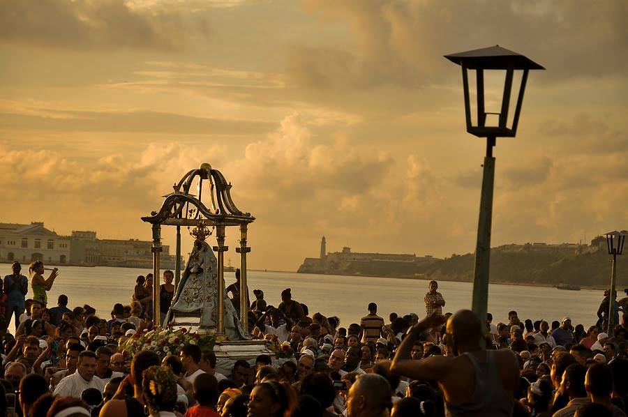
EASTERN CUBA TREASURE “THE BIG ROCK”, SANTIAGO DE CUBA.
Formed most likely from a volcanic rupture, the “Gran Piedra” (the Grand Stone) is an enormous rock measuring 51 yards long and 25 to 30 yards wide. With a calculated weight of 63,000 tons, this boulder is situated on the summit of a mountain rising 1,225 meters above sea level. The site is located 25 kilometers (16 miles) southeast from the city of Santiago de Cuba.
The legends of its origin include everything from it having formed with the impact of a meteorite that fell to the earth millions of years ago to what are believed more accurate versions that consider its birth due to the explosion of an underwater volcano.
This unique site is now registered as a national monument.
The gigantic stone mass was perhaps a witness to the volcanism of the Paleocene, just like all of the geology of the Sierra Maestra Mountains, where strata of this type of rock are present composed of layers of volcanic lava. This mass is famous not only within the frontiers of the island, but also all across the Caribbean since it is the largest such stone in the entire region.
It is a natural watch tower from where the whole mountain range of the Sierra Maestra can be observed; likewise, almost the entire southeastern coast can be seen from here. Locals swear that on a clear night one can even see the gleam of lights coming from the neighboring Republic of Haiti.
In its surroundings one can enjoy unique flora consisting of 222 varieties of ferns, as well as a total of 352 types of orchids, eucalyptuses, maestrense pines, cubenses, cypresses and a variety of fruit-bearing trees –among them peaches, as odd as that might seem.
The fauna of the Gran Piedra is also one of its strongest attractions. Around the great mass flutter carpenter birds, royal thrushes, cartacubas, sparrow hawks, torcazas and mays, all led by our national bird: the tocororo.
Only a half mile away, one can find the area’s Botanical Garden, where species such as the bird of the paradise, dahlias, magnolias and other flowers are raised in a singular manner as they take advantage of the microclimate that prevails in the area.
The constant fog and the ever-damp moss ground-coverings typically pervade the mystery and enigma of this setting, one whose geo-morphological, ecological, climatological and topographical particularities lend it great importance for ecological tourism.
The highlight of the visit is the exciting adventure of climbing, wrapped in the dense fog, 452 steps up and accompanied by a dense vegetation of ferns and other species that perfume the atmosphere.
Wiki/InternetPhotos/EcuRed/YouTube/TheCubanhistory.com
The Cuban History, Hollywood.
Arnoldo Varona, Editor.
CUBA, ARCHIPELAGO WITH A GREAT NATURAL HERITAGE.
Cuba is an archipelago with a great natural heritage; national parks, nature reserves, beaches and coves.
The Park of the Sierra Maestra is one of the best natural scenery. La Gran Piedra, a huge rock of 70,000 tonnes and 1225 meters high, is one of its main attractions. Cuba has always been a friend of the Spanish tourist destination, but now Cuba is fashionable. Opening seems more reason to visit the island; perhaps to see what Cuba was before capitalism arriving change everything.
The truth is that when we think of the Caribbean island comes to mind the image of their cities: Havana, Santiago, Trinidad … But as account Rumbo, Cuba is an archipelago with a great natural heritage: national parks, nature reserves, beaches and coves. Central Cuba includes the provinces of Cienfuegos, Villa Clara, Sancti Spiritus, Ciego de Avila and Camagüey and highlights the cities of Cienfuegos and Trinidad, both World Heritage Site by Unesco.
Cuba last 2014 attracted three million visitantes Las Tunas, Granma, Holguín, Santiago de Cuba and Guantanamo are the five provinces that are located in the eastern part of the island of Cuba. Its most important cities are Santiago de Cuba and Baracoa between nature reserves and national park stands the Sierra Maestra where is the Gran Piedra. Sierra Maestra is one of the best scenery in the country. In his magnificent natural parks such as the Turquino Peak Park, Granma Landing Park, Parque Santo Domingo-La Sierrita and Marea del Portillo are Park.
La Gran Piedra, a huge rock of 70,000 tonnes and located 1,225 meters high, is one of the main attractions of the area. Stand in the Cuban fauna, mammals such as jutías, various bats, reptiles (highlighting the large population of crocodiles), amphibians (including the smallest frog in the world), fish and marine animals. Also abound insects and insectivorous mammals.
The plant has more than 6,500 plant species only seed, especially in forests; among which are tropical plants, river and fruit. Cuba last 2014 attracted a total of three million visitors. In the last ten years, more than 60% of visitors came to the country in high season, covering the months between November and April.
Agencies / 20Minutos / InternetPhotos / www.thecubanhistory.com
The Cuban History, Hollywood.
Arnoldo Varona, Editor.
CUBA, UN ARCHIPIÉLAGO CON UN GRAN PATRIMONIO NATURAL.
Cuba es un archipiélago con un gran patrimonio natural; parques nacionales, reservas naturales, playas y calas.
El Parque de la Sierra Maestra es uno de los mejores escenarios naturales. La Gran Piedra, una enorme roca de 70.000 toneladas y a 1.225 metros de altura, es uno de sus principales atractivos. Cuba siempre ha sido un destino amigo del turista español, pero ahora Cuba está de moda. Su apertura parece una razón de más para visitar la isla; tal vez para ver qué era Cuba antes de que el capitalismo que llega lo cambie todo.
Lo cierto es que cuando pensamos en la isla caribeña nos viene a la mente la imagen de sus ciudades: La Habana, Santiago, Trinidad… Pero, como cuenta Rumbo, Cuba es un archipiélago con un gran patrimonio natural: parques nacionales, reservas naturales, playas y calas. Cuba central comprende las provincias de Cienfuegos, Villa Clara, Sancti Spíritus, Ciego de Ávila y Camagüey y destaca por las ciudades de Cienfuegos y Trinidad, ambas declaradas Patrimonio de la Humanidad por la Unesco.
Cuba atrajo el pasado 2014 a tres millones de visitantes Las Tunas, Granma, Holguín, Santiago de Cuba y Guantánamo son las cinco provincias que se sitúan en la parte oriental de la isla de Cuba. Sus ciudades más importantes son Santiago de Cuba y Baracoa y entre sus reservas naturales sobresale el Parque Nacional de la Sierra Maestra en el que se halla la Gran Piedra. Sierra Maestra es uno de los mejores escenarios naturales del país. En él se hallan magníficos parques naturales como el Parque Pico Turquino, Parque Desembarco del Granma, Parque Santo Domingo-la Sierrita o Parque Marea del Portillo.
La Gran Piedra, una enorme roca de 70.000 toneladas y situada a 1.225 metros de altura, es uno de sus principales atractivos de la zona. Destacan en la fauna cubana, mamíferos como las jutías, diversos murciélagos, reptiles (destacando la numerosa población de cocodrilos), anfibios (entre ellos la rana más pequeña del mundo), peces y animales marinos. También abundan los insectos y mamíferos insectívoros.
La flora cuenta con más de 6.500 especies solo de plantas con semilla, especialmente en los bosques; entre las que se encuentran plantas tropicales, de río y frutales. Cuba atrajo el pasado 2014 a un total de tres millones de visitantes. En los últimos diez años, algo más de 60% de los visitantes llegaron al país en temporada alta, que abarca los meses comprendidos entre noviembre y abril.
Agencies/20Minutos/InternetPhotos/www.thecubanhistory.com
The Cuban History, Hollywood.
Arnoldo Varona, Editor.
EL PARQUE TRILLO, THE HEART OF LA HAVANA.
The Trillo Park is one of the oldest in Havana, according to the stationery citadina emerged as a small seat for the rest, in the first decade of last century.
On July 26, 1912, by resolution 730 of the City of Havana, was the Key West area where is located this wooded area, now is also an important cultural place in the neighborhood. That is the genesis of the popular park, which has always sounded the rumba.
Cozy place, Trillo Park is characterized by its intimate character, its internal callecillas wooded, especially by those who make their environment the time for conversation and relaxation.
Are older people since the early hours reach the square of Trillo. There, between the security of their stocks, nostalgia and memories, the elderly back to the times when, in the same place sounded hides, now more than time to time, and the dancers were thrown into the ring in search of immediate joy .
Trillo Park, like the bandage, in the heart of Havana, is one of the best known of Havana. It can be said that all roads lead to the popular site.
Nestled between the San Rafael Street, San Miguel, Aramburu and Hospital, was one of the past where there was a weekly open market, where the buyer was the most unusual product, from the tasty and refreshing Cuban fruits, like mango and fruit pump (papaya) or seasonal meats, including sweet potato and cassava, bananas and tasty, always in time, through different types of meat, poultry, eggs.
It was a sort of flea market or flea market, existing in other Latin American nations.
Also there was also the scene of bloody incidents, among which is still remembered the assassination of famous criminal of the first half of last century by the people known as “Drake”.
In the first half of last century died at the scene in a shootout with police the notorious offender known by the nickname “Macho Duck”
It is said that the thug who boasted of good marksman, remained hidden in the mountains of the Archbishop, more than fifty miles from Havana and the day of his death, was caught in the park Trillo, he collected a package of food .
That’s why the song was born popular chaucha Because of the (food) / Drake killed / there in the park Trillo / fighting with the guys (police) / and even in 1966 the Cuban playwright Ignacio GUTIERRES, premiered in Havana the play “Macho Duck” with music by Hector Quintero.
Even a popular song dedicated to him the bully, which states: because of the green bean (food) / Drake killed / there in the park Trillo / fighting with the boys / …
Now the oldest and assiduous people coming to the spacious site in search of relaxation and rest, sometimes recall the event, to the beat of the sound of the keys and congas, chiming in the nearby Palacio de la Rumba, which opened in late 2009.
They also have a habanero mayor of that time, Justo Luis del Pozo, a bucket buried in the grounds of the park, that symbol of water scarcity in the district of Key West, and desires, never materialized in its mandate that situation regarding the vital fluid is normalized.
Preside over the intricacies of this popular space habanero a statue of General of the War of Independence Quintin Banderas, the Cubans pay homage to their daily struggle.
Also, in the Trillo Park, there is a giant Ceiba tree sacred to the gods of the Yoruba pantheon, and says that if you walk around you can see the dead of his family.
Herminio / Valenzuela / Arrajatabla / InternetPhotos / TheCubanHistory.com
The Cuban History, Hollywood.
Arnoldo Varona, Editor.
EL PARQUE TRILLO, EL CORAZÓN DE LA HABANA.
El parque Trillo es uno de los más antiguos de La Habana que, según la papelería citadina, surgió como un pequeño asiento para el descanso, en la primera década del pasado siglo.
El 26 de julio de 1912, por acuerdo 730 del Ayuntamiento de La Habana, se constituyó el barrio de Cayo Hueso donde está situado este espacio arbolado, que ahora es además una importante plaza cultural del barrio. Esa es la génesis del popular parque, donde siempre ha sonado la rumba.
Sitio acogedor, el Parque Trillo se caracteriza por su íntimo carácter, sus callecillas internas pobladas de árboles, y en especial por quienes hacen de su entorno el momento para la conversación y el descanso.
Son personas de más edad las que desde horas tempranas llegan hasta la placita de Trillo. Allí, entre la seguridad de sus existencias, añoranzas y recuerdos, los ancianos vuelven a las épocas en que, en ese mismo lugar sonaban los cueros, ahora más de tarde en tarde, y los bailadores se lanzaban al ruedo en busca de la alegría inmediata.
El Parque Trillo, como el del Curita, en el pleno corazón de La Habana, es uno de los más conocidos de La Habana. Puede decirse que todos los caminos conducen a ese popular sitio.
Emplazado entre las calles San Rafael, San Miguel, Aramburu y Hospital, fue uno de los últimos donde existía cada semana un mercado abierto, donde el comprador encontraba el producto más insólito: desde las sabrosas y refrescantes frutas cubanas, como el mango y la fruta bomba (papaya) o las viandas de estación, entre ellas el boniato y la yuca, y los sabrosos platanitos, siempre en época, pasando por distintos tipos de carnes, aves, huevos.
Era una especie de mercado de pulgas o pulguero, existente en otras naciones de América Latina.
Alli tambien fue también escenario de hechos sangrientos, entre los que aún se recuerda el asesinato del famoso delincuente de la primera mitad del siglo pasado conocido por el pueblo como “Pato Macho”.
En la primera mitad del siglo anterior murió en el lugar en un enfrentamiento armado con la policia el tristemente célebre delicuente conocido por el sobrenombre de “Pato Macho”
Se cuenta que el rufián que presumía de buen tirador, permanecía escondido en la Sierra del Arzobispo, a más de medio centenar de kilómetros de La Habana y que el día de su fallecimiento, fue sorprendido en el parque Trillo, cuando recogía un paquete de víveres.
Es por eso que nació la copla popular Por culpa de la chaucha(comida)/mataron a Pato Macho/ allá en el parque Trillo/ peleando con los muchachos( policias)/e incluso en 1966 el dramaturgo cubano Ignacio Gutiérres, estrenó en La Habana la obra teatral “Pato Macho” con música de Héctor Quintero.
Hasta una copla popular le dedicaron al matón, que dice así: por culpa de la chaucha (comida)/mataron a Pato Macho/allá en el parque de Trillo/peleando con los muchachos/…
Ahora las más viejas y asiduas personas que concurren al espacioso sitio, en busca de esparcimiento y descanso, rememoran en ocasiones el acontecimiento, al compás del sonido de las claves y tumbadoras, que repican en el cercano Palacio de la Rumba, inaugurado a finales de 2009.
Cuentan además que un alcalde habanero de aquella época, Justo Luis del Pozo, enterró un cubo en los terrenos del parque, cual símbolo de la escasez de agua del barrio de Cayo Hueso, y sus deseos, nunca materializados en su mandato, de que la situación respecto al vital líquido, se normalizara.
Presiden los recovecos de este popular espacio habanero una estatua del general de la Guerra de Independencia Quintín Banderas, al que los cubanos rinden homenaje con su bregar diario.
También, en el Parque Trillo, hay una Ceiba gigante, árbol sagrado de los dioses del panteón yoruba, y se dice que si usted camina a su alrededor puede ver los muertos de su familia.
Herminio / Valenzuela / Arrajatabla / InternetPhotos / TheCubanHistory.com
The Cuban History, Hollywood.
Arnoldo Varona, Editor.
CIENAGA DE ZAPATA, MATANZAS: A NATURE RESERVE
Zapata Swamp, with a total area of 10 499 km2, is located in the southern part of the province of Matanzas, is the largest wetland in the Caribbean and was declared a Biosphere Reserve in 2000. In its boundaries lies a exceptional richness of flora and fauna, guaranteed by the presence of more than 900 plant species, 160 bird species and numerous species of mammals, fish, amphibians and reptiles, including the Cuban crocodile stands there, however noted the total absence of dangerous man as poisonous snakes or fierce animals – nonexistent in Cuba allowing a safe environment.
Cienaga de Zapata say that is nature, ie virgin forests, swamps and bogs vegetation, ancient mangroves, beautiful beaches without any pollution, nature tourism.
Access to the region is via a road that connects with National Highway up to Jaguey Grande, in the Km 142. A visit to this region begins in the northern end after leaving the national highway. There are:
– Boca de Guama: 18 km from the National Highway Crocodile farms are created in 1962 with the aim of protecting the species, you can take pictures of individuals of various sizes.
– Laguna del Tesoro: accessed by boat from Boca del Guama through a canal surrounded by thick vegetation. Treasure Lake is a beautiful natural lake area of 9.0 km2 and average depth of 4 m, surrounded by virgin vegetation and with abundant trout.
– Playa Larga: located 12 km south of La Boca, at the inner end of the Bay of Pigs, Playa Larga offers the usual attractions of a beautiful beach, one of the best on the coast on the Caribbean Sea on the island and where also a magnificent coral reef with no beautiful seabed.
– Playa Giron: located at the east entrance of the Bay of Pigs and 34 km SE of Long Beach, Playa Giron remember your name at the French pirate Gilbert Giron origin who took refuge in the area back in the seventeenth century.
– La Cueva de los Peces: between Playa Larga and Playa Giron is a kind of deep cenote with crystal waters containing fish. Diving in the Cienaga de Zapata largely diving is linked to ancient cave systems in the area whose roofs collapsed.
Agencies / CubaNatural / Various / InternetPhotos / TheCubanHistory.com
The Cuban History, Hollywood.
Arnoldo Varona, Editor.
CIÉNAGA DE ZAPATA, MATANZAS: UNA RESERVA DE LA NATURALEZA.
La Ciénaga de Zapata, con un área total de 10 499 Km2, se ubica en la parte Sur de la provincia de Matanzas, es el mayor humedal del Caribe y fue declarada Reserva de la Biosfera en el año 2000. En sus límites se encuentra una excepcional riqueza de la flora y la fauna, avalada por la presencia de mas de 900 especies vegetales, 160 especies de aves y numerosas especies de mamíferos, peces, anfibios y reptiles, entre los que se destaca el cocodrilo cubano, hay, sin embargo que señalar la ausencia total de animales peligrosos al hombre como serpientes venenosas o fieras – inexistentes en Cuba- lo que permite un ambiente de seguridad.
Decir Ciénaga de Zapata es decir naturaleza, es decir bosques vírgenes, vegetación de pantanos y ciénagas, manglares centenarios, playas hermosas sin contaminación alguna, turismo de naturaleza.
El acceso a la región es a través de una carretera que entronca con la Autopista Nacional a la altura de Jaguey Grande, en el Km 142. Una visita a esta región comienza en su extremo Norte después de dejar atrás la Autopista Nacional. Alli se encuentran:
– Boca de Guamá: a 18 Km de la Autopista Nacional estan los criaderos de Cocodrilos, creado en el año 1962 con el objetivo de proteger la especie, se pueden tomar fotos de ejemplares de diversos tamaños.
– Laguna del Tesoro: se accede en barco desde Boca del Guamá a través de un canal rodeado de espesa y verde vegetación. La Laguna del Tesoro es un bello lago natural de 9.0 Km2 de área y 4 m de profundidad media, rodeado de vegetación virgen y donde abunda la trucha.
– Playa Larga: situada a 12 Km al Sur de La Boca, en el extremo interior de Bahía de Cochinos, Playa Larga ofrece los atractivos típicos de un hermosa playa, una de las mejores de la costa sobre el Mar Caribe en la isla y donde también una magnífica barrera coralina con hay bellos fondos marinos.
– Playa Girón: situada en la entrada Este de Bahía de Cochinos y a 34 Km al SE de Playa Larga, Playa Girón recuerda con su nombre al pirata de origen francés Gilbert Girón que se refugió en la zona allá por el siglo XVII.
– La Cueva de los Peces: situada entre Playa Larga y Playa Girón, es una especie de cenote con aguas cristalinas y profundas pobladas de peces. El buceo en la Ciénaga de Zapata en gran parte el buceo está vinculado con antiguos sistemas de cavernas de la zona cuyos techos se hundieron.
Agencies/CubaNatural/Various/InternetPhotos/TheCubanHistory.com
The Cuban History, Hollywood.
Arnoldo Varona, Editor.
THIS IS CAYO COCO, CUBA’S PARADISE.
Cayo Coco (Coco Key) is an island in central Cuba, known for its all inclusive resorts. It lies within the Ciego de Ávila Province and is part of a chain of islands called Jardines del Rey (“the King’s Gardens”). The cay is administered by the Morón municipality. It is named for the white ibis, locally called Coco (coconut) birds. It has a surface of 370 km².
Cayo Coco and its neighboring Cayo Guillermo, are the setting for Ernest Hemingway’s “Islands In The Stream” and “The Old Man and the Sea”. Now it keeps being visited by foreigners only or people with dollars to spend.
Used as a hideout by buccaneers in the early colonial period, the island was home to a small settlement of fishermen and charcoal producers until 1955 when the freshwater supply was exhausted and the market for charcoal ended with the spread of electrification after the Cuban Revolution. A causeway was built to the Cuban mainland in 1988, beginning the era of resort construction. The first resort, Guitart Cayo Coco (now the Hotel Colonial Cayo Coco, administer by spaniards), opened in 1993.
Present day
The causeway, or pedraplen in Spanish, linking Cayo Coco to the mainland is 27 km long and runs across Perros Bay (Bahia de Perros). It was built in 16 months and 3 million cubic meters of stone were needed to build it. The construction caused concern among environmentalists as it disturbed the tidal flow and thus life-cycle of waterlife. Despite fears, the wild flamingos still live in the shallow waters and can often be seen from the causeway although not as often as before the construction. A number of gaps were subsequently created in the causeway to restore water flow.
Still largely wild with swamps and scrubland populated by wild cattle, the islands boast about a dozen large international hotels spread out. Beaches are very good and the massive coral reef off the north coast attracts divers from around the world.
This is Cayo Coco, a Cuban archipelago who has become a new tourist paradise for foreigners and who can afford to spend dollars. Another part of Cuba that most Cubans are totally unaware off. A place you could only access after reside abroad and return to visit with dollars or euros to spend in Cuba.
Cayo Coco is linked by a short causeway to Cayo Guillermo to the west and by another short causeway to Cayo Romano to the east.
The island has its own international airport, the Jardines del Rey Airport (Aeropuerto Jardines del Rey).
Since 2005 tourists can fly directly in to the airport on Cayo Coco rather than to an airport on the mainland. An earlier airport, the Cayo Coco Airport has been reclaimed as a small natural park called Parque Natural El Baga.
Prior to the construction of the Jardines del Rey Airport, tourist flights for area resorts landed at the Máximo Gómez Airport near Morón.
WIki/ YouTube/ TheCubanHistory.com
The Cuban History, Hollywood.
Arnoldo Varona, Editor.
¡ESTE ES CAYO COCO , PARAISO DE CUBA.
Cayo Coco ( Cayo Coco ) es una isla en el centro de Cuba , conocida por sus resorts todo incluido . Se encuentra dentro de la provincia de Ciego de Ávila , y forma parte de una cadena de islas llamado Jardines del Rey ( ” Jardines del Rey “) . El cayo está administrado por el municipio de Morón. Se llama así por el ibis blanco , localmente llamado Coco ( coco) aves. Tiene una superficie de 370 km ².
Cayo Coco y su vecino Cayo Guillermo , son el escenario de Ernest Hemingway ” Islas en el Golfo ” y ” El Viejo y el Mar ” . Ahora sigue siendo visitado por los extranjeros o personas con suficiente dinero para gastar.
Se utiliza como escondite por los bucaneros en el período colonial temprano , la isla fue el hogar de un pequeño asentamiento de pescadores y productores de carbón hasta 1955 , cuando el suministro de agua dulce estaba agotado y el mercado de carbón terminó con la extensión de la electrificación después de la Revolución Cubana. Una calzada fue construida con tierra firme de Cuba en 1988 , a partir de la era de la construcción del centro turístico . El primer recurso , Guitart Cayo Coco (ahora el Hotel Colonial Cayo Coco , administrar por los españoles ) , abrió sus puertas en 1993 .
La calzada , o pedraplén en español , que une Cayo Coco con tierra firme es de 27 km de largo y se ejecuta a través de Perros Bay ( Bahía de Perros ) . Fue construido en 16 meses y se necesitaban 3 millones de metros cúbicos de piedra para su construcción. La construcción causó preocupación entre los ambientalistas , ya que altera el flujo de las mareas y de este modo el ciclo de vida de Waterlife . A pesar de los temores , los flamencos salvajes siguen viviendo en las aguas poco profundas y con frecuencia se pueden ver desde la calzada , aunque no tan a menudo como antes de la construcción . Una serie de lagunas fueron creados posteriormente en la calzada para restablecer el flujo de agua.
Sin embargo gran parte salvaje con pantanos y matorrales pobladas por ganado salvaje , las islas cuentan con una docena de grandes hoteles internacionales disperso . Las playas son muy buenas y el arrecife de coral masivo frente a la costa norte atrae a buzos de todo el mundo .
Esto es Cayo Coco , un archipiélago cubano que se ha convertido en un nuevo paraíso turístico para los extranjeros. Otra parte de Cuba que los cubanos son totalmente inconscientes apagado. Un lugar al que sólo podía acceder después de residir en el extranjero y regresar a visitar a dólares o euros para gastar en Cuba .
Cayo Coco está unida por un corto calzada a Cayo Guillermo , al oeste y por el otro corto calzada a Cayo Romano hacia el este.
Desde 2005 los turistas pueden volar directamente al aeropuerto de Cayo Coco en lugar de a un aeropuerto en el continente. Un aeropuerto antes, el Coco Aeropuerto Cayo ha sido reclamado como un pequeño parque natural llamado Parque Natural El Baga .
Antes de la construcción del aeropuerto de Jardines del Rey , vuelos turísticos para estaciones de la zona aterrizaron en el aeropuerto de Máximo Gómez (Aeropuerto Máximo Gómez cerca de Morón.
WIki/ YouTube/ TheCubanHistory.com
The Cuban History, Hollywood.
Arnoldo Varona, Editor.
CUBA’S MOST BEAUTIFUL BEACHES: “GUARDALAVACA”.
Guardalavaca is a town in the Holguín Province of Cuba. Better known for its white sandy beaches.
It is located on the northern shore of Cuba, bordering Bahia de Naranjo (Orange Bay), on Cabo Lucrecia, and is part of the municipality of Banes. Beaches in Guardalavaca include Guardalavaca Beach, Playa Esmeralda, Don Lino and Bahia de Naranjo.
“Guardalavaca” literally means “guard the cow” in Spanish. There are several accounts as to how this name may have originated; one version maintains that Guardalavaca is a malapropism for its original name Guardalabarca, meaning “guard the ship”. The area was once heavily targeted by sea pirates, and Bahía de Naranjo near what is now the town of Guardalavaca is a secluded shallow bay connected to the open sea by a narrow inlet, which made it a proper safe haven to guard ships against pirates. On the other hand, the name may have originated from pirates going after the cattle grazing in the area. As pirates were spotted, the local farmers would thus shout, “Guardalavaca” – guard the cow.
The Cuban government has attempted on several occasions to change the name of the area as they deem it not to be very appealing; they have so far been unsuccessful.
Agencies/Various/Wiki/InternetPhotos/thecubanhistory.com
The Cuban History, Hollywood.
Arnoldo Varona, Editor.
LAS MÁS BELLAS PLAYAS DE CUBA: “GUARDALAVACA” .
Guardalavaca es un pequeño pueblecito dentro de la provincia de Holguín en Cuba. Mas conocida desde hace muchos anos por su belleza de arenas blancas.
Se encuentra en la costa norte de Cuba, bordeando Bahía de Naranjo (Orange Bay), en Cabo Lucrecia, y es parte del municipio de Banes. Playas en Guardalavaca incluyen Playa Guardalavaca, Playa Esmeralda, Don Lino y Bahía de Naranjo.
“Guardalavaca” literalmente significa “guardia de la vaca” en español. Hay varias cuentas en cuanto a cómo este nombre puede tener su origen; una versión sostiene que Guardalavaca es una malapropism por su nombre original Guardalabarca, que significa “guardia de la nave”. El área fue una vez fuertemente atacado por piratas del mar, y la Bahía de Naranjo, cerca de lo que hoy es la ciudad de Guardalavaca es una bahía poco profunda aislada conectada con el mar abierto por un estrecho, lo que hizo un refugio seguro adecuado para proteger los barcos de los piratas. Por otra parte, el nombre puede tener su origen en los piratas que van tras el ganado que pasta en la zona. Como fueron vistos piratas, los agricultores locales serían por lo tanto gritar, “Guardalavaca” – custodiar la vaca.
El gobierno cubano ha intentado en varias ocasiones cambiar el nombre de la zona que consideren no es muy atractivo; hasta el momento no han tenido éxito.
Agencias / Varios / Wiki / InternetPhotos / thecubanhistory.com
The Cuban History, Hollywood.
Arnoldo Varona, Editor.
CUBA: OUR BEAUTIFUL BEACHES.
CUBA: Nuestras Bellas Playas.
Arias Productions/youTube/www.thecubanhistory.com
The Cuban History, Hollywood.
Arnoldo Varona, Editor
BACUNAYAGUA BRIDGE: Wonder of Cuban Architecture.
The Province of Matanzas had the opportunity to inaugurate the longest and highest bridge in Cuba. Built in the borders of Havana Province and Matanzas its construction is historically a crisscross with the Via Blanca (the highway that connects Havana City and Varadero), begun by Carlos Prío Socarrás´ government, with the purpose of shortening the distance between Matanzas and Havana. A total of 41 columns sustains the bridge of Bacunayagua, those that were in its moment the most slender in the world made of concrete.
In 1956 the works of construction of the bridge began, classified during that time as a colossal work, not only for its extension but for the height on an immense cliff. Its columns possess a pile of 22.50 meters each one, with a width of a meter for 1.60 meters, and some reach the 42 meters high.
On its bolsters there are 6 beams that weigh each one 47 tons, and that they were fused in the same place the bridge was being built. In total the bridge has a height 103 meters, with a longitude 314 meters and a width of 17. It did not go finished until October 1959, when the opening of the paths for the communication between Havana and Matanzas was officially settled.
This impressive step that is 18 kilometers away to the west of the city of Matanzas and it establishes the territorial limit with the county of Havana. To the north of the bridge, the immense sea is sighted; the channel and the outlet of what should be the bed of a mighty river in a remote time, and to the south, the extensive and exuberant Valley of Yumurí.
The importance of that crossing for the Via Blanca resides in that is the nearest and direct connection, for the beautiful landscape of the Cuban north coast, between the Tunnel of the capital of the country and the City Spa of Varadero.
The beauty of the environment of Bacunayagua, favored by the execution of that advanced project, alternates with multitude of headlands, hillsides and mangroves, natural refuge of great ornithological importance where 74 species of birds cohabit with 16 of reptiles and eight of amphibians. In the ecosystem of swamp of this area vegetable formations appear as the heath coastal xeroformo and the forest semideciduo, besides a rich and varied fauna with high percent of endemism.
The magnitude and splendid image of the place can be appreciated perfectly from the Mirador, located in an elevation to the end west of the wonderful work. This is a unique invitation you must take during your holidays in the island.
InsightCuba/YouTube/InternetPhotos/www.thecubanhistory.com
The Cuban History, Hollywood.
Arnoldo Varona, Editor.
EL PUENTE DE BACUNAYAGUA: MARAVILLA DE LA ARQUITECTURA CUBANA.
La Provincia de Matanzas tuvo la oportunidad de inaugurar el puente más largo y más alto en Cuba . Construido en las fronteras de la provincia de La Habana y Matanzas su construcción es históricamente un entrecruzado con la Vía Blanca ( la carretera que une Ciudad de La Habana y Varadero ) , iniciada por el gobierno de Carlos Prío Socarrás ‘ , con el fin de acortar la distancia entre Matanzas y La Habana . Un total de 41 columnas sostiene el puente de Bacunayagua , los que estaban en su momento el más delgado del mundo hecha de hormigón .
En 1956 las obras de construcción del puente comenzó , clasificadas durante ese tiempo como una obra colosal, no sólo por su extensión , sino por la altura en un inmenso acantilado. Sus columnas poseen un montón de 22,50 metros cada uno , con una anchura de un metro por 1,60 metros , y algunas alcanzan los 42 metros de altura .
En sus almohadones hay 6 vigas que pesan cada uno 47 toneladas , y que se fusionaron en el mismo lugar el puente se estaba construyendo . En total, el puente tiene una altura de 103 metros , con una longitud 314 metros y una anchura de 17 . No le fue terminada hasta octubre de 1959, cuando la apertura de los caminos para la comunicación entre La Habana y Matanzas se liquidó oficialmente .
Este impresionante paso que se encuentra a 18 kilómetros al oeste de la ciudad de Matanzas y establece el límite territorial con la provincia de La Habana. Al norte del puente, el inmenso mar se divisa , el canal y la salida de lo que debería ser el lecho de un río caudaloso en un tiempo remoto, y al sur , el valle extenso y exuberante de Yumurí .
La importancia de ese cruce de la Vía Blanca reside en que es la conexión más cercana y directa, por el hermoso paisaje de la costa norte de Cuba , entre el túnel de la capital del país y el Spa Ciudad de Varadero.
La belleza del entorno de Bacunayagua , favorecida por la ejecución de ese proyecto avanzado , se alterna con multitud de cabos , laderas y manglares, refugio natural de gran importancia ornitológica donde 74 especies de aves conviven con 16 de reptiles y ocho de anfibios. En el ecosistema del pantano de esta área formaciones vegetales aparecen como el xeroformo costera salud y el bosque semideciduo , además de una rica y variada fauna con alto porcentaje de endemismo.
La magnitud y la espléndida imagen del lugar se pueden apreciar perfectamente desde el Mirador , ubicado en una elevación al oeste final de la obra maravillosa. Esta es una invitación única que debe tomar durante sus vacaciones en la isla.
InsightCuba / YouTube / InternetPhotos / www.thecubanhistory.com
The Cuban History, Hollywood.
Arnoldo Varona, Editor.
(VIDEO) TRAVELING From Santiago to Havana.
(VIDEO) Recorrido a Cuba desde Santiago Hasta la Habana.
YouTube/JosephSudicvideo/www.thecubanhistory.com
The Cuban History, Hollywood.
Arnoldo Varona, Editor.
HAVANA’S, EL “MALECÓN”
The evocative promenade of Havana, 8 kilometers long, is one of the most authentic and quintessential Cuban avenues.
Traditional popular meeting point for lovers, philosophers, poets, troubadours, nomadic fishermen and melancholy looking to Florida, the atmosphere of the Malecón is especially intense at sunset, cuandola weak yellow light from Vedado is filtered as a dim torch into buildings Centro Habana, giving the dilapidated facades a marked temporal character.
Designed in the early 1900s first as recreational promenade for the middle classes, the Malecon expanded rapidly eastward during the first decade of the century with an eclectic architecture combining neoclassical solid with whimsical art nouveau.
In the twenties Avenue had reached the outer limit of Vedado flowering and early 50s, had become a busy six-lane road carrying Buicks and Chevrolets floods in from the castle of San Salvador tip to confines of Miramar.
Currently the Malecon remains an open air theater where the whole city comes to greet, get out and discussed. Fighting the ocean corrosive, buildings faced abandonment, demolition or irreparable damage, although the Office of the Historian has 14 city blocks a special category to slow his fall.
Agencies / ElMalecónHabanero / InternetPhotos / www.thecubanhistory.com
The Cuban History, Hollywood.
Arnoldo Varona, Editor.
EL MALECÓN DE LA HABANA.
El evocador paseo marítimo de La Habana, de 8 kilómetros de largo, es una de las avenidas más auténticas y cubanas por antonomasia.
Tradicional punto de reunión predilecto de amantes, filósofos, poetas, trovadores, nómadas, pescadores y melancólicos que miran a Florida, el ambiente del Malecón es especialmente intenso al atardecer, cuandola debil luz amarilla procedente de Vedado se filtra como una tenue antorcha hacia los edificios de Centro Habana, confiriendo a las desvencijadas fachadas un marcado caracter temporal.
Diseñado a principios en la primera década de 1900 como paseo marítimo de recreo para las clases medias, el Malecón se expandió rapidamente hacia el este durante la primera década del siglo con una ecléctica arquitectura que combinaba el estilo neoclásico macizo con el caprichoso art noveau.
En los años veinte la avenida había alcanzado el límite exterior del floreciente Vedado y, a principios de los 50, se había convertido en una concurrida carretera de seis carriles que transportaban riadas de Buicks y Chevrolets desde el castillo de San Salvador de la punta a los confines de Miramar.
Actualmente el Malecón sigue siendo un teatro al aire libre donde toda la ciudad acude para saludarse, salir y debatir. Luchando contra el corrosivo océano, los edificios se enfrentan al abandono, a los daños irreparables o a la demolición, aunque la Oficina del Historiador ha dado a 14 manzanas de la ciudad una categoria especial para frenar su caida.
Agencies/ElMalecónHabanero/InternetPhotos/www.thecubanhistory.com
The Cuban History, Hollywood.
Arnoldo Varona, Editor.
THE TOA RIVER. THE MIGHTIEST AND ISOLATED OF THE ISLAND.
The Toa is the mightiest and most conserved of the Cuban archipelago river basin. It extends for about 1060 km2 of mountain massif in northern eastern city of Baracoa, Guantanamo province. It is the least populated area Cuba, occupies about 70% of the biosphere reserve “Frijol” and is the best preserved of the Cuban archipelago.
Its name comes from an Indian word meaning “frog”.
The river has a length of 130 km, rises in the mountains of Nipe-Sagua Baracoa and empties into the Frijol on the north coast of the province.
In addition to its abundant flow distinguish numerous waterfalls, including the one known as The Saltadero, the highest with 17 meters high, navigating several kilometers and good water quality.
Its basin is approximately 1,060 km² and the average annual rainfall is 2,800 mm, the largest in Cuba.
The river is one of the best preserved of the country due to the relative isolation of the area where it is located high, highly protected. Surrounded by the best preserved tropical forests of the Caribbean island, is an important ecological region.
This Biosphere Reserve by UNESCO holds a large number of species of plants and animals in danger of extinction, including the Cuban land snail, who wears brightly colored spirals and whose diameter is about two inches.
Wiki / InternetPhotos / www.thecubanhistory.com
The Cuban History, Hollywood.
Arnoldo Varona, Editor.
CUBA PHOTOS. Lomas cerca de Santiago de Cuba.
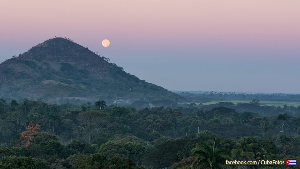
EL RÍO TOA, EL MAS CAUDALOSO Y AISLADO DE LA ISLA.
El Toa es el río más caudaloso y de cuenca más conservada del archipiélago cubano. Se extiende por unos 1060 Km2 del macizo montañoso del norte de oriental ciudad de Baracoa, provincia Guantánamo. Es la zona de Cuba menos habitada, ocupa alrededor del 70% de la reserva de la biosfera “Cuchillas del Toa” y es la más conservada del archipiélago cubano.
Su nombre procede de una voz indígena que significa “rana”.
El río tiene una longitud de 130 km, nace en las montañas de Nipe-Sagua Baracoa y desemboca en las Cuchillas del Toa en la costa norte de la provincia.
Además de su abundante caudal lo distinguen numerosas cascadas, entre ellas, la conocida como El Saltadero, la más elevada con 17 metros de altura, la navegación por varios kilómetros y la buena calidad del agua.
Su cuenca es de aproximadamente 1.060 km² y la lluvia media anual es de 2.800 mm, la mayor de toda Cuba.
El río es uno de los mejor conservados del país debido al relativo aislamiento de la zona donde se encuentra enclavado, altamente protegida. Rodeado por los bosques tropicales mejor conservados del Caribe insular, es una importante región ecológica.
Esta Reserva de la Biosfera de la UNESCO ostenta un gran número de especies de plantas y animales en peligro de extinción, incluyendo el caracol terrestre cubano, que luce espirales de llamativos colores y cuyo diámetro es de unas dos pulgadas.
Wiki/InternetPhotos/www.thecubanhistory.com
The Cuban History, Hollywood.
Arnoldo Varona, Editor.
(Video) WALKING AROUND (Today) CHINATOWN IN HABANA.
(Video) RECORRIENDO HOY EL BARRIO CHINO DE LA HABANA.
Video/YouTube/www.thecubanhistory.com
The Cuban History, Hollywood.
Arnoldo Varona, Editor.
CUBA, PINAR DEL RIO Soroa’s Orchid Garden and Waterfall.
Pinar del Río, Cuba’s westernmost province also called the green province, is a gift of nature, is home for some of the most beautiful and largest collection of orchid in the world.
Soroa, Cuba, World famous Soroa Orchid Garden and water falls and gardens have been effected by consecutive hurricanes, yet they have increased collections of rare flowers donated by other gardens and private collectors.
The first orchids arrived in Soroa in 1948. They were imported by the founder of the Soroa Cuba orchid garden, Tomás Felipe Camacho. Soroa is named after two Spanish brothers, Lorenzo and Antonio Soroa Muñagorri who arrived in Cuba in 1856 with the hope of making a fortune as coffee producers.
The Soroa gardens in Pinar Del Rio Cuba, is home to 650 rare types of orchids, both native and exotic. After hurricanes Gustavo the Soroa Orchids garden received many donations of the rarest orchids from various regions of the world to help recover from the damage caused by tropical storms.
Eco-friendly Soroa has recovered, the orchid garden has won national and foreign championships for Orchid gardens due to its winding paths, pavilions covered with thin blankets and amazing waterfalls.
Soroa, which is 70 kilometers west of the Cuban capital, is a site of breathtaking natural beauty, with a 22-meter waterfall. One of the mountains surrounding Soroa, who are known as “mogotes” because of their rounded tops, is a lookout that overlooks a breathtakingly beautiful area that is full of birds and plants, many of which are endemic of the region.
Pinar del Rio Province is in Cuba where tobacco is grown in its extraordinary fertile lands and valleys. This tobacco is used to produce the Habanos or Cuban cigars, the best in the world.
Viñales Valley (Spanish: Valle de Viñales) is a karstic depression in Cuba. The valley has an area of 132 km2 (51 sq mi) and is located in the Sierra de los Organos, just north of Viñales in the Pinar del Río Province.
The conspicuous cliffs rising like islands from the bottom of the valley are called mogotes. Mogotes are isolated, steep-sided, residual, hills, which are composed of either limestone, marble, or dolomite and surrounded by nearly flat alluvial plains. These hills typically have a rounded, tower-like form. This term was originally used for karst hills developed in the folded limestone in the Sierra de los Organos, Cuba. This term is now used internationally for karst hills, which are surrounded by alluvial plains, in the Tropics regardless of whether the carbonate strata in which they have formed is folded or not.
Tobacco and other crops are cultivated on the bottom of the valley, mostly by traditional agriculture techniques. Many caves dot the surrounding hillfaces (Cueva del Indio, Cueva de José Miguel).
Las Terrazas is situated in Sierra del Rosario, one of Cuba’s natural strongholds, which was designated a Biosphere Reserve by the United Nations Educational, Scientific and Cultural Organization (UNESCO) in 1985.
Also the coffee cultivation history, which started in the region in the 19th century was built on the ruins of the coffee farm of same name, founded by French immigrants.
Wiki/InternetPhotos/Youttube/TheCubanHistory.com
The Cuban History, Hollywood.
Arnoldo Varona, Editor.
PINAR DEL RIO: EL JARDIN DE ORQUIDEAS Y CASCADA DE SOROA
Pinar del Río, provincia más occidental de Cuba también se llama la provincia verde, es un don de la naturaleza, es el hogar de algunas de las colecciones más hermoso y más grande de orquídeas en el mundo.
Soroa, Cuba, El mundialmente famoso Soroa Orchid Garden y caídas de agua y jardines han sido afectados por los huracanes consecutivos, sin embargo, han aumentado las colecciones de flores raras donados por otros jardines y coleccionistas privados.
Las primeras orquídeas llegaron a Soroa en 1948. Ellos fueron importados por el fundador de la Soroa Cuba jardín de orquídeas, Tomás Felipe Camacho. Soroa es el nombre de dos hermanos españoles, Lorenzo y Antonio Soroa Muñagorri quien llegó a Cuba en 1856 con la esperanza de hacer una fortuna como productores de café.
Los jardines de Soroa en Pinar Del Rio Cuba, es el hogar de 650 tipos de orquídeas raras, tanto nativas como exóticas. Después de los huracanes Gustavo el jardín Soroa orquídeas recibido muchas donaciones de las orquídeas más raras de las distintas regiones del mundo para ayudar a recuperarse de los daños causados por las tormentas tropicales.
Eco-friendly Soroa se ha recuperado, el jardín de orquídeas ha ganado campeonatos nacionales y extranjeros para los jardines Orchid por sus senderos, pabellones cubiertos con mantas delgadas y cascadas impresionantes.
Soroa, que está a 70 kilómetros al oeste de la capital cubana, es un lugar de una belleza natural impresionante, con una cascada de 22 metros. Una de las montañas de los alrededores Soroa, que se conocen como “mogotes”, debido a sus cimas redondeadas, es un mirador que da a una zona impresionante y hermoso que está lleno de aves y plantas, muchas de las cuales son endémicas de la región.
Pinar del Rio Province se encuentra en Cuba donde se cultiva el tabaco en sus tierras fértiles y valles extraordinarias. Este tabaco se utiliza para producir los Habanos o puros cubanos, los mejores del mundo.
Valle de Viñales (españoles: Valle de Viñales) es una depresión kárstica en Cuba. El valle tiene una superficie de 132 km2 (51 millas cuadradas) y está situada en la Sierra de los Organos, al norte de Viñales en Pinar del Río.
Los acantilados visibles elevan como islas desde el fondo del valle son llamados mogotes. Mogotes son aislados, empinados, colinas residuales, que se componen de una de piedra caliza, mármol o dolomita y rodeado de llanuras aluviales casi planas. Estas colinas suelen tener una forma redondeada, torre-como forma. Este término fue utilizado originalmente por colinas kársticas desarrolladas en las calizas plegadas en la Sierra de los Organos, Cuba. Este término se utiliza ahora internacionalmente por colinas karst, que están rodeadas por llanuras aluviales, en las zonas tropicales, independientemente de si los estratos de carbonato en el que se han formado es doblada o no.
Tabaco y otros cultivos se cultivan en la parte inferior del valle, en su mayoría por técnicas de agricultura tradicional. Muchas cuevas salpican las hillfaces circundantes (Cueva del Indio, Cueva de José Miguel).
Las Terrazas está situado en la Sierra del Rosario, una de las fortalezas naturales de Cuba, la cual fue declarada Reserva de la Biosfera de las Naciones Unidas para la Educación, la Ciencia y la Cultura (UNESCO) en 1985.
También la historia cultivo del café, que comenzó en la región en el siglo 19 fue construida sobre las ruinas de la finca de café del mismo nombre, fundada por inmigrantes franceses.
Wiki/InternetPhotos/Youttube/TheCubanHistory.com
The Cuban History, Hollywood.
Arnoldo Varona, Editor.
oooooooooooooooooo


